Category:Old maps of Ceuta
Jump to navigation
Jump to search
Provinces of Spain: Asturias‡ · Balearic Islands‡ · Biscay · Cantabria‡ · Castellón · A Coruña · Gipuzkoa · Guadalajara · Lugo · Madrid‡ · Murcia‡ · Navarre‡ · Ourense · Pontevedra · La Rioja‡ · Salamanca · Soria · Toledo · Autonomous cities: Ceuta · Melilla
‡: uniprovincial autonomous communities.
‡: uniprovincial autonomous communities.
Autonomous communities of Spain: Andalusia · Aragon · Asturias · Balearic Islands · Basque Autonomous Community · Canary Islands · Cantabria · Castile and León · Castilla–La Mancha · Catalonia · Extremadura · Galicia · Community of Madrid · Region of Murcia · Navarre · La Rioja · Valencian Community · Autonomous cities: Ceuta · Melilla
Countries of Africa: Algeria · Angola · Benin · Botswana · Burkina Faso · Burundi · Cameroon · Cape Verde · Central African Republic · Chad · Comoros · Democratic Republic of the Congo · Republic of the Congo · Djibouti · Egypt‡ · Equatorial Guinea · Eritrea · Eswatini · Ethiopia · Gabon · The Gambia · Ghana · Guinea · Guinea-Bissau · Ivory Coast · Kenya · Lesotho · Liberia · Libya · Madagascar · Malawi · Mali · Mauritania · Mauritius · Morocco · Mozambique · Namibia · Niger · Nigeria · Rwanda · São Tomé and Príncipe · Senegal · Seychelles · Sierra Leone · Somalia · South Africa · South Sudan · Sudan · Tanzania · Togo · Tunisia · Uganda · Zambia · Zimbabwe
Limited recognition: Puntland · Somaliland – Other areas: Canary Islands · Ceuta · Madeira · Mayotte · Melilla · Réunion · Western Sahara
‡: partly located in Africa
Limited recognition: Puntland · Somaliland – Other areas: Canary Islands · Ceuta · Madeira · Mayotte · Melilla · Réunion · Western Sahara
‡: partly located in Africa
Use the appropriate category for maps showing all or a large part of Ceuta. See subcategories for smaller areas:
| If the map shows | Category to use |
|---|---|
| Ceuta on a recently created map | Category:Maps of Ceuta or its subcategories |
| Ceuta on a map created more than 70 years ago | Category:Old maps of Ceuta or its subcategories |
| the history of Ceuta on a recently created map | Category:Maps of the history of Ceuta or its subcategories |
| the history of Ceuta on a map created more than 70 years ago | Category:Old maps of the history of Ceuta or its subcategories |
Subcategories
This category has only the following subcategory.
M
Media in category "Old maps of Ceuta"
The following 30 files are in this category, out of 30 total.
-
 1704 - Louis Boudan - Taking of Gibraltar.jpg 6,896 × 5,616; 6.5 MB
-
 1730 map of Andalusia and Gibraltar by Matthaus Seutter.jpg 1,850 × 1,600; 811 KB
-
 1780 - P Santini - Map Gibraltar.jpg 1,379 × 1,600; 522 KB
-
 Plano del monte Acho, Ceuta, en 1801.jpg 4,863 × 3,941; 7.99 MB
-
 Historia de la plaza de Ceuta 263.jpg 4,935 × 3,560; 8.82 MB
-
 Plano de Ceuta 1860.jpeg 963 × 1,436; 187 KB
-
-

-

-
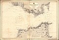 Admiralty Chart No 142 Strait of Gibraltar, Published 1938.jpg 12,352 × 8,488; 36.33 MB
-
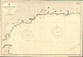 Admiralty Chart No 773 Gibraltar to Adra, Published 1895.jpg 16,169 × 11,089; 44.49 MB
-
 ATLAS JUSTUS PERTHES 08.jpg 4,547 × 3,933; 10.25 MB
-
 Ceuta - Plaza de Ceuta - Plan cropped.jpg 1,632 × 837; 1.07 MB
-
 Ceuta - Plaza de Ceuta - Plan.jpg 2,166 × 2,176; 2.83 MB
-
 Ceuta durante el sitio de 1790 - 1791.jpg 1,578 × 1,105; 332 KB
-
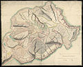
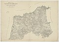
 Ceuta y Sierra Bullones.png 963 × 1,436; 1.51 MB
-
 Ceuta. Fortificaciones. Planos. 1797.jpg 6,656 × 3,408; 6.4 MB
-
 Ciudadela del Monte Acho, Ceuta, en 1801.JPG 831 × 608; 114 KB
-
-
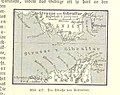
 Lange diercke sachsen europaeische landschaften gibraltar.jpg 1,251 × 1,052; 664 KB
-
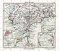
 Map of Tangier Zone (Morocco).jpg 3,904 × 3,199; 4.93 MB
-
-

-
-
 Plan de la Ville de Ceuta.jpg 2,148 × 1,200; 1,014 KB
-
 Plano de Ceuta en 1855.jpg 7,402 × 3,436; 3.39 MB
-
 Plano de Ceuta s. XIX.jpeg 1,563 × 1,073; 273 KB
-

-
 Plano-de-la-Ciudad-de-Ceuta-1943.jpg 7,948 × 4,771; 7.13 MB
-
 Sitio de Ceuta (1694-1727).jpg 502 × 567; 178 KB


.jpg)
.jpg)


.jpg)


.jpg)