Category:Old maps of São Tomé and Príncipe
Jump to navigation
Jump to search
Countries of Africa: Algeria · Angola · Benin · Botswana · Burkina Faso · Burundi · Cameroon · Cape Verde · Central African Republic · Chad · Comoros · Democratic Republic of the Congo · Republic of the Congo · Djibouti · Egypt‡ · Equatorial Guinea · Eritrea · Eswatini · Ethiopia · Gabon · The Gambia · Ghana · Guinea · Guinea-Bissau · Ivory Coast · Kenya · Lesotho · Liberia · Libya · Madagascar · Malawi · Mali · Mauritania · Mauritius · Morocco · Mozambique · Namibia · Niger · Nigeria · Rwanda · São Tomé and Príncipe · Senegal · Seychelles · Sierra Leone · Somalia · South Africa · South Sudan · Sudan · Tanzania · Togo · Tunisia · Uganda · Zambia · Zimbabwe
Limited recognition: Puntland · Somaliland – Other areas: Canary Islands · Ceuta · Madeira · Mayotte · Melilla · Réunion · Western Sahara
‡: partly located in Africa
Limited recognition: Puntland · Somaliland – Other areas: Canary Islands · Ceuta · Madeira · Mayotte · Melilla · Réunion · Western Sahara
‡: partly located in Africa
Use the appropriate category for maps showing all or a large part of São Tomé and Príncipe. See subcategories for smaller areas:
| If the map shows | Category to use |
|---|---|
| São Tomé and Príncipe on a recently created map | Category:Maps of São Tomé and Príncipe or its subcategories |
| São Tomé and Príncipe on a map created more than 70 years ago | Category:Old maps of São Tomé and Príncipe or its subcategories |
| the history of São Tomé and Príncipe on a recently created map | Category:Maps of the history of São Tomé and Príncipe or its subcategories |
| the history of São Tomé and Príncipe on a map created more than 70 years ago | Category:Old maps of the history of São Tomé and Príncipe or its subcategories |
Subcategories
This category has only the following subcategory.
Media in category "Old maps of São Tomé and Príncipe"
The following 13 files are in this category, out of 13 total.
-

-
 AMH-6800-NA Map of the island of San Thomé.jpg 7,320 × 5,304; 6.24 MB
-

-
 Carte des Costes de l'Afrique.jpg 512 × 697; 63 KB
-
 Ilha de S. Thomé, 1888 - btv1b8439784s.jpg 6,876 × 7,627; 5.5 MB
-
 Ilhe de S. Thomé, 1888 - btv1b8444630m.jpg 7,275 × 7,767; 5.45 MB
-
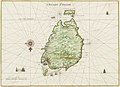
 Insula St. Thomae-1616.jpg 697 × 542; 89 KB
-
 Island St. Thomas-1780.jpg 2,048 × 2,791; 2.93 MB
-

-
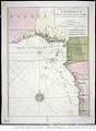
 La Baye de l'Isle de Prince LCCN2003662094.jpg 1,536 × 1,038; 388 KB
-
 La Baye de l'Isle de Prince LCCN2003662094.tif 1,536 × 1,038; 1.52 MB
-
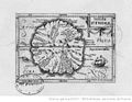
 Urbs S. Thomae-1647 (2).png 1,189 × 474; 556 KB
-
 Urbs S. Thomae-1647.jpg 1,305 × 1,054; 532 KB
.jpg)

,_RP-P-OB-75.404.jpg)


_Afteeckeninge_van_St._Thomae,_RP-P-OB-75.427.jpg)


.png)