Category:Old maps of South Africa
Jump to navigation
Jump to search
Countries of Africa: Algeria · Angola · Benin · Botswana · Burkina Faso · Burundi · Cameroon · Cape Verde · Central African Republic · Chad · Comoros · Democratic Republic of the Congo · Republic of the Congo · Djibouti · Egypt‡ · Equatorial Guinea · Eritrea · Eswatini · Ethiopia · Gabon · The Gambia · Ghana · Guinea · Guinea-Bissau · Ivory Coast · Kenya · Lesotho · Liberia · Libya · Madagascar · Malawi · Mali · Mauritania · Mauritius · Morocco · Mozambique · Namibia · Niger · Nigeria · Rwanda · São Tomé and Príncipe · Senegal · Sierra Leone · Somalia · South Africa · South Sudan · Sudan · Tanzania · Togo · Tunisia · Uganda · Zambia · Zimbabwe
Limited recognition: Puntland · Somaliland – Other areas: Canary Islands · Ceuta · Madeira · Mayotte · Melilla · Réunion · Western Sahara
‡: partly located in Africa
Limited recognition: Puntland · Somaliland – Other areas: Canary Islands · Ceuta · Madeira · Mayotte · Melilla · Réunion · Western Sahara
‡: partly located in Africa
Use the appropriate category for maps showing all or a large part of South Africa. See subcategories for smaller areas:
| If the map shows | Category to use |
|---|---|
| South Africa on a recently created map | Category:Maps of South Africa or its subcategories |
| South Africa on a map created more than 70 years ago | Category:Old maps of South Africa or its subcategories |
| the history of South Africa on a recently created map | Category:Maps of the history of South Africa or its subcategories |
| the history of South Africa on a map created more than 70 years ago | Category:Old maps of the history of South Africa or its subcategories |
Subcategories
This category has the following 12 subcategories, out of 12 total.
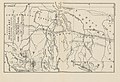
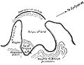
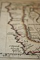
Media in category "Old maps of South Africa"
The following 98 files are in this category, out of 98 total.
-

-

-

-

-

-
 Tabula Moderna Secunde Porcionis Aphricae.jpg 14,062 × 10,326; 23.46 MB
-

-
-
 Cape Colony00.jpg 1,038 × 647; 300 KB
-
 Travels and adventures in southern Africa (1827) (14785056015).jpg 3,338 × 2,294; 1.02 MB
-
 MAP OF SOUTH AFRICA BY R.W. LEYLAND.jpg 3,172 × 2,465; 1.79 MB
-
 Philips' detailed map of the Transvaal with part of the Orange River Colony.jpg 4,643 × 3,938; 7.65 MB
-
 Brockhaus and Efron Encyclopedic Dictionary b81 290-0.jpg 2,330 × 1,770; 2.96 MB
-
 Map of South Africa, showing sites of Bushman drawings. Wellcome M0015200.jpg 3,039 × 3,925; 2.44 MB
-
 227 of 'History of the Boers in South Africa ... with three maps' (11188782773).jpg 2,256 × 1,415; 601 KB
-
 24 of 'Diamonds and Gold in South Africa ... With maps, etc' (11220471646).jpg 2,464 × 3,256; 1.25 MB
-

-

-

-

-
 275 of 'History of the Boers in South Africa ... with three maps' (11189780013).jpg 2,150 × 1,406; 577 KB
-
 28 of 'A Visit to Cape Colony and Natal, in 1879' (11128380084).jpg 1,502 × 2,474; 767 KB
-

-

-
 295 of 'Natal, the Land and its story, etc. (With map.)' (11214223393).jpg 4,415 × 5,793; 4.5 MB
-

-

-

-

-

-

-
 476 of '(The Story of Africa and its Explorers. (With plates and maps.))' (11235661086).jpg 2,007 × 1,828; 1,019 KB
-
 507 of 'Zuid-Afrika. Reisherinneringen. (With maps and illustrations.)' (11206731394).jpg 3,231 × 2,452; 1.58 MB
-
-

-
 94 of 'In the Land of Cecil Rhodes' (11233938066).jpg 1,888 × 1,281; 448 KB
-

-
 A map of Witwatersrand goldfield, South Africa, showing prop Wellcome V0023537.jpg 4,400 × 1,543; 3.3 MB
-

-
 Abraham Jacobus Wendel - Map of South Africa.png 1,600 × 895; 1.66 MB
-
 Admiralty Chart No 642 Algoa Bay, Published 1856.jpg 16,224 × 11,148; 37.78 MB
-

-

-

-
 BIC00.jpg 2,034 × 1,158; 168 KB
-
 Bophuthatswana. LOC 80692110.jpg 4,140 × 3,177; 1.91 MB
-
 Bophuthatswana. LOC 80692110.tif 4,140 × 3,177; 37.63 MB
-
 Brockhaus and Efron Jewish Encyclopedia e3 465-0.jpg 1,093 × 634; 137 KB
-
 C. 1897 South Africa.jpg 4,010 × 3,100; 4.86 MB
-
 Chart of South Africa and Madagascar(GN01112).jpg 3,264 × 2,448; 1.57 MB
-
 Churchill Ladysmith 3.jpg 600 × 465; 32 KB
-
 Churchill Ladysmith 4.jpg 600 × 568; 45 KB
-
 Churchill Ladysmith 5.jpg 600 × 339; 46 KB
-
 Churchill Ladysmith 7.jpg 469 × 427; 40 KB
-
 Dr Holub, Szerpa Pinta, Livingston útjai a középső Zambezi mellékén.jpg 1,371 × 1,230; 179 KB
-

-

-

-

-

-

-

-

-

-

-
 Karte des europaeischen Gebiets am Vorgebirge Der Guten Hoffnung.jpg 8,260 × 6,239; 16.24 MB
-
 Karte vom Süd-Ende Afrika's und dem Cap-Colonie-Lande.jpg 6,278 × 5,273; 7.77 MB
-
 Churchill Ladysmith 6.jpg 451 × 233; 11 KB
-
 Levaillant map.png 5,384 × 3,944; 31.28 MB
-
 Map of 'South African Republic' Wellcome L0021298.jpg 1,538 × 1,248; 1.02 MB
-
 Map of the seat of war in Africa LOC 2009582411.jpg 10,349 × 14,606; 20.83 MB
-
 Map Stellaland.jpg 600 × 397; 259 KB
-

-
 Old Portuguese map of SA 527.JPG 3,456 × 2,304; 1.67 MB
-
 Old Portuguese map of SA 530.JPG 3,456 × 2,304; 1.87 MB
-
 Old Portuguese map of SA 533.JPG 3,456 × 2,304; 1.4 MB
-
 Old Portuguese map of SA 534.JPG 3,456 × 2,304; 1.38 MB
-
 Old Portuguese map of SA 539.JPG 3,456 × 2,304; 1.53 MB
-
 Old Portuguese map of SA 540.JPG 3,456 × 2,304; 1.6 MB
-
 Old Portuguese map of SA 544.JPG 2,304 × 3,456; 1.27 MB
-
 Old Portuguese map of SA 549.JPG 3,456 × 2,304; 1.46 MB
-
 Old Portuguese map of SA 550.JPG 3,456 × 2,304; 1.41 MB
-
 P007 - N° 521. Théâtre de la Guerre des Boers. - Liv4-Ch05.png 1,448 × 1,708; 255 KB
-
 P027 - N° 525. Composition ethnique de l’Afrique du Sud. - Liv4-Ch05.png 1,444 × 1,628; 346 KB
-

-
 Plano que contiene la Bahía de Tabla con la ciudad del Cabo LOC 90683990.jpg 8,473 × 6,178; 6.95 MB
-
 Plano que contiene la Bahía de Tabla con la ciudad del Cabo LOC 90683990.tif 8,473 × 6,178; 149.76 MB
-
 Rigobert-Bonne-Atlas-de-toutes-les-parties-connues-du-globe-terrestre MG 9991.tif 5,230 × 3,564; 53.36 MB
-
 Seven Years in South Africa, map.jpg 1,572 × 3,492; 2.94 MB
-
 Sketch map of East Griqualand and Pondoland with concession of Emil Nagel.jpg 2,640 × 3,782; 4.51 MB
-
 South Africa (1909) (14597685477).jpg 2,192 × 2,492; 1.01 MB
-

-
 Special Karte No.2. Die Victoriafälle des Zambesi nach Compassaufnahmen Dr. Emil Holub.jpg 5,000 × 4,002; 2.89 MB
-
 Suedafrika 1885.jpg 850 × 733; 140 KB
-

-
 The Cape Colony - 1878.jpg 1,987 × 1,606; 1.02 MB
-
 The Free Burghers Settlement.jpg 1,509 × 2,024; 1.11 MB
-

.jpg)
%27_(11247033405).jpg)
.jpg)
.jpg)

.jpg)


_(14785056015).jpg)


.jpg)
.jpg)
.jpg)
.jpg)
.jpg)
.jpg)
.jpg)
.jpg)
.jpg)
.jpg)
%27_(11214223393).jpg)
.jpg)
.jpg)
%27_(11240170966).jpg)
%27_(11239979646).jpg)
%27_(11252975186).jpg)
)%27_(11235661086).jpg)
%27_(11206731394).jpg)
.jpg)
.jpg)
.jpg)
.jpg)
_(14581929200).jpg)


_(17792406774).jpg)
_(18227449808).jpg)
_(18388837446).jpg)


.jpg)


_(14596040840).jpg)
.jpg)
,_Sheba.jpg)
.jpg)
.jpg)
.jpg)


_(14760816881).jpg)


_(14597685477).jpg)


.jpg)


.jpg)
.jpg)
%27_(11001788756).jpg)