Category:Old maps of Togo
Jump to navigation
Jump to search
Countries of Africa: Algeria · Angola · Benin · Botswana · Burkina Faso · Burundi · Cameroon · Cape Verde · Central African Republic · Chad · Comoros · Democratic Republic of the Congo · Republic of the Congo · Djibouti · Egypt‡ · Equatorial Guinea · Eritrea · Eswatini · Ethiopia · Gabon · The Gambia · Ghana · Guinea · Guinea-Bissau · Ivory Coast · Kenya · Lesotho · Liberia · Libya · Madagascar · Malawi · Mali · Mauritania · Mauritius · Morocco · Mozambique · Namibia · Niger · Nigeria · Rwanda · São Tomé and Príncipe · Senegal · Seychelles · Sierra Leone · Somalia · South Africa · South Sudan · Sudan · Tanzania · Togo · Tunisia · Uganda · Zambia · Zimbabwe
Limited recognition: Puntland · Somaliland – Other areas: Canary Islands · Ceuta · Madeira · Mayotte · Melilla · Réunion · Western Sahara
‡: partly located in Africa
Limited recognition: Puntland · Somaliland – Other areas: Canary Islands · Ceuta · Madeira · Mayotte · Melilla · Réunion · Western Sahara
‡: partly located in Africa
Use the appropriate category for maps showing all or a large part of Togo. See subcategories for smaller areas:
| If the map shows | Category to use |
|---|---|
| Togo on a recently created map | Category:Maps of Togo or its subcategories |
| Togo on a map created more than 70 years ago | Category:Old maps of Togo or its subcategories |
| the history of Togo on a recently created map | Category:Maps of the history of Togo or its subcategories |
| the history of Togo on a map created more than 70 years ago | Category:Old maps of the history of Togo or its subcategories |
Subcategories
This category has the following 2 subcategories, out of 2 total.
- 19th-century maps of Togo (13 F)
Media in category "Old maps of Togo"
The following 11 files are in this category, out of 11 total.
-

-
-

-

-

-
 Ewe-Gebiet 1888.jpg 3,323 × 3,820; 2.37 MB
-
 Map WestAfrica 16cent Blake.png 4,575 × 3,313; 1.13 MB
-
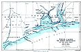
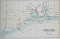 Scottish geographical magazine (1885) (14596430019).jpg 2,368 × 1,548; 260 KB
-

-
 The Slave Coast on a John Bartholomew & Co. map published c. 1914 (part).jpg 1,541 × 946; 780 KB
-
 Togo1885.jpg 1,365 × 879; 220 KB
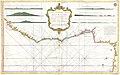
_-_Geographicus_-_Guinea-ogilby-1670.jpg)

%27_(11175283123).jpg)
%27_(11174468585).jpg)
.jpg)


_(14596430019).jpg)

.jpg)
