Category:Old maps of Mauritania
Jump to navigation
Jump to search
Countries of Africa: Algeria · Angola · Benin · Botswana · Burkina Faso · Burundi · Cameroon · Cape Verde · Central African Republic · Chad · Comoros · Democratic Republic of the Congo · Republic of the Congo · Djibouti · Egypt‡ · Equatorial Guinea · Eritrea · Eswatini · Ethiopia · Gabon · The Gambia · Ghana · Guinea · Guinea-Bissau · Ivory Coast · Kenya · Lesotho · Liberia · Libya · Madagascar · Malawi · Mali · Mauritania · Mauritius · Morocco · Mozambique · Namibia · Niger · Nigeria · Rwanda · São Tomé and Príncipe · Senegal · Seychelles · Sierra Leone · Somalia · South Africa · South Sudan · Sudan · Tanzania · Togo · Tunisia · Uganda · Zambia · Zimbabwe
Limited recognition: Puntland · Somaliland – Other areas: Canary Islands · Ceuta · Madeira · Mayotte · Melilla · Réunion · Western Sahara
‡: partly located in Africa
Limited recognition: Puntland · Somaliland – Other areas: Canary Islands · Ceuta · Madeira · Mayotte · Melilla · Réunion · Western Sahara
‡: partly located in Africa
Use the appropriate category for maps showing all or a large part of Mauritania. See subcategories for smaller areas:
| If the map shows | Category to use |
|---|---|
| Mauritania on a recently created map | Category:Maps of Mauritania or its subcategories |
| Mauritania on a map created more than 70 years ago | Category:Old maps of Mauritania or its subcategories |
| the history of Mauritania on a recently created map | Category:Maps of the history of Mauritania or its subcategories |
| the history of Mauritania on a map created more than 70 years ago | Category:Old maps of the history of Mauritania or its subcategories |
Subcategories
This category has the following 5 subcategories, out of 5 total.
P
- Ptolemy's 1st African Map (48 F)
- Ptolemy's 4th African Map (51 F)
Media in category "Old maps of Mauritania"
The following 5 files are in this category, out of 5 total.
-
 A new chart of the sea coast of ARGUIN from Gulf of Anna to the Land bank of Tindel NYPL1640671.tiff 7,230 × 5,428; 112.28 MB
-
 Admiralty Chart No 1699 Baie du Levrier, Published 1918, Large Corrections 1961.jpg 11,372 × 16,495; 24.64 MB
-

-
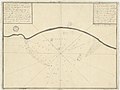 Plan de la baie de Portendic.jpg 1,350 × 1,013; 246 KB
-


