Category:Maps of the history of Saxony
Jump to navigation
Jump to search
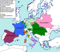
Federal states of Germany:
Subcategories
This category has the following 12 subcategories, out of 12 total.
A
- Maps of Saxe-Altenburg (12 F)
C
- Maps of Saxe-Coburg and Gotha (19 F)
E
K
L
- Maps of Bezirk Leipzig (17 F)
M
- Maps of Saxe-Meiningen (11 F)
S
- Maps of Schwarzburg-Rudolstadt (13 F)
W
- Maps of Saxe-Weimar-Eisenach (14 F)
Media in category "Maps of the history of Saxony"
The following 84 files are in this category, out of 84 total.
-
-
 AHS Dresden.jpg 519 × 478; 93 KB
-
 Landratsämter Altenburg und Ronneburg.svg 2,092 × 1,612; 1.32 MB
-
 C. 1000 Europe and Byzantine Empire.jpg 1,349 × 1,055; 1.83 MB
-
 C. 1000 Holy Roman Empire (Northern).jpg 3,816 × 2,989; 5.81 MB
-
 C. 1000 Western Europe.jpg 1,454 × 1,302; 2.1 MB
-
 C. 1360 Europe and Western Asia.jpg 2,112 × 1,365; 2.11 MB
-
 C. 1360 Europe.jpg 4,045 × 3,000; 3.9 MB
-
 C. 1540 Austrian territories (Eastern and Southern).jpg 2,279 × 2,046; 4.71 MB
-
 C. 768 Frankish Dominions (486-768).jpg 3,890 × 3,010; 3.66 MB
-
 C. 800 Carolingian Empire.jpg 2,204 × 1,880; 2.98 MB
-
 C. 814 Frankish Kingdoms.jpg 1,267 × 792; 721 KB
-
 C. 843 Division of Carolingian Empire.jpg 2,201 × 1,874; 3.08 MB
-
 C. 888 Europe.jpg 2,305 × 1,454; 1.73 MB
-
 C. 900 Frankish Dominions (768-900).jpg 3,879 × 3,031; 3.8 MB
-
 C. 962 Europe.jpg 4,066 × 3,010; 3.6 MB
-
 Claimed territory of the Soviet Republic of Saxony.png 1,014 × 849; 232 KB
-
 CoburgDet.jpg 435 × 280; 19 KB
-
 CobutgSaalfeldDet.jpg 528 × 430; 47 KB
-
 Conséquences territoriales du traité de Vienne (1738).png 2,012 × 1,761; 222 KB
-
 DDR-Bezirk-Cottbus.png 1,500 × 2,036; 42 KB
-
 DDR-Bezirk-Dresden-Kreis-Meissen.PNG 1,500 × 2,036; 151 KB
-
 DDR-Bezirk-Dresden.png 1,500 × 2,036; 43 KB
-
 Der Meissnische Kreis Oder Dresdner Regierungsbezirk in 4 Amtshauptmannschaften.jpg 4,764 × 5,640; 7.98 MB
-
 EisenachDet.jpg 285 × 487; 31 KB
-
 Erfurter Teilung 1572.jpg 1,199 × 768; 412 KB
-
 Ernestine Saxony 1517.svg 4,274 × 3,200; 645 KB
-
 Freie Republik Schwarzenberg 1945 Karte.svg 1,000 × 820; 101 KB
-
 G5241.jpg 823 × 649; 110 KB
-
 GothaAltenburgDet.jpg 956 × 440; 81 KB
-
 GothaDet.jpg 343 × 450; 34 KB
-
 Guelf c12-ar.jpg 600 × 614; 162 KB
-
 Kreis Hoyerswerda im Bezirk Cottbus.PNG 1,500 × 2,036; 150 KB
-
 Karte Pleißenland um 1185.jpg 3,477 × 2,735; 1.92 MB
-
 Karte Sachsen1549.jpg 3,480 × 2,740; 5.96 MB
-
 Karte vom Königreiche Sachsen.jpg 5,313 × 3,801; 7.15 MB
-
 Karte vor Schaffung des Pleißenlands, um 1000 n.C..jpg 4,558 × 3,605; 4.49 MB
-
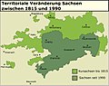
 Karte-Sachsen-1815 Kopie.jpg 1,442 × 1,482; 382 KB
-

-
 Locator Bishopric of Meissen - NL.png 1,917 × 1,289; 1,008 KB
-
 Locator Bishopric of Merseburg - NL.png 1,917 × 1,289; 1,013 KB
-
 Locator Bishopric of Naumburg - NL.png 1,917 × 1,289; 1,012 KB
-
 Locator Duchy of Saxe-Zeitz (1680).svg 1,329 × 1,164; 394 KB
-
 Locator Duchy of Saxony (1554-1566)-NL.svg 1,725 × 1,160; 444 KB
-
 Locator Electoral Saxony within the Holy Roman Empire (1618).svg 2,769 × 2,524; 1 MB
-
 Luther region 1519.png 1,119 × 712; 2.3 MB
-
 MarcaSajonaOrientalAño1000.svg 1,471 × 1,954; 6.07 MB
-
 Osterland 1250.PNG 303 × 263; 75 KB
-
 Sachsen-Anhalt Landesteile Beschriftet.png 1,096 × 1,128; 30 KB
-
 Sachsen-Anhalt Landesteile.png 1,096 × 1,128; 13 KB
-
 Sachsen-Coburg und Gotha.png 2,104 × 1,630; 88 KB
-
 Sajonia1485.jpg 750 × 463; 82 KB
-
 SajoniaCoburg.jpg 550 × 450; 50 KB
-
 SajoniaCoburgSaalfeld.jpg 550 × 450; 51 KB
-
 SajoniaEisenach.jpg 550 × 450; 51 KB
-
 SajoniaEisenberg.jpg 550 × 450; 50 KB
-
 SajoniaGotha.jpg 550 × 450; 48 KB
-
 SajoniaGotha1.jpg 550 × 450; 53 KB
-
 SajoniaGothaAltenburg.jpg 550 × 450; 51 KB
-
 SajoniaGothaAltenburg.png 550 × 450; 121 KB
-
 SajoniaJena.jpg 550 × 450; 51 KB
-
 SajoniaMarksuhl.jpg 550 × 450; 51 KB
-
 SajoniaRömhild.jpg 550 × 400; 49 KB
-
 SajoniaSaalfeld.jpg 550 × 450; 50 KB
-
 SajoniaWeimar Map.svg 550 × 450; 1.78 MB
-
 SajoniaWeimar.jpg 550 × 450; 50 KB
-
 Saxoniae Superioris Circulus.jpg 7,332 × 6,268; 19.03 MB
-
 Saxony (Division of Leipzig) - DE.png 1,430 × 959; 653 KB
-
 Saxony (Division of Leipzig) - NL.png 2,875 × 1,933; 1.44 MB
-
 Saxony 1930.svg 610 × 410; 31 KB
-
 Saxony after the Capitulation of Wittenberg (1547) - DE.png 1,428 × 958; 717 KB
-
 Saxony after the Capitulation of Wittenberg (1547) - NL.png 2,875 × 1,933; 1.63 MB
-
 Saxony after the Treaty of Naumburg - DE.png 2,892 × 1,953; 955 KB
-
 Saxony after the Treaty of Naumburg - NL.png 1,928 × 1,302; 862 KB
-

-
 Saxony in the German Reich (1925).svg 1,425 × 1,133; 967 KB
-
 Saxony z.png 800 × 640; 12 KB
-
 Sächsische Ostmark.PNG 566 × 739; 289 KB
-
 Topographisch-militairische Charte von Teutschland - Section 083.png 3,412 × 2,695; 23.15 MB
-
 Torgauer und Dessauer Bund.svg 1,500 × 900; 786 KB
-
 Voegte 1350.png 800 × 966; 167 KB
-
 Vogtland 1350.png 800 × 966; 174 KB
-
 WeimarDet.jpg 686 × 410; 56 KB
-
 Лужицкие сербы в IX веке.svg 531 × 435; 1.96 MB


.jpg)


.jpg)
.jpg)


.jpg)


.png)


.svg)
-NL.svg)
.svg)


_-_DE.png)
_-_NL.png)

_-_DE.png)
_-_NL.png)


.svg)


