Category:Maps of the history of Baden-Württemberg
Jump to navigation
Jump to search
Federal states of Germany:
Subcategories
This category has the following 5 subcategories, out of 5 total.
B
M
S
W
Media in category "Maps of the history of Baden-Württemberg"
The following 76 files are in this category, out of 76 total.
-
1442 Grafschaft Wuerttemberg.png 1,601 × 1,840; 3.33 MB
-
C. 1771-1805 Western Germany.jpg 902 × 1,340; 1.49 MB
-
C. 1780-1805 Germany Wurtemburg region.jpg 889 × 1,327; 1.59 MB
-
Insurrection badoise d'avril 1848.png 1,687 × 803; 128 KB
-
1950 Baden-Württemberg referendum proposals.svg 1,761 × 978; 224 KB
-
Strategischer Bahnbau in Südbaden.png 2,000 × 1,105; 899 KB
-
Bodensee1846.png 847 × 870; 24 KB
-
Breisgau 1803.png 284 × 379; 101 KB
-
Breisgau 1805.png 285 × 339; 15 KB
-
Deutschland Besatzungszonen 1945 1946 franzoesisch.png 500 × 646; 18 KB
-
Die Teilung Württembergs durch den Nürtinger Vertrag 1442 (Karte).png 878 × 886; 175 KB
-
Drehstromuebertragung Lauffen-Frankfurt.png 615 × 1,332; 1.31 MB
-
Duchy of Swabia locator map (1004).svg 4,431 × 3,875; 4.7 MB
-
Edelfingen1846.png 1,277 × 851; 41 KB
-
Einteilung KWStE-Streckennetz EJ Württ Report.png 1,774 × 2,337; 578 KB
-
Einteilung KWStE-Streckennetz Fraas.png 1,774 × 2,338; 611 KB
-
Einteilung KWStE-Streckennetz Jacob.png 1,774 × 2,333; 606 KB
-
Einteilung KWStE-Streckennetz Katasterpläne RBD Stuttgart.png 1,774 × 2,337; 578 KB
-
Einteilung KWStE-Streckennetz La Süd.png 1,774 × 2,390; 635 KB
-
Einteilung KWStE-Streckennetz Morlok.png 1,774 × 2,337; 666 KB
-
Einteilung KWStE-Streckennetz Mühl Seidel.png 1,774 × 2,336; 538 KB
-
Einteilung KWStE-Streckennetz NVBW-Bahntouren.png 1,774 × 2,337; 773 KB
-
Einteilung KWStE-Streckennetz VzG.png 1,774 × 2,338; 549 KB
-
Fünf Zeitzonen am Bodensee.png 682 × 346; 77 KB
-
Grafschaften Hohenzollern 1370.png 1,629 × 2,063; 3.65 MB
-
Hhechingen1848.png 306 × 258; 8 KB
-
HohengeroldseckFsm.png 748 × 592; 14 KB
-
Zollernalbkreis mit Hohenzollern.png 749 × 875; 304 KB
-
Hsigmaringen1848.png 306 × 258; 8 KB
-
Karte Badische Revolution.png 1,211 × 1,329; 1.54 MB
-
Karte Bann Kippenheim Sulz OA Mahlberg 1780 1784.jpg 5,279 × 3,768; 6.72 MB
-
Karte Besitz der Herren von Waldeck.png 1,406 × 944; 1.06 MB
-
Karte Deutsche Westbefestigungen vor Westwall.png 1,000 × 1,050; 1.56 MB
-
Karte Deutsche Westbefestigungen vor Westwall.svg 1,000 × 1,050; 2.22 MB
-
Karte Donautalbahn Bauabschnitte.png 1,500 × 976; 469 KB
-
Karte Gäubahn Bauabschnitte.png 1,001 × 1,500; 663 KB
-
Karte Neckar-Enz-Stellung Bunker KW.png 596 × 1,622; 666 KB
-
Karte Neckar-Enz-Stellung Bunker KW.svg 596 × 1,622; 641 KB
-
Karte Neckar-Enz-Stellung Bunker.png 596 × 1,622; 1.13 MB
-
Karte Neckar-Enz-Stellung Bunker.svg 596 × 1,622; 321 KB
-
Karte Neckar-Enz-Stellung.png 1,000 × 2,000; 3.02 MB
-
Karte Neckar-Enz-Stellung.svg 1,000 × 2,000; 486 KB
-
Karte Römischer Gutshof Büßlingen.png 2,203 × 2,883; 887 KB
-
Karte Verbreitung Einheitsbahnhof Wuerttemberg.png 2,537 × 3,374; 1 MB
-
Karte Württembergischer Landgraben.png 2,000 × 1,270; 967 KB
-
Karte-Hohenzollern.png 1,274 × 977; 59 KB
-
KarteSchaffhausen1900.png 972 × 758; 20 KB
-
Kleinkastell Hankertsmühle - Lage der Anlage.jpg 1,040 × 1,200; 235 KB
-
Kurpfalz 1400.png 505 × 506; 218 KB
-
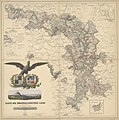
Liebenow-wilhelm-karte-der-hohenzollernschen-lande-berlin-1854-wlb-stuttgart-18Cg-171.jpg 3,822 × 3,867; 4.24 MB
-
Lv nordbaden.gif 226 × 213; 3 KB
-
Map-SouthBaden.svg 650 × 830; 225 KB
-
Map-Wuerttemberg-Baden.svg 650 × 830; 225 KB
-
Map-Wuerttemberg-Hohenzollern.svg 650 × 830; 225 KB
-
Meyer‘s Zeitungsatlas 030 – Bayern, Würtemberg, beyde Hohenzollern und Baden.jpg 7,351 × 6,245; 20.25 MB
-
Neckar-Enz-Stellung Ende 2. WK.png 2,000 × 2,432; 2.39 MB
-
Neckar-Enz-Stellung Ende 2. WK.svg 1,000 × 1,216; 1.63 MB
-
Nürtinger Vertrag.png 2,078 × 1,945; 122 KB
-
OstrachKarteBHW.png 524 × 497; 13 KB
-
Römische Expansion in Südwestdeutschland.png 361 × 367; 50 KB
-
Schalksburg Kloster mit Gutsbesitz.png 1,332 × 984; 1.27 MB
-
Sixth AG offensive.png 1,581 × 1,777; 4.85 MB
-
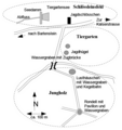
Skizze vom Jungholz um 1780.png 724 × 768; 52 KB
-
Spruner-Menke Handatlas 1880 Karte 40 Nebenkarte 1.jpg 1,697 × 1,133; 189 KB
-
Strategischer Bahnbau in Südbaden new.png 2,000 × 1,105; 911 KB
-
Suedwest-vor1945.png 660 × 844; 16 KB
-
Suedwest-vor1945.svg 1,000 × 1,177; 67 KB
-
Suedweststaat-Baden.png 628 × 729; 139 KB
-
Suedweststaat-HE.png 628 × 729; 22 KB
-
Suedweststaat-Württemberg-Baden.png 628 × 729; 104 KB
-
Suedweststaat-Württemberg-Hohenzollern.png 628 × 729; 143 KB
-
Suedweststaat.png 628 × 729; 25 KB
-
Südbaden.png 289 × 345; 35 KB
-
Widdern1846.png 1,008 × 832; 33 KB
-
자르 보호령.png 800 × 947; 120 KB


