Category:Maps of the history of Lower Saxony
Jump to navigation
Jump to search
Federal states of Germany:
Use the appropriate category for maps showing all or a large part of Lower Saxony. See subcategories for smaller areas:
| If the map shows | Category to use |
|---|---|
| Lower Saxony on a recently created map | Category:Maps of Lower Saxony or its subcategories |
| Lower Saxony on a map created more than 70 years ago | Category:Old maps of Lower Saxony or its subcategories |
| the history of Lower Saxony on a recently created map | Category:Maps of the history of Lower Saxony or its subcategories |
| the history of Lower Saxony on a map created more than 70 years ago | Category:Old maps of the history of Lower Saxony or its subcategories |
Subcategories
This category has the following 24 subcategories, out of 24 total.
A
B
E
H
- Maps of Hildesheim (region) (4 F)
L
- Maps of Lüneburg (region) (10 F)
M
- Maps of the Duchy of Saxony (9 F)
O
- Maps of the Duchy of Oldenburg (16 F)
S
- Maps of Schaumburg-Lippe (9 F)
W
Media in category "Maps of the history of Lower Saxony"
The following 49 files are in this category, out of 49 total.
-
 Hanse-Departments.png 2,362 × 1,709; 1.28 MB
-

-
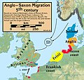 Anglo.Saxon.migration.5th.cen.jpg 1,800 × 1,703; 875 KB
-
 JadeWeser-arngast.png 478 × 476; 19 KB
-
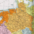
 Bakker Schut-plan.PNG 664 × 466; 23 KB
-
 Braunschweig 1932-1945.png 5,155 × 4,000; 2.47 MB
-
 Corvey possessions.svg 461 × 396; 876 KB
-
 1811k Aller ok.JPG 1,177 × 889; 171 KB
-
 Die Freien vor dem Nordwalde.png 704 × 535; 41 KB
-
 Friesische Seelande Brookmerland.PNG 1,191 × 666; 259 KB
-
 Graafschap Pyrmont.png 198 × 229; 14 KB
-
 Countships of Schaumburg.png 1,713 × 2,362; 314 KB
-
 Guelf c12.jpg 600 × 614; 76 KB
-
 Hannover innerhalb der britischen Besatzungszone 1946.svg 512 × 624; 454 KB
-
 Annexations of France North 1795-1811 -es.svg 932 × 832; 622 KB
-
 Annexations of France North 1795-1811 -nl.svg 957 × 838; 921 KB
-
 Departments of French Empire North 1811-ex.svg 957 × 838; 947 KB
-
 Herzogtum Sachsen 1000.PNG 785 × 763; 262 KB
-
 HRR 1400, Ausschnitt Grafschaft Hohnstein.jpg 398 × 399; 68 KB
-
 JadeWeser.png 3,365 × 3,231; 655 KB
-
 Karte - Britisch-Kanadischer Vormarsch, April 1945.png 1,164 × 577; 214 KB
-
 Karte Stammesherzogtum Sachsen um 1000-es.svg 1,500 × 1,500; 5.35 MB
-
 Karte Stammesherzogtum Sachsen um 1000.png 1,090 × 1,124; 1.16 MB
-
 Locator County of Bentheim (1560).svg 3,821 × 3,455; 374 KB
-
 Locator Prince-Bishopric of Osnabrück (1560).svg 3,821 × 3,455; 375 KB
-
 Loingau19042012.jpg 1,465 × 1,760; 233 KB
-
 Map-WR-Oldenburg.svg 1,185 × 1,007; 541 KB
-
 NDS Kreise + Backsteingotik.png 1,686 × 1,423; 329 KB
-
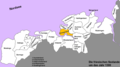
 Nordwestblock.png 632 × 435; 113 KB
-
 Ostfalia locator map (1000).svg 1,500 × 1,500; 5.62 MB
-
 Saxe primitive.JPG 576 × 551; 103 KB
-
 Saxon.emigration.5th.cen.jpg 2,301 × 2,140; 1,000 KB
-
 Saxony locator map (1000).svg 4,431 × 3,875; 4.7 MB
-
 Schuchardt Atlas Nds (6).jpg 3,048 × 1,543; 2.06 MB
-
 Seelandeauricherland.png 1,191 × 666; 241 KB
-
 Seelandeemsigerland.png 1,191 × 666; 242 KB
-
 Seelandefedergo.png 1,191 × 666; 241 KB
-
 Seelandeharlingerland.png 1,191 × 666; 254 KB
-
 Seelandelengen.png 1,191 × 666; 254 KB
-
 Seelandenorden.png 1,191 × 666; 254 KB
-
 Seelandeoestringen.png 1,191 × 666; 254 KB
-
 Seelanderheiderland.png 1,191 × 666; 254 KB
-
 Seelandeverledingen.png 1,191 × 666; 254 KB
-
 Spruner-Menke Handatlas 1880 Karte 33 (Leinegau).jpg 1,319 × 1,614; 1.07 MB
-
 Spruner-Menke Handatlas 1880 Karte 33 (Liesgau).jpg 1,472 × 1,642; 1.16 MB
-
 Swedish Bremen-Verden.svg 1,800 × 1,800; 305 KB
-
 TerritoriosGüelfosEnriqueElLeón5.svg 1,337 × 1,339; 421 KB
-
 Thidrekssaga Karte.jpg 532 × 608; 131 KB
-
 VitalienbruederNordsee.png 1,633 × 1,622; 1.19 MB


.svg)
.svg)


.svg)


.svg)
.jpg)


.jpg)
.jpg)


