Category:Maps of the history of Brandenburg
Jump to navigation
Jump to search
Federal states of Germany:
Subcategories
This category has the following 6 subcategories, out of 6 total.
*
F
- Maps of Bezirk Frankfurt (14 F)
M
- Maps of Brandenburg Province (17 F)
P
- Maps of Potsdam District (GDR) (23 F)
Media in category "Maps of the history of Brandenburg"
The following 75 files are in this category, out of 75 total.
-
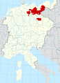 Margraviate of Brandenburg locator map (1250).svg 7,000 × 9,593; 3.23 MB
-
 MarcasNororientalesSacroImperioRomanoGermánicoAño1000.svg 1,471 × 1,954; 6.11 MB
-
 Nordmark.jpg 540 × 477; 68 KB
-
 Północno-wschodnie Niemcy ok 1000-es.svg 1,787 × 1,894; 1.93 MB
-
 Północno-wschodnie Niemcy ok 1000.svg 700 × 742; 3.96 MB
-
 Mark Brandenburg unter den Anhaltinern.jpg 1,682 × 1,321; 786 KB
-
 Karte Mark Brandenburg 1320.png 1,200 × 962; 607 KB
-
 Karte Mark Brandenburg 1320b.png 1,200 × 962; 415 KB
-
 MarkBrandenburg.png 1,200 × 962; 674 KB
-
 Kur Brandenburg.jpg 2,278 × 1,469; 1.37 MB
-
 Brandenburg1477.png 596 × 392; 405 KB
-
 Groß-Mehßow und UmgebungBild802.tif 1,611 × 2,029; 9.38 MB
-
 Sachsen-Anhalt Landesteile Beschriftet.png 1,096 × 1,128; 30 KB
-
 Sachsen-Anhalt Landesteile.png 1,096 × 1,128; 13 KB
-
 DDRBezirke-Brandenburg (ru).png 1,500 × 2,036; 49 KB
-
 DDRBezirke-Brandenburg.png 1,500 × 2,036; 28 KB
-
 BGG-Forschungsgebiet.jpg 3,508 × 2,480; 7.26 MB
-
 Brandenburg in German Democratic Republic 1949 - 1952.svg 618 × 789; 574 KB
-
 C. 1250 Brandenburg region and Sclavonia.jpg 891 × 660; 769 KB
-
 C. 1350 Brandenburg Pomerania.jpg 1,299 × 740; 1.27 MB
-
 C. 1400 Northern Europe Hanseatic League.jpg 2,907 × 1,933; 3.03 MB
-
 C. 1417 Holy Roman Empire (Brandenburg region).jpg 937 × 925; 1.05 MB
-
 C. 1450 Brandenburg Pomerania.jpg 1,151 × 789; 1.03 MB
-
 C. 1540 Brandenburg Pomerania region.jpg 1,215 × 917; 1.24 MB
-
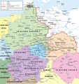
 C. 1610 Holy Roman Empire (Brandenburg region).jpg 940 × 928; 1.07 MB
-
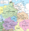
 C. 1688 Brandenburg Prussia and region.jpg 1,884 × 828; 1.74 MB
-
 DDR-Bezirk-Schwerin.png 1,500 × 2,036; 53 KB
-
 Die Woltersdorfer Gutsheide bis 1859.png 4,728 × 3,626; 671 KB
-
 Heutige Zugehörigkeit des ehemaligen Kreisgebietes.png 3,008 × 3,456; 307 KB
-
 Historische Ausdehnung des Schenkenländchens.png 822 × 1,890; 113 KB
-
 Hochstift Brandenburg Ausschnitt.svg 140 × 105; 4.99 MB
-
 Holy Roman Empire 1648 Hohenzollern Brandenburg.png 681 × 595; 162 KB
-
 Karte von Gosen.png 1,982 × 1,348; 1.97 MB
-
 Kreis Perleberg im Bezirk Schwerin.png 418 × 587; 8 KB
-

-
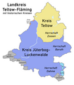 Landkreis Teltow-Fläming mit historischen Kreisen.png 1,676 × 1,912; 132 KB
-
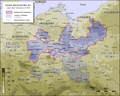
 Locator Brandenburg within the Holy Roman Empire (1618).svg 2,769 × 2,524; 1,024 KB
-
 Lutizenbund-es.svg 1,134 × 997; 1.31 MB
-
 Map for the Silesian and Seven Years Wars.jpg 1,672 × 1,238; 438 KB
-
 MarcaSajonaOrientalAño1000.svg 1,471 × 1,954; 6.07 MB
-
 Grafschaften Holstein Ratzeburg Schwerin Dannenberg Luechow 1250.svg 700 × 794; 1.66 MB
-
 Mark Brandenburg um 1618 auf heutige Ländergrenzen übertragen.png 797 × 534; 138 KB
-
 Bezirk Neubrandenburg in East Germany.svg 554 × 727; 215 KB
-
 Bezirk Neubrandenburg.png 1,500 × 2,036; 76 KB
-
 DDR-Bezirk-NBB.png 1,093 × 1,583; 62 KB
-
 Kreis Pasewalk im Bezirk Neubrandenburg.png 418 × 568; 157 KB
-
 Perleberg in German Democratic Republic.svg 618 × 789; 3 MB
-
 Polabian Slavs.png 550 × 664; 141 KB
-
 DDR-Bezirk-Neubrandenburg-Kreis-Prenzlau.png 418 × 568; 157 KB
-
 Rüdersdorfer Heide um 1800.png 573 × 559; 93 KB
-
 Spruner-Menke Handatlas 1880 Karte 46 Nebenkarte 2.jpg 5,043 × 3,438; 1.62 MB
-
 Kreis Strasburg im Bezirk Neubrandenburg.png 418 × 568; 158 KB
-
 Sächsische Ostmark.PNG 566 × 739; 289 KB
-
 DDR-Bezirk-Neubrandenburg-Kreis-Templin.png 418 × 568; 157 KB
-
 The story of the map of Europe, its making and its changing (1916) (14591691728).jpg 2,800 × 1,840; 523 KB
-
 TribusEslavasOccidentalesAño1000-es.svg 1,420 × 1,230; 1.88 MB
-
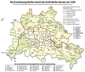 Die Erweiterung Berlins durch das Groß-Berlin-Gesetz von 1920 (Karte).png 1,840 × 1,569; 609 KB
-
 DDR-Bezirk-Cottbus.png 1,500 × 2,036; 42 KB
-
 Karte Jaxa.jpg 647 × 454; 75 KB
-
 Settlements of the Slavic tribes in the Nordmark about 1150 ru.png 1,000 × 763; 323 KB
-
 Karte havellandzaucheteltow.png 1,000 × 763; 149 KB
-
 Karte havellandzaucheteltowspandau.jpg 967 × 645; 155 KB
-
 Karte des Hochstifts Brandenburg.svg 1,890 × 1,030; 82 KB
-
 Land given up to Silesian dukes (Dr. T. Szulc).jpg 1,266 × 779; 218 KB
-
 WielkoPolska epoki Piastowskiej.jpg 4,075 × 3,613; 10.46 MB
-
 Former eastern territories of Germany - Neumark.png 322 × 368; 6 KB
-
 Neumark 1485.svg 744 × 1,052; 14 KB
-
 Nowa marchia 1485.png 745 × 1,053; 71 KB
-
 Reilly 352.jpg 1,320 × 947; 658 KB
-
 Neumark1818.jpg 451 × 490; 48 KB
-
 Nuemarkt 1938.svg 744 × 1,052; 76 KB
-
 Neumarkt1938.png 745 × 1,053; 67 KB
-
 Ruppin 1400.png 651 × 434; 89 KB
-
 Herrschaft Ruppin 1400.PNG 460 × 248; 86 KB
-
 Zones de cantonnement.png 1,808 × 2,083; 559 KB
.svg)


.png)


.jpg)


.jpg)


.svg)


_(14591691728).jpg)

.png)


.jpg)


