Category:Maps of the Margraviate of Meissen
Jump to navigation
Jump to search
Media in category "Maps of the Margraviate of Meissen"
The following 8 files are in this category, out of 8 total.
-
 "Misnia marchionatus = Meissen" (22232354136).jpg 3,978 × 3,079; 2.7 MB
-
 Karte der Markgrafschaft Meißen mit einem Teil des Vogtlandes.jpg 3,000 × 2,682; 1.87 MB
-
 Karte der Markgrafschaft Meißen.png 1,148 × 929; 212 KB
-
 March of Meissen locator map (1004).svg 1,390 × 1,790; 2.45 MB
-
 Mark Lausitz, Karte Anno 1200.jpg 567 × 479; 377 KB
-
 Mark Meißen und Lausitz um 1600, Bartholomäus Scultetus.jpg 1,406 × 1,999; 627 KB
-
 Mark Meißen, Seutter.jpg 14,542 × 12,527; 42.47 MB
-
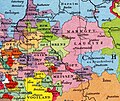
 Markgrafschaft Meissen 1000.png 890 × 570; 369 KB
.jpg)


.svg)


