Category:SVG locator maps of the british occupation zone (location map scheme)
Jump to navigation
Jump to search
Media in category "SVG locator maps of the british occupation zone (location map scheme)"
The following 11 files are in this category, out of 11 total.
-
 Braunschweig innerhalb der britischen Besatzungszone 1946.svg 512 × 624; 454 KB
-
 Deutschland Besatzungszonen 8 Jun 1947 - 22 Apr 1949 britisch.svg 1,075 × 1,273; 738 KB
-
 Hamburg innerhalb der britischen Besatzungszone 1946.svg 512 × 624; 454 KB
-
 Hannover innerhalb der britischen Besatzungszone 1946.svg 512 × 624; 454 KB
-
 Lippe innerhalb der britischen Besatzungszone 1946.svg 512 × 624; 454 KB
-
-
 Oldenburg innerhalb der britischen Besatzungszone 1946.svg 512 × 624; 454 KB
-
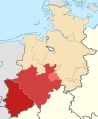
 Rheinland innerhalb der britischen Besatzungszone 1946.svg 639 × 779; 584 KB
-
 Schaumburg-Lippe innerhalb der britischen Besatzungszone 1946.svg 512 × 624; 454 KB
-
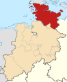 Schleswig-Holstein innerhalb der britischen Besatzungszone 1946.svg 512 × 624; 454 KB
-
 Westfalen innerhalb der britischen Besatzungszone 1946.svg 512 × 624; 454 KB


