Category:Maps of the Duchy of Brunswick
Jump to navigation
Jump to search
Subcategories
This category has the following 2 subcategories, out of 2 total.
Media in category "Maps of the Duchy of Brunswick"
The following 23 files are in this category, out of 23 total.
-
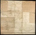
Landkarte Ducatus Brunsvicensis fereq(ue) Lunaeburgensis.jpg 3,617 × 2,989; 2.48 MB
-
1725 Baronie Schauen.jpg 1,443 × 849; 450 KB
-
Brunswick in the German Reich (1871).svg 1,425 × 1,133; 1,014 KB
-
Deutsches R Braunschweig.png 626 × 519; 22 KB
-
Deutsches Reich (Karte) Braunschweig.svg 650 × 545; 1.04 MB
-
Hannover Oldenburg Braunschweig 1905.png 1,900 × 1,484; 1.77 MB
-
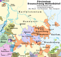
Herzogtum Braunschweig 1789.png 1,000 × 935; 478 KB
-
Herzogtum Braunschweig 1914.png 1,000 × 935; 422 KB
-
Herzogtum Braunschweig.png 1,111 × 886; 205 KB
-
KrkHannover.png 894 × 953; 535 KB
-
Map-DB-Braunschweig.svg 1,793 × 1,571; 1.67 MB
-
Map-DR-Brunswick.svg 2,621 × 2,224; 712 KB
-
Meyers b3 s0359a.jpg 2,048 × 1,626; 1,012 KB
-
Meyer‘s Zeitungsatlas 041 – Herzogthum Braunschweig.jpg 7,344 × 6,251; 18.2 MB
-
Regierungsbezirk Hildesheim - Braunschweig.jpeg 1,075 × 1,165; 857 KB
-
Stielers Handatlas 1891 10 Braunschweig.jpg 1,520 × 1,096; 1.81 MB


