Category:Maps of Oldenburg
Jump to navigation
Jump to search
Subcategories
This category has the following 2 subcategories, out of 2 total.
Media in category "Maps of Oldenburg"
The following 14 files are in this category, out of 14 total.
-
 45 of 'Geschichte des Jeverlands' (11299693373).jpg 1,438 × 1,197; 376 KB
-
 "Oldenburg comitatus - E. Sigmonsz sculp." (21636801553).jpg 3,876 × 3,126; 2.48 MB
-
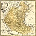 Counties of Oldenburg and Delmenhost 1761.jpg 1,910 × 1,912; 1.93 MB
-
 Locator County of Oldenburg & Delmenhorst (1560).svg 3,821 × 3,455; 375 KB
-
 Locator County of Oldenburg (1560).svg 3,821 × 3,455; 374 KB
-
 Oldenburg 1500.png 371 × 409; 411 KB
-
 EKD Oldenburg.svg 500 × 646; 84 KB
-
 Ekd-oldenburg.png 204 × 278; 6 KB
-
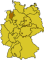
 Oldenburg innerhalb der britischen Besatzungszone 1946.svg 512 × 624; 454 KB
-
 Hannover Oldenburg Braunschweig 1905.png 1,900 × 1,484; 1.77 MB
-
 Karte-Oldenburg-Ex.png 518 × 1,047; 20 KB
-
 Meyers b12 s0362a.jpg 1,619 × 2,048; 840 KB
-
 Seelandeoestringen.png 1,191 × 666; 254 KB
-
 VB Oldenburg.jpg 872 × 741; 71 KB
.jpg)
.jpg)

.svg)
.svg)


