Category:Maps of Brandenburg Province
Jump to navigation
Jump to search
Media in category "Maps of Brandenburg Province"
The following 17 files are in this category, out of 17 total.
-
 Provinz Brandenburg 1871.png 3,240 × 2,588; 434 KB
-
 1905 Administrative Map Province of Brandenburg.svg 512 × 381; 214 KB
-
 Brandenburg superimposed on modern borders.svg 100 × 100; 750 KB
-
 Deutsches Reich (Karte) Provinz Brandenburg.svg 650 × 545; 817 KB
-
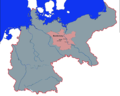
 German Empire - Prussia - Brandenburg (1871).svg 976 × 818; 767 KB
-
 Karte der Provinz Brandenburg - entworfen und gezeichnet von F. Handtke - btv1b530251629.jpg 12,798 × 7,570; 18.7 MB
-
 Landesberg - 33-53.jpg 3,082 × 5,019; 2.86 MB
-
 Lubrza mapa 1936.jpg 909 × 920; 315 KB
-
 Map-Prussia-Brandenburg.png 1,741 × 1,444; 83 KB
-
 Map-Prussia-Brandenburg.svg 2,592 × 2,200; 754 KB
-
 PrBrandenburg.png 1,200 × 1,015; 38 KB
-
 Province of Brandenburg Kingdom of Prussia, 1905, Administrative Map.png 1,875 × 1,390; 560 KB
-

-
 Provinz Brandenburg 1905.png 1,800 × 1,368; 1.43 MB
-
 Provinz Brandenburg.jpg 5,405 × 4,504; 7.02 MB
-
 RBBrandenburg1878.png 388 × 342; 13 KB
-
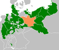
 Weimar Republic - Prussia - Brandenburg (1925).svg 976 × 818; 697 KB


_Provinz_Brandenburg.svg)
.svg)


.svg)