Category:Geological maps of Wyoming
Jump to navigation
Jump to search
States of the United States: Alabama · Alaska · Arizona · Arkansas · California · Colorado · Connecticut · Delaware · Florida · Georgia · Hawaii · Idaho · Illinois · Indiana · Iowa · Kansas · Kentucky · Louisiana · Maine · Maryland · Massachusetts · Michigan · Minnesota · Mississippi · Missouri · Montana · Nebraska · Nevada · New Hampshire · New Jersey · New Mexico · New York · North Carolina · North Dakota · Ohio · Oklahoma · Oregon · Pennsylvania · Rhode Island · South Carolina · South Dakota · Tennessee · Texas · Utah · Vermont · Virginia · Washington · West Virginia · Wisconsin · Wyoming
Puerto Rico
Puerto Rico
Subcategories
This category has the following 8 subcategories, out of 8 total.
Media in category "Geological maps of Wyoming"
The following 25 files are in this category, out of 25 total.
-
CRB-Yellowstone mantle plume model.jpg 3,789 × 4,069; 1.84 MB
-
Denver Basin Location Map.png 750 × 1,225; 30 KB
-
Fold and thrust in the Snake River Canyon.pdf 1,275 × 1,650; 7 KB
-
Geological map Laramie.jpg 1,368 × 1,128; 454 KB
-
Greater Green River Basin Map.jpg 1,285 × 1,408; 336 KB
-
Green River Basin geologic structure map.png 624 × 549; 206 KB
-
Grouse Creek Block Location.jpg 563 × 523; 185 KB
-
Grouse Creek block location1.jpg 1,131 × 1,206; 565 KB
-
Newberry-Yellowstone tracks.png 536 × 326; 19 KB
-
NPS devils-tower-geologic-map.jpg 3,637 × 4,147; 2.99 MB
-
NPS grand-teton-geologic-map-north.jpg 3,087 × 3,595; 2.59 MB
-
NPS yellowstone-lake-geologic-map.jpg 4,508 × 4,460; 2.93 MB
-
NPS yellowstone-norris-geyser-basin-geologic-map.jpg 6,372 × 7,484; 6.73 MB
-
Powder-River-Map.jpg 412 × 444; 130 KB
-
Williston Basin structure map.jpg 871 × 708; 86 KB
-
Williston Basin tectonic map.jpg 635 × 748; 83 KB
-
Wpdms nasa topo shoshone basin.jpg 335 × 280; 30 KB
-
Wpdms nasa topo wind river range.jpg 335 × 280; 30 KB
-
Wyoming Level IV ecoregions.pdf 1,275 × 1,650; 477 KB
-
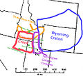
Wyoming, Mojave, Yavapai, Mazatzal, Trans-Hudson.gif 705 × 1,000; 95 KB
-
Yellowstone Caldera map-HE.jpg 3,072 × 2,479; 1.76 MB
-
Yellowstone Caldera map2 750px.JPG 750 × 600; 73 KB
-
Yellowstone Caldera map2.jpg 3,072 × 2,479; 2.42 MB


