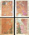
Category:Geological maps of Yellowstone National Park
Jump to navigation
Jump to search
United States national parks: Acadia · American Samoa · Badlands · Bryce Canyon · Canyonlands · Capitol Reef · Carlsbad Caverns · Congaree · Crater Lake · Cuyahoga Valley · Denali · Dry Tortugas · Everglades · Glacier · Glacier Bay · Grand Canyon · Grand Teton · Great Basin · Great Smoky Mountains · Guadalupe Mountains · Haleakalā · Hawaii Volcanoes · Hot Springs · Indiana Dunes · Isle Royale · Joshua Tree · Lake Clark · Lassen Volcanic · Mammoth Cave · Mesa Verde · Mount Rainier · Petrified Forest · Rocky Mountain · Saguaro · Shenandoah · Theodore Roosevelt · Virgin Islands · Voyageurs · White Sands · Wind Cave · Wrangell-St. Elias · Yellowstone · Yosemite · Zion
Subcategories
This category has the following 2 subcategories, out of 2 total.
Media in category "Geological maps of Yellowstone National Park"
The following 13 files are in this category, out of 13 total.
-
HotspotsSRP update2013.JPG 1,063 × 730; 535 KB
-
NPS yellowstone-geologic-map.jpg 6,892 × 5,496; 6.37 MB
-
NPS yellowstone-lake-geologic-map.jpg 4,508 × 4,460; 2.93 MB
-
NPS yellowstone-norris-geyser-basin-geologic-map.jpg 6,372 × 7,484; 6.73 MB
-
USGSmap1959quake.JPG 409 × 417; 49 KB
-
YELL145676.00002 (19292943972).jpg 2,936 × 4,012; 15.59 MB
-
Yellowstone Caldera map-HE.jpg 3,072 × 2,479; 1.76 MB
-
Yellowstone Caldera map.jpg 600 × 635; 75 KB
-
Yellowstone Caldera map2 750px.JPG 750 × 600; 73 KB
-
Yellowstone Caldera map2.jpg 3,072 × 2,479; 2.42 MB
-
Yellowstone volcano - ash beds.jpg 1,000 × 650; 297 KB
-
Yellowstone volcano - ash beds.svg 1,430 × 930; 192 KB


