Category:Geological maps of North Carolina
Jump to navigation
Jump to search
States of the United States: Alabama · Alaska · Arizona · Arkansas · California · Colorado · Connecticut · Delaware · Florida · Georgia · Hawaii · Idaho · Illinois · Indiana · Iowa · Kansas · Kentucky · Louisiana · Maine · Maryland · Massachusetts · Michigan · Minnesota · Mississippi · Missouri · Montana · Nebraska · Nevada · New Hampshire · New Jersey · New Mexico · New York · North Carolina · North Dakota · Ohio · Oklahoma · Oregon · Pennsylvania · Rhode Island · South Carolina · South Dakota · Tennessee · Texas · Utah · Vermont · Virginia · Washington · West Virginia · Wisconsin · Wyoming
Puerto Rico
Puerto Rico
Subcategories
This category has the following 2 subcategories, out of 2 total.
Media in category "Geological maps of North Carolina"
The following 7 files are in this category, out of 7 total.
-
 Farmington Gabbro Map Unit.jpg 480 × 492; 53 KB
-
 Mid-Atlantic Appalachian rock types.gif 858 × 614; 66 KB
-
 Mid-Atlantic Appalachian rock types.png 858 × 614; 52 KB
-
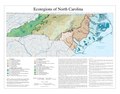 North Carolina Level IV ecoregions.pdf 3,600 × 2,812; 674 KB
-
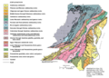
 NPS great-smoky-mountains-geologic-map.jpg 6,434 × 4,233; 10.65 MB
-

-


