Category:Geological maps of Utah
Jump to navigation
Jump to search
States of the United States: Alabama · Alaska · Arizona · Arkansas · California · Colorado · Connecticut · Delaware · Florida · Georgia · Hawaii · Idaho · Illinois · Indiana · Iowa · Kansas · Kentucky · Louisiana · Maine · Maryland · Massachusetts · Michigan · Minnesota · Mississippi · Missouri · Montana · Nebraska · Nevada · New Hampshire · New Jersey · New Mexico · New York · North Carolina · North Dakota · Ohio · Oklahoma · Oregon · Pennsylvania · Rhode Island · South Carolina · South Dakota · Tennessee · Texas · Utah · Vermont · Virginia · Washington · West Virginia · Wisconsin · Wyoming
Puerto Rico
Puerto Rico
Subcategories
This category has the following 13 subcategories, out of 13 total.
Media in category "Geological maps of Utah"
The following 33 files are in this category, out of 33 total.
-
Colorado Plateaus map2.jpg 131 × 135; 5 KB
-
Greater Green River Basin Map.jpg 1,285 × 1,408; 336 KB
-
Green River Basin geologic structure map.png 624 × 549; 206 KB
-
Green River Formation Oil Gas Fields map.png 878 × 546; 112 KB
-
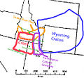
Grouse Creek Block Location.jpg 563 × 523; 185 KB
-
Grouse Creek block location1.jpg 1,131 × 1,206; 565 KB
-
Kosmoceratops map.png 1,968 × 1,378; 556 KB
-
Mancos Mowry shale oil gas fields.png 885 × 545; 205 KB
-
Map of the Navajo Volcanic Fields.jpg 1,280 × 1,467; 568 KB
-
Mesaverde Gas Fields.png 914 × 559; 223 KB
-
Mt. Kinesava geologic map.png 2,191 × 2,307; 7.99 MB
-
Nasutoceratops map.png 1,968 × 1,378; 557 KB
-
NPS bryce-canyon-geologic-map.jpg 3,262 × 4,054; 2.17 MB
-
NPS capitol-reef-geologic-map.jpg 4,222 × 5,695; 5.81 MB
-
NPS cedar-breaks-geologic-map.gif 1,848 × 2,282; 405 KB
-
NPS dinosaur-geologic-map.jpg 6,373 × 4,188; 6.03 MB
-
NPS glen-canyon-geologic-map-central.jpg 3,143 × 1,859; 2.39 MB
-
NPS glen-canyon-geologic-map-north.jpg 2,003 × 2,997; 2.24 MB
-
NPS glen-canyon-geologic-map-south.jpg 3,145 × 1,865; 2.13 MB
-
NPS rainbow-bridge-geologic-map.jpg 1,466 × 1,932; 382 KB
-
NPS zion-geologic-map.jpg 7,787 × 5,332; 10.96 MB
-
Paradox Basin.jpg 3,400 × 4,400; 2.11 MB
-
Spence Shale stratigrapy 03.png 444 × 539; 199 KB
-
Summerville Formation map.jpg 768 × 852; 91 KB
-
Uinta Basin map.png 976 × 561; 77 KB
-
Uinta Piceance Basins geologic map.gif 1,782 × 1,115; 170 KB
-
Uinta Piceance Basins geologic map.png 1,008 × 545; 185 KB
-
USGS Bulletin 1021-E Plate 17.tif 4,245 × 8,389, 5 pages; 5.57 MB
-
USGS Lisbon Valley map.png 613 × 571; 42 KB
-
Utah Oil Shale and Tar Sands Deposits.gif 800 × 618; 68 KB
-
Utah regional geology.PNG 472 × 613; 64 KB
-
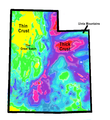
Utah-Gravity-Map-Simplified.png 990 × 1,080; 513 KB
-
UtahTarSands.png 3,960 × 3,060; 827 KB


