Category:Geological maps of New Mexico
Jump to navigation
Jump to search
States of the United States: Alabama · Alaska · Arizona · Arkansas · California · Colorado · Connecticut · Delaware · Florida · Georgia · Hawaii · Idaho · Illinois · Indiana · Iowa · Kansas · Kentucky · Louisiana · Maine · Maryland · Massachusetts · Michigan · Minnesota · Mississippi · Missouri · Montana · Nebraska · Nevada · New Hampshire · New Jersey · New Mexico · New York · North Carolina · North Dakota · Ohio · Oklahoma · Oregon · Pennsylvania · Rhode Island · South Carolina · South Dakota · Tennessee · Texas · Utah · Vermont · Virginia · Washington · West Virginia · Wisconsin · Wyoming
Puerto Rico
Puerto Rico
Subcategories
This category has the following 7 subcategories, out of 7 total.
Media in category "Geological maps of New Mexico"
The following 22 files are in this category, out of 22 total.
-
AZ NM ecoregions.gif 462 × 381; 25 KB
-
Colorado Plateaus map2.jpg 131 × 135; 5 KB
-
Condon 1992 USGS Professional Paper 1505-A plate-1.jpg 19,400 × 13,400; 19.12 MB
-
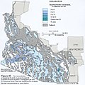
Delaware Basin map.PNG 1,160 × 734; 123 KB
-
EBloc.jpg 272 × 354; 22 KB
-
Geologic Map of New Mexico.png 3,384 × 3,816; 16.31 MB
-
Geological map of the southeast San Juan Basin.png 3,250 × 1,611; 1.09 MB
-
Hillsboro New Mexico geologic map.png 766 × 615; 335 KB
-
Kingston New Mexico geologic map.png 775 × 610; 391 KB
-
Map of major formations of the Permian Basin (34241207496).png 556 × 291; 106 KB
-
Map of the Navajo Volcanic Fields.jpg 1,280 × 1,467; 568 KB
-
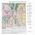
New Mexico EPA ecoregions.pdf 3,600 × 3,600; 3.18 MB
-
NPS bandelier-geologic-map.jpg 4,582 × 2,767; 4.58 MB
-
NPS carlsbad-caverns-geologic-map.jpg 3,190 × 2,491; 1.59 MB
-
NPS white-sands-geologic-map-regional.jpg 3,113 × 1,694; 1.24 MB
-
NPS white-sands-geologic-map.jpg 3,092 × 1,659; 1.12 MB
-
Paradox Basin.jpg 3,400 × 4,400; 2.11 MB
-
Riogranderift localitymap.png 595 × 704; 58 KB
-
Southern-Arizona-fluoride-groundwater.jpeg 603 × 597; 343 KB
-
Texas seismicity map.pdf 1,800 × 1,350; 2.15 MB
-
Val Verde Generalized Map.jpg 478 × 372; 36 KB


