Category:Geological maps of Idaho
Jump to navigation
Jump to search
States of the United States: Alabama · Alaska · Arizona · Arkansas · California · Colorado · Connecticut · Delaware · Florida · Georgia · Hawaii · Idaho · Illinois · Indiana · Iowa · Kansas · Kentucky · Louisiana · Maine · Maryland · Massachusetts · Michigan · Minnesota · Mississippi · Missouri · Montana · Nebraska · Nevada · New Hampshire · New Jersey · New Mexico · New York · North Carolina · North Dakota · Ohio · Oklahoma · Oregon · Pennsylvania · Rhode Island · South Carolina · South Dakota · Tennessee · Texas · Utah · Vermont · Virginia · Washington · West Virginia · Wisconsin · Wyoming
Puerto Rico
Puerto Rico
Subcategories
This category has the following 6 subcategories, out of 6 total.
Media in category "Geological maps of Idaho"
The following 27 files are in this category, out of 27 total.
-
Atlanta Lobe of the Idaho Batholith geologic map.png 714 × 763; 339 KB
-
Bitterroot Lobe of the Idaho Batholith geologic map.png 723 × 768; 243 KB
-
Boulder batholith location.jpg 712 × 779; 81 KB
-
Columbia River Flood-Basalt Province.jpg 1,224 × 1,237; 1.48 MB
-
Craters of the Moon geologic map.jpg 5,312 × 2,988; 6.54 MB
-
CRB-Yellowstone mantle plume model.jpg 3,789 × 4,069; 1.84 MB
-
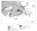
Geologic Map Atlanta area.png 892 × 764; 178 KB
-
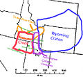
Grouse Creek Block Location.jpg 563 × 523; 185 KB
-
Grouse Creek block location1.jpg 1,131 × 1,206; 565 KB
-
HotspotsSRP update2013.JPG 1,063 × 730; 535 KB
-
Idaho Batholith and Salmon River Arch.png 438 × 783; 143 KB
-
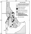
Idaho Batholith.png 698 × 781; 164 KB
-
IdahoBatholith.jpg 1,931 × 3,150; 591 KB
-
Lava Ridge Wind Project DEIS Comparison of Action Alternatives.png 1,155 × 655; 1.13 MB
-
Level IV ecoregions, Snake River Plain.png 1,479 × 802; 875 KB
-
Map of Washington, Oregon and Idaho geological deposits.jpeg 900 × 634; 315 KB
-
Newberry-Yellowstone tracks.png 536 × 326; 19 KB
-
Purcell and Rocky Mountain Trenches within the US.png 1,228 × 835; 122 KB
-
Salmon River Arch.png 604 × 761; 82 KB
-
Snake R volcanic field 5563.jpg 6,000 × 4,000; 7.96 MB
-
Snake river plain aquifer H058.jpeg 883 × 529; 156 KB
-
Snake river plain.png 1,161 × 928; 179 KB
-
Spence Shale stratigrapy 03.png 444 × 539; 199 KB
-
Yellowstone Caldera map-HE.jpg 3,072 × 2,479; 1.76 MB
-
Yellowstone Caldera map2 750px.JPG 750 × 600; 73 KB
-
Yellowstone Caldera map2.jpg 3,072 × 2,479; 2.42 MB


