Category:Geological maps of Minnesota
Jump to navigation
Jump to search
States of the United States: Alabama · Alaska · Arizona · Arkansas · California · Colorado · Connecticut · Delaware · Florida · Georgia · Hawaii · Idaho · Illinois · Indiana · Iowa · Kansas · Kentucky · Louisiana · Maine · Maryland · Massachusetts · Michigan · Minnesota · Mississippi · Missouri · Montana · Nebraska · Nevada · New Hampshire · New Jersey · New Mexico · New York · North Carolina · North Dakota · Ohio · Oklahoma · Oregon · Pennsylvania · Rhode Island · South Carolina · South Dakota · Tennessee · Texas · Utah · Vermont · Virginia · Washington · West Virginia · Wisconsin · Wyoming
Puerto Rico
Puerto Rico
Subcategories
This category has the following 2 subcategories, out of 2 total.
Media in category "Geological maps of Minnesota"
The following 29 files are in this category, out of 29 total.
-
13,000 YBP Lockhart Phase.jpg 1,463 × 1,210; 127 KB
-
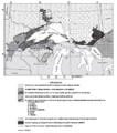
Animikie Group and Marquette Range and Huronian supergroups.PNG 386 × 436; 59 KB
-
Animikie Group, Marquette Range and Huronian supergroups2.PNG 692 × 776; 183 KB
-
Bedrock geology of Minnesota.png 750 × 750; 40 KB
-
Cuyuna Iron Range general geology.PNG 663 × 462; 30 KB
-
Frac Sand Midwest.svg 622 × 638; 3.83 MB
-
Geologic Map Lake Superior MN WI MI.jpg 16,327 × 11,018; 35.93 MB
-
Geologic map NE Minnesota.jpg 12,413 × 8,640; 23.82 MB
-
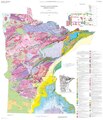
Geologic Map of Minnesota- Bedrock Geology (2011).pdf 7,500 × 8,737; 10.37 MB
-
Geologic Map SE MN.jpg 12,796 × 9,827; 32.94 MB
-
Glacial lakes of Minnesota.GIF 340 × 440; 19 KB
-
Iron Ranges.jpg 675 × 510; 92 KB
-
Iron Ranges—Залізорудні родовища району озера Верхнього.png 2,697 × 2,040; 384 KB
-
Midcontinent Rift map.PNG 774 × 675; 55 KB
-
Minn ecoregionsmap.pdf 1,612 × 2,512; 613 KB
-
Minnesota's Distribution of Exposed Crystalline Rocks.PNG 611 × 678; 92 KB
-
Minnesota's earthquake epicenters.PNG 599 × 715; 97 KB
-
MN Geologic Map.jpg 14,944 × 11,281; 25.46 MB
-
MN USGS Tapestry.jpg 569 × 349; 163 KB
-
MNbedrock1.gif 725 × 725; 34 KB
-
MNGeolRegions.GIF 1,200 × 1,500; 669 KB
-
MNShadedRelief.gif 328 × 358; 63 KB
-
Ne mn geologic map.jpg 779 × 731; 185 KB
-
Quaternary Geologic Map Minnesota.jpg 15,203 × 17,256; 53.93 MB
-
River Warren Valley.gif 617 × 427; 220 KB
-
SJU Native Vegetation New Wiki Version.JPG 1,828 × 2,127; 1.21 MB
-
The Vermilion iron-bearing district of Minnesota - with an atlas (1903) (14774025495).jpg 4,086 × 1,448; 1.15 MB
-
Traverse Gap and Big Stone Lake.gif 425 × 425; 77 KB


