Category:Maps of geologic formations in New Mexico
Jump to navigation
Jump to search
States of the United States: Florida · New Mexico
Media in category "Maps of geologic formations in New Mexico"
The following 10 files are in this category, out of 10 total.
-
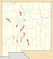 Abo Formation exposure map.jpg 400 × 450; 38 KB
-
 Arroyo Penasco outcrop map.jpg 400 × 450; 31 KB
-
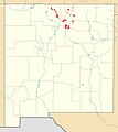
 Bandelier Tuff map.jpg 400 × 450; 32 KB
-
 Caballero Formation outcrop map.jpg 1,245 × 1,401; 163 KB
-
 Glorieta Formation outcrop map.jpg 400 × 450; 43 KB
-
 Hondo Group outcrop map.jpg 400 × 450; 33 KB
-
 La Tuna Map.jpg 1,245 × 1,401; 158 KB
-
 Summerville Formation map.jpg 768 × 852; 91 KB
-
 Vadito Group outcrop map.jpg 400 × 450; 33 KB
-
 Yeso Formation exposure map.jpg 400 × 450; 50 KB


