Category:Details of old maps of Israel and Palestine
Jump to navigation
Jump to search
Subcategories
This category has the following 21 subcategories, out of 21 total.
P
Media in category "Details of old maps of Israel and Palestine"
The following 25 files are in this category, out of 25 total.
-

-
 Darton, William. Turkey in Asia. 1811 (DB).jpg 768 × 923; 186 KB
-
 Pinkerton, John. Turkey in Asia. 1813 (FC).jpg 467 × 593; 106 KB
-
-

-
 Tel Yokneam and Jacotin's map.png 314 × 469; 318 KB
-

-
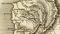
 Johnston, Alexander Keith (1804-1871). Turkey in Asia, Transcaucasia. 1861 (C).jpg 1,720 × 1,417; 460 KB
-

-

-

-

-
 WilsonHoshAlBurak.png 1,883 × 3,087; 1.63 MB
-
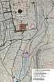
 Kalat al Jalud in the 1865 Ordnance Survey of Jerusalem Old City full map (cropped).jpg 1,405 × 1,436; 1.08 MB
-
 Silwan in the 1865 Ordnance Survey of Jerusalem Old City full map (cropped).jpg 1,973 × 3,231; 3.12 MB
-
 Southern wall of the Temple Mount, City of David, Kidron Valley and Siloam, 1865.jpg 3,279 × 4,970; 8.31 MB
-

-
 Carte Mission Parker.jpg 659 × 996; 876 KB
-
 RC schick 1894.jpg 800 × 831; 237 KB
-
 Heinrich Kiepert. Asia citerior.Coele.Syria.jpg 1,678 × 1,243; 361 KB
-
 Heinrich Kiepert. Asia citerior.Judaea.jpg 854 × 1,055; 199 KB
-
 Heinrich Kiepert. Asia citerior.Mare.Phoenicium.jpg 1,539 × 2,077; 616 KB
-
 Heinrich Kiepert. Asia citerior.Palastina.jpg 1,197 × 1,055; 263 KB
-
 Heinrich Kiepert. Asia citerior.Phoenice.jpg 1,154 × 1,283; 291 KB
-

.H.jpg)
.jpg)
.jpg)


.jpg)
.jpg)

.jpg)


_Pool_in_the_Ordnance_Survey_of_Jerusalem.png)
._Turkey_in_Asia,_Transcaucasia._1861_(C).jpg)
._Turkey_in_Asia,_Transcaucasia._1861_(CC).jpg)
._Turkey_in_Asia,_Transcaucasia._1861_(CCB).jpg)
._Turkey_in_Asia,_Transcaucasia._1861_(CCC).jpg)
._Turkey_in_Asia,_Transcaucasia._1861_(CCD).jpg)