Category:PEF Map of Western Palestine (details)
Jump to navigation
Jump to search
Media in category "PEF Map of Western Palestine (details)"
The following 10 files are in this category, out of 10 total.
-
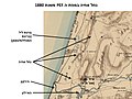
 Jericho and Tell es Sultan in the Survey of Western Palestine 1880.18 (cropped).jpg 2,480 × 1,404; 1.15 MB
-

-
 Tell Arad in the Survey of Western Palestine 1880.25 (cropped).jpg 1,240 × 695; 273 KB
-
 אזור ואדי חנין בסביבות 1880.jpg 960 × 720; 116 KB
-
 יער השרון במפת ה PEF (סביבות 1880).jpg 960 × 720; 118 KB
-
 יער השרון מפת ה PEF.jpg 960 × 720; 121 KB
-
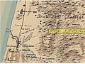
 מפת ה PEF (סביבות 1880) קווי הטלגרף הוליכים ליפו מדרום.png 960 × 720; 1.09 MB
-
 מפת חורבת זנוח.jpg 971 × 492; 120 KB
-
 נחל אחיה PEF.jpg 960 × 720; 89 KB
-
 עמק גלילות מפת PEF.jpg 960 × 720; 112 KB
.jpg)
.jpg)
.jpg)

.jpg)

_%D7%A7%D7%95%D7%95%D7%99_%D7%94%D7%98%D7%9C%D7%92%D7%A8%D7%A3_%D7%94%D7%95%D7%9C%D7%99%D7%9B%D7%99%D7%9D_%D7%9C%D7%99%D7%A4%D7%95_%D7%9E%D7%93%D7%A8%D7%95%D7%9D.png)


