Category:PEF map of Western Palestine (details of sheet 20)
Jump to navigation
Jump to search
Media in category "PEF map of Western Palestine (details of sheet 20)"
The following 33 files are in this category, out of 33 total.
-
-
 Ashkelon1870s.jpg 1,877 × 1,176; 500 KB
-
 Conder and Kitchener 1880, Tel Erani.jpg 400 × 739; 73 KB
-
 Historical map series for the area of al-Dawayima (1870s).jpg 736 × 740; 224 KB
-
 Historical map series for the area of al-Faluja (1870s).jpg 737 × 740; 131 KB
-
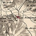
 Historical map series for the area of al-Jammama (1870s).jpg 736 × 739; 238 KB
-
 Historical map series for the area of al-Jiyya (1870s).jpg 737 × 740; 186 KB
-
 Historical map series for the area of al-Muharraqa (1870s).jpg 736 × 739; 194 KB
-
 Historical map series for the area of Al-Qubayba, Hebron (1870s).jpg 736 × 740; 216 KB
-
 Historical map series for the area of Barbara, Gaza (1870s).jpg 737 × 740; 196 KB
-
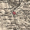 Historical map series for the area of Bayt Jibrin (1870s).jpg 737 × 740; 259 KB
-
 Historical map series for the area of Bayt Jirja (1870s).jpg 737 × 740; 166 KB
-
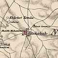
 Historical map series for the area of Bayt Tima (1870s).jpg 737 × 740; 197 KB
-
 Historical map series for the area of Burayr (1870s).jpg 736 × 740; 143 KB
-
 Historical map series for the area of Dayr Muhaysin (1870s).jpg 738 × 742; 230 KB
-
 Historical map series for the area of Dayr Nakhkhas (1870s).jpg 737 × 740; 252 KB
-
 Historical map series for the area of Hatta, Gaza (1870s).jpg 737 × 741; 109 KB
-
 Historical map series for the area of Huj, Gaza (1870s).jpg 736 × 740; 197 KB
-
 Historical map series for the area of Hulayqat (1870s).jpg 737 × 740; 199 KB
-
 Historical map series for the area of Iraq al-Manshiyya (1870s).jpg 737 × 740; 122 KB
-
 Historical map series for the area of Iraq Suwaydan (1870s).jpg 737 × 741; 161 KB
-
 Historical map series for the area of Jusayr (1870s).jpg 737 × 741; 118 KB
-
 Historical map series for the area of Karatiyya (1870s).jpg 737 × 741; 132 KB
-
 Historical map series for the area of Kawfakha (1870s).jpg 736 × 739; 228 KB
-
 Historical map series for the area of Kawkaba (1870s).jpg 737 × 740; 197 KB
-
 Historical map series for the area of Kudna (1870s).jpg 737 × 741; 254 KB
-
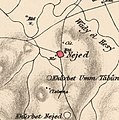 Historical map series for the area of Najd, Gaza (1870s).jpg 736 × 740; 183 KB
-
 Historical map series for the area of Ni'ilya (1870s).jpg 737 × 741; 217 KB
-
 Historical map series for the area of Simsim, Gaza (1870s).jpg 736 × 740; 176 KB
-
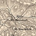
 Historical map series for the area of Summil (1870s).jpg 737 × 741; 180 KB
-
 Historical map series for the area of Zayta, Hebron (1870s).jpg 737 × 741; 187 KB
-
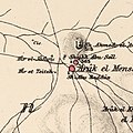
 Historical map series for the area of Zikrin (1870s).jpg 737 × 741; 222 KB
-
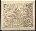
 Tell el Hesy in the Survey of Western Palestine 1880.20 (cropped).jpg 1,437 × 1,029; 812 KB
.jpg)


.jpg)
.jpg)
.jpg)
.jpg)
.jpg)
.jpg)
.jpg)
.jpg)
.jpg)
.jpg)
.jpg)
.jpg)
.jpg)
.jpg)
.jpg)
.jpg)
.jpg)
.jpg)
.jpg)
.jpg)
.jpg)
.jpg)
.jpg)
.jpg)
.jpg)
.jpg)
.jpg)
.jpg)
.jpg)
.jpg)