Category:PEF map of Western Palestine (details of sheet 4)
Jump to navigation
Jump to search
Media in category "PEF map of Western Palestine (details of sheet 4)"
The following 51 files are in this category, out of 51 total.
-

-
 Historical map series for the area of 'Akbara (1870s).jpg 747 × 751; 242 KB
-
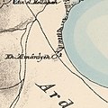 Historical map series for the area of al-'Ulmaniyya (1870s).jpg 749 × 752; 145 KB
-
 Historical map series for the area of al-Buwayziyya (1870s).jpg 749 × 753; 248 KB
-
 Historical map series for the area of al-Dirdara (1870s).jpg 748 × 752; 91 KB
-
 Historical map series for the area of Al-Malkiyya (1870s).jpg 749 × 627; 190 KB
-
 Historical map series for the area of al-Mansura, Acre (1870s).jpg 749 × 752; 246 KB
-
 Historical map series for the area of al-Nabi Yusha' (1870s).jpg 749 × 753; 235 KB
-
 Historical map series for the area of al-Ras al-Ahmar (1870s).jpg 748 × 752; 218 KB
-
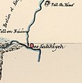 Historical map series for the area of al-Salihiyya (1870s).jpg 749 × 753; 111 KB
-
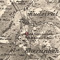 Historical map series for the area of al-Sammu'i (1870s).jpg 748 × 751; 249 KB
-
 Historical map series for the area of al-Wayziyya (1870s).jpg 748 × 752; 202 KB
-
 Historical map series for the area of al-Zahiriyya al-Tahta (1870s).jpg 748 × 751; 253 KB
-
 Historical map series for the area of al-Zanghariyya (1870s).jpg 748 × 751; 235 KB
-
 Historical map series for the area of Ammuqa (1870s).jpg 748 × 752; 228 KB
-
 Historical map series for the area of Arab al-Zubayd (1870s).jpg 749 × 752; 203 KB
-
 Historical map series for the area of Baysamun (1870s).jpg 749 × 752; 227 KB
-
 Historical map series for the area of Biriyya (1870s).jpg 748 × 751; 223 KB
-
 Historical map series for the area of Dallata (1870s).jpg 748 × 752; 200 KB
-
 Historical map series for the area of Dayr al-Qassi (1870s).jpg 748 × 752; 249 KB
-
 Historical map series for the area of Dayshum (1870s).jpg 749 × 752; 222 KB
-
 Historical map series for the area of Ein al-Zeitun (1870s).jpg 748 × 751; 238 KB
-
 Historical map series for the area of Fara, Safad (1870s).jpg 749 × 752; 222 KB
-
 Historical map series for the area of Farradiyya (1870s).jpg 747 × 751; 252 KB
-
 Historical map series for the area of Fir'im (1870s).jpg 748 × 751; 232 KB
-
 Historical map series for the area of Ghabbatiyya (1870s).jpg 748 × 752; 246 KB
-
 Historical map series for the area of Harrawi (1870s).jpg 749 × 752; 235 KB
-
 Historical map series for the area of Jahula (1870s).jpg 749 × 753; 237 KB
-
 Historical map series for the area of Kafr 'Inan (1870s).jpg 747 × 751; 257 KB
-
 Historical map series for the area of Kafr Bir'im (1870s).jpg 748 × 752; 247 KB
-
 Historical map series for the area of Khirbat al-Muntar (1870s).jpg 748 × 752; 184 KB
-
 Historical map series for the area of Mallaha (1870s).jpg 749 × 752; 207 KB
-
 Historical map series for the area of Mansurat al-Khayt (1870s).jpg 748 × 751; 228 KB
-
 Historical map series for the area of Marus (1870s).jpg 748 × 752; 240 KB
-
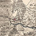 Historical map series for the area of Meiron (1870s).jpg 748 × 751; 234 KB
-
 Historical map series for the area of Mughr al-Khayt (1870s).jpg 748 × 752; 238 KB
-
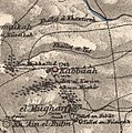 Historical map series for the area of Qabba'a (1870s).jpg 748 × 752; 236 KB
-
 Historical map series for the area of Qadas (1870s).jpg 499 × 753; 125 KB
-
 Historical map series for the area of Qaddita (1870s).jpg 748 × 752; 208 KB
-
 Historical map series for the area of Sa'sa' (1870s).jpg 748 × 752; 233 KB
-
 Historical map series for the area of Sabalan, Safad (1870s).jpg 748 × 752; 253 KB
-
 Historical map series for the area of Safsaf (1870s).jpg 748 × 752; 212 KB
-
 Historical map series for the area of Saliha (1870s).jpg 749 × 752; 222 KB
-
 Historical map series for the area of Taytaba (1870s).jpg 748 × 752; 191 KB
-
 Historical map series for the area of Tulayl (1870s).jpg 748 × 752; 123 KB
-
 Historical map series for the area of Yarda, Safad (1870s).jpg 748 × 752; 150 KB
-
 Historical map series for the area of Zawiya, Safad (1870s).jpg 749 × 753; 176 KB
-
 Huleh Valley - PEF map 1880 rework 1.jpg 3,569 × 5,537; 4.68 MB
-
 Huleh Valley - PEF map 1880.jpg 2,793 × 3,105; 1.76 MB
-
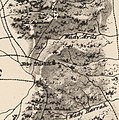
 Jaauneh - Rosh Pina - PEF map 1880.jpg 1,545 × 667; 346 KB
-
 Tel Teo map of the P.E.F 1887.jpg 602 × 357; 138 KB
.jpg)
.jpg)
.jpg)
.jpg)
.jpg)
.jpg)
.jpg)
.jpg)
.jpg)
.jpg)
.jpg)
.jpg)
.jpg)
.jpg)
.jpg)
.jpg)
.jpg)
.jpg)
.jpg)
.jpg)
.jpg)
.jpg)
.jpg)
.jpg)
.jpg)
.jpg)
.jpg)
.jpg)
.jpg)
.jpg)
.jpg)
.jpg)
.jpg)
.jpg)
.jpg)
.jpg)
.jpg)
.jpg)
.jpg)
.jpg)
.jpg)
.jpg)
.jpg)
.jpg)
.jpg)
.jpg)
.jpg)


