Category:PEF map of Western Palestine (details of sheet 11)
Jump to navigation
Jump to search
Media in category "PEF map of Western Palestine (details of sheet 11)"
The following 9 files are in this category, out of 9 total.
-

-
 Historical map series for the area of al-Jalama, Tulkarm (1870s).jpg 743 × 747; 127 KB
-
 Historical map series for the area of al-Manshiyya, Tulkarm (1870s).jpg 743 × 747; 137 KB
-
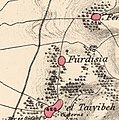 Historical map series for the area of Fardisya (1870s).jpg 742 × 746; 203 KB
-
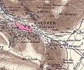
 Historical map series for the area of Khirbat al-Majdal (1870s).jpg 743 × 747; 140 KB
-
 Historical map series for the area of Khirbat Zalafa (1870s).jpg 743 × 747; 151 KB
-
 Historical map series for the area of Qaqun (1870s).jpg 743 × 746; 112 KB
-
-
 Sheet 11.part.jpg 2,185 × 1,910; 2.85 MB
.jpg)
.jpg)
.jpg)
.jpg)
.jpg)
.jpg)
.jpg)
.jpg)
