Category:Aerial photographs of the Northern Mariana Islands
Jump to navigation
Jump to search
Countries of Oceania: Australia · Fiji · Federated States of Micronesia · Kiribati · Marshall Islands · Nauru · New Zealand · Palau · Papua New Guinea · Samoa · Solomon Islands · Tonga · Tuvalu · Vanuatu
Other areas: American Samoa · Clipperton Island · Cook Islands · French Polynesia · Guam · Hawaii · New Caledonia · Northern Mariana Islands · Wallis and Futuna – Partly: British overseas territories · Indonesia · French Southern and Antarctic Lands · United States Minor Outlying Islands
Other areas: American Samoa · Clipperton Island · Cook Islands · French Polynesia · Guam · Hawaii · New Caledonia · Northern Mariana Islands · Wallis and Futuna – Partly: British overseas territories · Indonesia · French Southern and Antarctic Lands · United States Minor Outlying Islands
States of the United States: Alabama · Alaska · Arizona · Arkansas · California · Colorado · Connecticut · Delaware · Florida · Georgia · Hawaii · Idaho · Illinois · Indiana · Iowa · Kansas · Kentucky · Louisiana · Maine · Maryland · Massachusetts · Michigan · Minnesota · Mississippi · Missouri · Montana · Nebraska · Nevada · New Hampshire · New Jersey · New Mexico · New York · North Carolina · North Dakota · Ohio · Oklahoma · Oregon · Pennsylvania · Rhode Island · South Carolina · South Dakota · Tennessee · Texas · Utah · Vermont · Virginia · Washington · West Virginia · Wisconsin · Wyoming – District of Columbia: Washington, D.C.
insular area of the United States: American Samoa · Guam · Northern Mariana Islands · Puerto Rico · United States Virgin Islands – United States Minor Outlying Islands: Baker Island · Midway Atoll · Wake Island
insular area of the United States: American Samoa · Guam · Northern Mariana Islands · Puerto Rico · United States Virgin Islands – United States Minor Outlying Islands: Baker Island · Midway Atoll · Wake Island
Media in category "Aerial photographs of the Northern Mariana Islands"
The following 16 files are in this category, out of 16 total.
-
 Aerial view of Tinian island.jpg 640 × 480; 83 KB
-
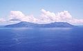 Anatahan aerial.jpg 640 × 400; 29 KB
-
 Asuncion Island Aerial.jpg 432 × 258; 32 KB
-
 Asuncion island.jpg 640 × 416; 19 KB
-
 Farallon de Medinilla Aerial.jpg 268 × 175; 84 KB
-
 Farallon de Pajaros USGS.jpg 432 × 276; 29 KB
-
 Farallon de Pajaros.jpg 640 × 453; 26 KB
-
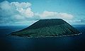
 Guguan island.jpg 640 × 421; 59 KB
-
 Isley field end of war lg.jpg 800 × 572; 101 KB
-
 Maug Islands Aerial.JPG 432 × 283; 29 KB
-
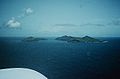
 Maug islands.jpg 640 × 417; 27 KB
-
 Saipan.jpg 3,008 × 2,000; 3.93 MB
-
 Sarigan Aerial.jpg 432 × 270; 30 KB
-
 Sarigan island.jpg 640 × 416; 27 KB
-
 South Pagan.jpg 640 × 414; 34 KB
-
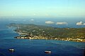
 Typhoon Pongsona - Rota.jpg 3,000 × 1,955; 5.13 MB


