Category:Aerial photographs of Montana
Jump to navigation
Jump to search
States of the United States: Alabama · Alaska · Arizona · Arkansas · California · Colorado · Connecticut · Delaware · Florida · Georgia · Hawaii · Idaho · Illinois · Indiana · Iowa · Kansas · Kentucky · Louisiana · Maine · Maryland · Massachusetts · Michigan · Minnesota · Mississippi · Missouri · Montana · Nebraska · Nevada · New Hampshire · New Jersey · New Mexico · New York · North Carolina · North Dakota · Ohio · Oklahoma · Oregon · Pennsylvania · Rhode Island · South Carolina · South Dakota · Tennessee · Texas · Utah · Vermont · Virginia · Washington · West Virginia · Wisconsin · Wyoming – District of Columbia: Washington, D.C.
insular area of the United States: American Samoa · Guam · Northern Mariana Islands · Puerto Rico · United States Virgin Islands – United States Minor Outlying Islands: Baker Island · Midway Atoll · Wake Island
insular area of the United States: American Samoa · Guam · Northern Mariana Islands · Puerto Rico · United States Virgin Islands – United States Minor Outlying Islands: Baker Island · Midway Atoll · Wake Island
English: Aerial photographs of Montana.
Subcategories
This category has the following 4 subcategories, out of 4 total.
Media in category "Aerial photographs of Montana"
The following 172 files are in this category, out of 172 total.
-
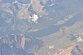
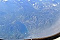
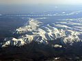
 2009-0603-10-Air-RockyMountainFront.jpg 3,648 × 2,736; 5.9 MB
-
 Aerial - Bull Lake, Montana 01 (10323421216).jpg 2,848 × 4,288; 3.78 MB
-
 Aerial - Bull Lake, Montana 01 - white balanced (10329376873).jpg 2,848 × 4,288; 5.79 MB
-
 Aerial - Bull Lake, Montana 02 (10323060293).jpg 4,288 × 2,848; 3.91 MB
-
 Aerial - Bull Lake, Montana 02 - white balanced (10329487584).jpg 4,288 × 2,848; 6.32 MB
-
 Aerial - Bull Lake, Montana 03 (10323081813).jpg 2,848 × 4,288; 5.25 MB
-
 Aerial - Bull Lake, Montana 03 - white balanced (10329240274).jpg 2,848 × 4,288; 6.38 MB
-
 Aerial - central part of St. Mary Lake (MT) 01 (10322548244).jpg 4,288 × 2,848; 4.18 MB
-
 Aerial - central part of St. Mary Lake (MT) 01 - white balanced (10321903563).jpg 4,288 × 2,848; 8.35 MB
-
 Aerial - Coutts, Alberta & Sweet Grass, MT 01 (10321153895).jpg 4,288 × 2,848; 5.05 MB
-
 Aerial - Coutts, Alberta & Sweet Grass, MT 01 - white balanced (10321201586).jpg 4,288 × 2,848; 7.09 MB
-
 Aerial - east part of St. Mary Lake & Lower St. Mary Lake (MT) 01 (10322511374).jpg 4,288 × 2,848; 4.04 MB
-

-
 Aerial - east part of St. Mary Lake & Lower St. Mary Lake (MT) 02 (10322674303).jpg 4,288 × 2,848; 4.24 MB
-

-
 Aerial - east part of St. Mary Lake (MT) 01 (10322563676).jpg 4,288 × 2,848; 4.23 MB
-
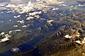
 Aerial - Glacier National Park 01 (10322640886).jpg 4,288 × 2,848; 4.69 MB
-
 Aerial - Glacier National Park 01 - white balanced (10321915685).jpg 4,288 × 2,848; 5.99 MB
-
 Aerial - Glacier National Park 02 (10323321986).jpg 2,848 × 4,288; 5.25 MB
-
 Aerial - Glacier National Park 02 - white balanced (10321869064).jpg 2,848 × 4,288; 6.65 MB
-
 Aerial - Glacier National Park 03 (10322769273).jpg 4,288 × 2,848; 5.41 MB
-
 Aerial - Glacier National Park 03 - white balanced (10321856565).jpg 4,288 × 2,848; 7.55 MB
-
 Aerial - Lake Koocanusa 01 (10322757634).jpg 4,288 × 2,848; 4.83 MB
-
 Aerial - Lake Koocanusa 01 - white balanced (10322463563).jpg 4,288 × 2,848; 6.36 MB
-
 Aerial - Lake Koocanusa 02 (10322770206).jpg 4,288 × 2,848; 4.45 MB
-
 Aerial - Lake Koocanusa 02 - white balanced (10322272175).jpg 4,288 × 2,848; 5.81 MB
-
 Aerial - Lake McDonald (MT) 01 (10323341516).jpg 2,848 × 4,288; 4.8 MB
-
 Aerial - Lake McDonald (MT) 01 - white balanced (10321970205).jpg 2,848 × 4,288; 5.18 MB
-
 Aerial - Lake McDonald (MT) 02 (10322629224).jpg 4,288 × 2,848; 4.86 MB
-
 Aerial - Lake McDonald (MT) 02 - white balanced (10321946125).jpg 4,288 × 2,848; 6.42 MB
-
 Aerial - Lake Sherburne (MT) 01 (10322476464).jpg 4,288 × 2,848; 3.86 MB
-
 Aerial - Lake Sherburne (MT) 01 - white balanced (10321468035).jpg 4,288 × 2,848; 7.25 MB
-
 Aerial - land between St. Mary Lake & Lower St. Mary Lake (MT) 01 (10322638123).jpg 4,288 × 2,848; 4.52 MB
-

-
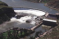
 Aerial - Libby Dam, Montana 01 (10322782514).jpg 4,288 × 2,848; 4.97 MB
-
 Aerial - Libby Dam, Montana 01 - white balanced (10323489774).jpg 4,288 × 2,848; 7.75 MB
-
 Aerial - Libby, Montana 01 (10322876086).jpg 4,288 × 2,848; 4.95 MB
-
 Aerial - Libby, Montana 01 - white balanced (10322324434).jpg 4,288 × 2,848; 9.87 MB
-
 Aerial - Libby, Montana 02 (10323000513).jpg 4,288 × 2,848; 4.81 MB
-
 Aerial - Libby, Montana 02 - white balanced (10322401176).jpg 4,288 × 2,848; 9.22 MB
-
 Aerial - looking north toward Libby, Montana 01 (10339669203).jpg 2,848 × 4,288; 4.48 MB
-
 Aerial - looking north toward Libby, Montana 01 - white balanced (10323234575).jpg 2,848 × 4,288; 8.07 MB
-
 Aerial - looking north toward Libby, Montana 02 (10322817935) (2).jpg 4,288 × 2,848; 3.89 MB
-
 Aerial - looking north toward Libby, Montana 02 - white balanced (10323456784).jpg 4,288 × 2,848; 6.74 MB
-
 Aerial - Lower St. Mary Lake & Lake Sherburne (MT) 01 (10322437294).jpg 4,288 × 2,848; 3.76 MB
-
 Aerial - Lower St. Mary Lake & Lake Sherburne (MT) 01 - white balanced (10321355454).jpg 4,288 × 2,848; 7.32 MB
-
 Aerial - Lower St. Mary Lake & Lake Sherburne (MT) 02 (10322420504).jpg 4,288 × 2,848; 4.02 MB
-
 Aerial - Lower St. Mary Lake & Lake Sherburne (MT) 02 - white balanced (10321342915).jpg 4,288 × 2,848; 7.53 MB
-
 Aerial - Lower St. Mary Lake & Lake Sherburne (MT) 03 (10322437816).jpg 4,288 × 2,848; 3.99 MB
-

-
 Aerial - Lower St. Mary Lake (MT) 01 (10323269925).jpg 2,848 × 4,288; 4.38 MB
-
 Aerial - Lower St. Mary Lake (MT) 01 - white balanced (10321539424).jpg 2,848 × 4,288; 9.67 MB
-
 Aerial - Lower St. Mary Lake (MT) 02 (10323251525).jpg 2,848 × 4,288; 4.11 MB
-
 Aerial - Lower St. Mary Lake (MT) 02 - white balanced (10321513965).jpg 2,848 × 4,288; 8.68 MB
-
 Aerial - near Coutts, Alberta & Sweet Grass, MT 01 (10322406125).jpg 4,288 × 2,848; 3.93 MB
-
 Aerial - near Coutts, Alberta & Sweet Grass, MT 01 - white balanced (10321224294).jpg 4,288 × 2,848; 7.04 MB
-
 Aerial - North Fork Flathead River (MT) 01 (10322830073).jpg 4,288 × 2,848; 4.69 MB
-
 Aerial - North Fork Flathead River (MT) 01 - white balanced (10322018694).jpg 4,288 × 2,848; 7.52 MB
-
 Aerial - North Fork Flathead River (MT) 02 (10323362326).jpg 2,848 × 4,288; 4.67 MB
-
 Aerial - North Fork Flathead River (MT) 02 - white balanced (10322010826).jpg 2,848 × 4,288; 6.19 MB
-
 Aerial - St. Mary Lake (MT) 01 (10323448803).jpg 2,848 × 4,288; 4.21 MB
-
 Aerial - St. Mary Lake (MT) 01 - white balanced (10321829106).jpg 2,848 × 4,288; 8.75 MB
-
 Aerial - U.S. 2 south of Libby, Montana 01 (10329111614).jpg 4,288 × 2,848; 4.97 MB
-
 Aerial - U.S. 2 south of Libby, Montana 01 - white balanced (10323459926).jpg 4,288 × 2,848; 9.81 MB
-
 Aerial - west tip of St. Mary Lake (MT) 01 (10322566694).jpg 4,288 × 2,848; 4.25 MB
-
 Aerial - west tip of St. Mary Lake (MT) 01 - white balanced (10321776575).jpg 4,288 × 2,848; 7.77 MB
-
 Aerial - Whitefish Lake (MT) 01 (10322715514).jpg 4,288 × 2,848; 4.73 MB
-
 Aerial - Whitefish Lake (MT) 01 - white balanced (10322170696).jpg 4,288 × 2,848; 6.62 MB
-
 Aerial - Whitefish Lake (MT) 02 (10322694124).jpg 4,288 × 2,848; 4.52 MB
-
 Aerial - Whitefish Lake (MT) 02 - white balanced (10322115975).jpg 4,288 × 2,848; 5.2 MB
-
 Aerial - Whitefish Lake (MT) 03 (10322673274).jpg 4,288 × 2,848; 5.13 MB
-
 Aerial - Whitefish Lake (MT) 03 - white balanced (10322103656).jpg 4,288 × 2,848; 11.27 MB
-
 Aerial Fort Peck Dam after slide B.jpg 3,033 × 2,407; 6.66 MB
-
 Aerial Fort Peck Dam before slide B.jpg 2,100 × 1,628; 2.18 MB
-
 Aerial Fort Peck Dam looking west.jpg 2,619 × 2,074; 4.56 MB
-
 Aerial of Bowdoin NWR (12819750675).jpg 512 × 219; 21 KB
-
 Aerial of Hewitt Lake NWR (13106547294).jpg 3,072 × 2,097; 1.12 MB
-
 Aerial of McNeil Slough WPA (13106205285).jpg 3,072 × 1,618; 1.26 MB
-
 Aerial photograph of Benton Lake (8600350473).jpg 600 × 536; 50 KB
-
 Aerial Photograph of Benton Lake (8601450234).jpg 1,600 × 1,072; 670 KB
-

-
-

-

-

-

-

-

-

-

-
 Aerial View of Sunset over Forest Slope.jpg 2,048 × 1,360; 2.54 MB
-

-
 AerialPhotoLameDeerMT.JPG 1,672 × 1,254; 438 KB
-
 Alder, Montana - panoramio.jpg 2,552 × 1,912; 1.96 MB
-
 American Prairie Reserve 2021 04.jpg 5,464 × 3,640; 14.91 MB
-
 American Prairie Reserve 2021 05.jpg 5,464 × 3,640; 13.17 MB
-
 American Prairie Reserve 2021 06.jpg 5,367 × 3,575; 12.69 MB
-
 American Prairie Reserve 2021 07.jpg 5,464 × 3,640; 11.86 MB
-
 American Prairie Reserve 2021 08.jpg 5,464 × 3,640; 10.82 MB
-
 American Prairie Reserve 2021 11.jpg 4,804 × 2,702; 9.31 MB
-
 American Prairie Reserve 2021 12.jpg 5,464 × 3,640; 9.5 MB
-
 American Prairie Reserve 2021 13.jpg 5,464 × 3,640; 13.61 MB
-
 American Prairie Reserve 2021 14.jpg 5,464 × 3,640; 14.22 MB
-
 Antelope,MT,2009aerial.jpg 640 × 426; 109 KB
-
 Belfry Aerial Photo.jpg 4,032 × 3,024; 3.52 MB
-
 Belfry MT Aerial.jpg 1,470 × 719; 379 KB
-
 Berkeley Pit Butte, Montana.jpg 1,080 × 810; 701 KB
-
 Bigfork, Montana.jpg 2,048 × 1,365; 664 KB
-
 Billings MT and Yellowstone River.jpg 1,924 × 1,324; 1.29 MB
-
 Gold Pan Lake.jpg 4,000 × 3,000; 5.73 MB
-
 Bob Marshall Wilderness (1).jpg 3,796 × 2,520; 3.41 MB
-
 Bozeman MT aerial.jpg 1,024 × 681; 146 KB
-
 Bozeman, 1935 (5978874213).jpg 960 × 511; 78 KB
-
 CanyonFerryDamoverhead.jpg 352 × 235; 16 KB
-
 Cathedral Helena.jpg 375 × 500; 156 KB
-
 Choteau MT - aerial.jpg 4,288 × 2,848; 4.51 MB
-

-
 Cornfield Bomber Aerial View 01.jpg 1,800 × 1,190; 455 KB
-
 Crazy Mountains Montana August 2017.jpg 3,088 × 2,056; 2.53 MB
-
 Deckers coal mine in Montana.jpg 450 × 306; 16 KB
-
 Deer Lodge MT - aerial.jpg 4,288 × 2,848; 5.65 MB
-
 East Glacier Park Village MT - aerial.jpg 4,288 × 2,848; 4.81 MB
-
 Florence, MT - 2005 NAIP.png 4,038 × 2,353; 19.11 MB
-
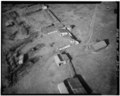
 Fort Peck Dam (Fort Peck Montana) 1986 01.jpg 1,397 × 693; 778 KB
-
 Gordon Butte Montana.jpeg 4,032 × 2,268; 2.68 MB
-
 Great Falls MT.JPG 1,638 × 1,229; 650 KB
-

-
 Hebgen Lake Landslide.jpg 980 × 667; 100 KB
-
 Helena Cathedral crop.png 1,281 × 1,795; 3.71 MB
-
 Helena Cathedral.jpg 1,657 × 2,246; 1.29 MB
-
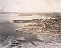
 Helena Luftaufnahme 1999.jpg 600 × 400; 58 KB
-
 High Angle View of the National Cemetery (1bb2117b-a462-4d64-9c0f-b4711c75d4d6).jpg 4,032 × 3,024; 2.88 MB
-
 Hingham.JPG 2,338 × 1,700; 601 KB
-
 Kalispell.jpg 1,024 × 683; 252 KB
-
 Kirkwood Marina, Hebgen Lake, West Yellowstone, Montana - panoramio.jpg 1,912 × 2,552; 1.89 MB
-
 Libby Dam (Libby Montana) 1986.jpg 1,500 × 1,008; 1 MB
-
 Libby, Montana - date unknown (14604413572).jpg 1,466 × 1,122; 429 KB
-
 Madison Valley (East of Cliff Lake), Montana - panoramio.jpg 2,552 × 1,912; 1.96 MB
-
 MIA-YVR aerial shots - Canyon Ferry Lake, Montana - (19335535782).jpg 3,250 × 2,167; 8.56 MB
-
 MIA-YVR aerial shots - looking N to Canada from Montana - (19345589071).jpg 2,942 × 1,961; 4.92 MB
-
 Miles City aerial 2.jpg 3,510 × 2,124; 3.01 MB
-
 Miles City aerial.jpg 4,368 × 2,912; 4.01 MB
-
 Milltownaerial.jpg 111 × 123; 4 KB
-
 Montana winter aerial.jpg 4,368 × 2,912; 3.76 MB
-
 MT RRocks aerial.jpg 10,595 × 9,666; 15.57 MB
-
 MT RRocks aerial.pdf 5,297 × 4,833; 749 KB
-
 Old Mill District 2019.jpg 2,048 × 1,364; 2.61 MB
-
 Panoramic aerial view of Saint Mary Lake, Glacier National Park, Montana 01.jpg 7,016 × 3,608; 5.72 MB
-
 Panoramic aerial view of Saint Mary Lake, Glacier National Park, Montana 01b.jpg 5,203 × 1,480; 4.5 MB
-
 Pleasant View housing development, Missoula, Montana - panoramio.jpg 2,552 × 1,912; 2.14 MB
-
 Prairie Potholes (12819767085).jpg 512 × 385; 27 KB
-
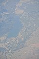
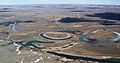
 RedRockRiverMontana.jpg 4,036 × 2,423; 1.14 MB
-
 RockyMountains-October2011.JPG 3,240 × 2,430; 2.41 MB
-
 Ronan from North Crow.jpg 604 × 406; 49 KB
-
 Ryan Dam.jpg 2,820 × 1,870; 1.54 MB
-
 Sodbusting04 (38361673784).jpg 2,250 × 1,500; 4.41 MB
-
 Sodbusting06 (24210573187).jpg 2,250 × 1,500; 5.79 MB
-
 Sodbusting07 (24210574847).jpg 2,250 × 1,500; 3.54 MB
-
 Stevensville, Montana - panoramio.jpg 2,552 × 1,912; 2.12 MB
-
 Tally Gorge and Tally Lake from the air (7204766590).jpg 1,502 × 1,127; 268 KB
-
 Tally Gorge and Tally Lake from the air, 2006 (7204765846).jpg 3,072 × 2,304; 1.6 MB
-
 Two Medicine Lake (left) and Lower Two Medicine L…Flathead, Montana (10830851345).jpg 2,121 × 1,414; 2.35 MB
-
 U.S. Route 93 in Montana near Lower Stillwater Lake 01 (10323372474).jpg 2,848 × 4,288; 4.95 MB
-
 U.S. Route 93 in Montana near Lower Stillwater Lake 01 - white balanced (10322243725).jpg 2,848 × 4,288; 7.72 MB
-
 U.S. Route 93 in Montana near Lower Stillwater Lake 02 (10323530903).jpg 2,848 × 4,288; 4.84 MB
-
 U.S. Route 93 in Montana near Lower Stillwater Lake 02 - white balanced (10322367463).jpg 2,848 × 4,288; 9.55 MB
-

-
 USACE Fort Peck Dam.jpg 1,500 × 1,001; 473 KB
-
 West Yellowstone MT - aerial edit.jpg 1,000 × 346; 424 KB
-
 West Yellowstone MT - aerial.jpg 2,552 × 1,912; 1.81 MB
-
 Wild fires near Bitterroot Valley, Montana - panoramio.jpg 2,552 × 1,912; 2.14 MB
-
 Wisdom MT - aerial.jpg 4,288 × 2,848; 4.03 MB

.jpg)
.jpg)
.jpg)
.jpg)
.jpg)
.jpg)
_01_(10322548244).jpg)
_01_-_white_balanced_(10321903563).jpg)
.jpg)
.jpg)
_01_(10322511374).jpg)
_01_-_white_balanced_(10321663326).jpg)
_02_(10322674303).jpg)
_02_-_white_balanced_(10321619216).jpg)
_01_(10322563676).jpg)
.jpg)
.jpg)
.jpg)
.jpg)
.jpg)
.jpg)
.jpg)
.jpg)
.jpg)
.jpg)
_01_(10323341516).jpg)
_01_-_white_balanced_(10321970205).jpg)
_02_(10322629224).jpg)
_02_-_white_balanced_(10321946125).jpg)
_01_(10322476464).jpg)
_01_-_white_balanced_(10321468035).jpg)
_01_(10322638123).jpg)
_01_-_white_balanced_(10321438226).jpg)
.jpg)
.jpg)
.jpg)
.jpg)
.jpg)
.jpg)
.jpg)
.jpg)
_(2).jpg)
.jpg)
_01_(10322437294).jpg)
_01_-_white_balanced_(10321355454).jpg)
_02_(10322420504).jpg)
_02_-_white_balanced_(10321342915).jpg)
_03_(10322437816).jpg)
_03_-_white_balanced_(10321298755).jpg)
_01_(10323269925).jpg)
_01_-_white_balanced_(10321539424).jpg)
_02_(10323251525).jpg)
_02_-_white_balanced_(10321513965).jpg)
.jpg)
.jpg)
_01_(10322830073).jpg)
_01_-_white_balanced_(10322018694).jpg)
_02_(10323362326).jpg)
_02_-_white_balanced_(10322010826).jpg)
_01_(10323448803).jpg)
_01_-_white_balanced_(10321829106).jpg)
.jpg)
.jpg)
_01_(10322566694).jpg)
_01_-_white_balanced_(10321776575).jpg)
_01_(10322715514).jpg)
_01_-_white_balanced_(10322170696).jpg)
_02_(10322694124).jpg)
_02_-_white_balanced_(10322115975).jpg)
_03_(10322673274).jpg)
_03_-_white_balanced_(10322103656).jpg)


.jpg)
.jpg)
.jpg)
.jpg)
.jpg)


.jpg)

.jpg)


_1986_01.jpg)


.jpg)


_1986.jpg)
.jpg)
,_Montana_-_panoramio.jpg)
.jpg)
.jpg)


.jpg)


.jpg)
.jpg)
.jpg)

.jpg)
.jpg)
_and_Lower_Two_Medicine_L%E2%80%A6Flathead,_Montana_(10830851345).jpg)
.jpg)
.jpg)
.jpg)
.jpg)


