Category:Aerial photographs of Texas
Jump to navigation
Jump to search
States of the United States: Alabama · Alaska · Arizona · Arkansas · California · Colorado · Connecticut · Delaware · Florida · Georgia · Hawaii · Idaho · Illinois · Indiana · Iowa · Kansas · Kentucky · Louisiana · Maine · Maryland · Massachusetts · Michigan · Minnesota · Mississippi · Missouri · Montana · Nebraska · Nevada · New Hampshire · New Jersey · New Mexico · New York · North Carolina · North Dakota · Ohio · Oklahoma · Oregon · Pennsylvania · Rhode Island · South Carolina · South Dakota · Tennessee · Texas · Utah · Vermont · Virginia · Washington · West Virginia · Wisconsin · Wyoming – District of Columbia: Washington, D.C.
insular area of the United States: American Samoa · Guam · Northern Mariana Islands · Puerto Rico · United States Virgin Islands – United States Minor Outlying Islands: Baker Island · Midway Atoll · Wake Island
insular area of the United States: American Samoa · Guam · Northern Mariana Islands · Puerto Rico · United States Virgin Islands – United States Minor Outlying Islands: Baker Island · Midway Atoll · Wake Island
English: Aerial photographs of Texas
Español: Fotografías aéreas de Texas
Subcategories
This category has the following 6 subcategories, out of 6 total.
A
Media in category "Aerial photographs of Texas"
The following 200 files are in this category, out of 244 total.
(previous page) (next page)-

-
 110426-F-RM405-451 (5662097746).jpg 4,256 × 2,832; 922 KB
-
 2008 SpaceX's Rocket Development facility, McGregor, TX.jpg 3,000 × 2,000; 1.48 MB
-
-
-
 20150715 Port Isabel Aerial Photo IMG 6462 by sebaso.jpg 5,184 × 3,456; 2.86 MB
-
 20200724-NRCS-LSC-0867-PANO (50169110987).jpg 13,979 × 3,558; 32.34 MB
-
 20200816-NRCS-LSC-0269 (50295984783).jpg 5,464 × 3,640; 14.29 MB
-
 20200816-NRCS-LSC-0274 (50296814402).jpg 5,464 × 3,640; 15.08 MB
-
 20200816-NRCS-LSC-0290 (50295966508).jpg 5,464 × 3,640; 11 MB
-
 20200816-NRCS-LSC-0295 (50295962603).jpg 5,464 × 3,640; 12.59 MB
-
 20200816-NRCS-LSC-0362 (50296620171).jpg 5,092 × 2,864; 13.76 MB
-
 20200816-RD-LSC-0561 (50315215522).jpg 17,553 × 7,058; 94.28 MB
-
 7.5 minute series orthophotomap (topographic).jpg 3,783 × 4,500; 3.38 MB
-
-
 A RESIDENTIAL SECTION OF NORTH DALLAS, NEAR THE L.B.J. FREEWAY - NARA - 547769.jpg 3,000 × 2,034; 982 KB
-
 A slabbed home Jarrell tornado aerial upscaled.jpg 923 × 609; 433 KB
-
 Abernathy TX.JPG 3,111 × 1,893; 3.21 MB
-
 Above Texas.JPG 3,264 × 2,448; 5.06 MB
-
 Adriatica in McKinney Texas.jpg 8,064 × 4,536; 25.61 MB
-
 Aerial - Colorado River (Texas) and Pedernales River 01.jpg 4,288 × 2,848; 9.6 MB
-
 Aerial - Colorado River - Lake Travis 01.jpg 4,288 × 2,848; 8.29 MB
-
 Aerial - Colorado River - Lake Travis 02.jpg 4,288 × 2,848; 9.46 MB
-
 Aerial - Mansfield Dam and Lake Travis 01.jpg 4,288 × 2,848; 9.8 MB
-
 Aerial photo - London, Texas.jpg 773 × 619; 797 KB
-
 Aerial photo - Marble Falls, Texas.jpg 773 × 619; 980 KB
-
 Aerial photo - Mason, Texas.jpg 773 × 619; 987 KB
-
 Aerial photo - Menard, Texas.jpg 773 × 619; 1,021 KB
-
 Aerial photo - Pyote, Texas.jpg 773 × 619; 1,016 KB
-
 Aerial photo - Red Bluff Reservoir.jpg 567 × 1,008; 1.03 MB
-
 Aerial photo of a boat deposited inland in Texas.jpg 4,256 × 2,832; 4.19 MB
-
-
 Aerial photograph of Camp Taliaferro, Texas, in the snow. (24292138326).jpg 965 × 1,584; 1.68 MB
-
 Aerial View of Autumn Forest Colors.jpg 2,048 × 1,360; 3.05 MB
-
 Aerial View of Corpus Christi Texas 1.jpg 2,816 × 2,112; 826 KB
-
 Aerial View of Corpus Christi Texas 2.jpg 2,816 × 2,112; 887 KB
-
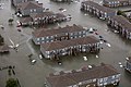
 AERIAL VIEW OF DAMAGE CAUSED BY FLOODING OF GUADALUPE RIVER - NARA - 544471.jpg 3,000 × 2,021; 1.07 MB
-
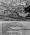 Aerial view of Dealey Plaza, CE876.jpg 514 × 614; 228 KB
-
 Aerial view of flying Turkey Vulture over Enchanted Rock State Natural Area, Texas.jpg 2,048 × 1,360; 1.09 MB
-
-
 Aerial View of Keller Bay, Texas.jpg 4,608 × 3,456; 3.72 MB
-
 Aerial view of oil refinery next to the Gulf of Mexico near Houston, Texas LCCN2011630532.tif 4,314 × 3,396; 83.86 MB
-
 Aerial View Of Part Of The Padre Island National Seashore.jpg 4,608 × 3,456; 3.84 MB
-
 Aerial view of Port Arthur, Texas.JPG 3,264 × 2,448; 1.72 MB
-
 Aerial view of rural Texas from airplane window, modified.jpg 6,000 × 4,000; 25.09 MB
-
 Aerial view of Seabrook, Texas LCCN2011633622.tiff 6,342 × 4,793; 173.96 MB
-
 Aerial View Of The Northern Part Of Harlingen, TX 08202022 1.jpg 4,608 × 3,456; 3.77 MB
-
 Aerial View Of The Northern Part Of Harlingen, TX 08202022 2.jpg 4,608 × 3,456; 3.9 MB
-
 Aerial View Of The Northern Part Of Harlingen, TX 08202022 3.jpg 4,608 × 3,456; 3.85 MB
-
 Aerial View Of The Northern Part Of Harlingen, TX 08202022 4.jpg 4,608 × 3,456; 3.92 MB
-

-
 Alibates Flint National Monument, Texas (4d247af7-016c-46d2-a131-de656ffafaef).jpg 3,072 × 2,048; 711 KB
-
 Alibates Flint National Monument, Texas (7fdbedce-d12e-407b-8898-7e27f6312845).jpg 3,072 × 2,048; 700 KB
-
 American Dam and Canal at Smeltertown El Paso Texas.jpg 1,437 × 917; 949 KB
-
 An aerial photo of a residential neighborhood on Padre Island.jpg 3,992 × 2,242; 4.49 MB
-
 An aerial photo of the USS Lexington in Corpus Christi.jpg 2,897 × 2,171; 2.33 MB
-
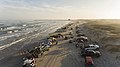 An aerial view of South Padre Island with people parked and driving on the beach.jpg 3,992 × 2,242; 4.09 MB
-
 AscaratePark-US-MexicoBorderAerial (24086868608).jpg 2,400 × 1,600; 3.05 MB
-
 Ashburn General Hospital McKinney, Texas.jpeg 2,836 × 2,281; 1.16 MB
-
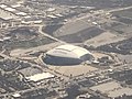 AT&T Stadium Aerial.jpeg 4,032 × 3,024; 1.21 MB
-
 Barstow, TX.jpg 782 × 676; 991 KB
-
 Bergstromafb-0362.jpg 427 × 302; 45 KB
-
 Between Denver City, Texas and Hobbs, New Mexico (2913189236).jpg 1,280 × 960; 115 KB
-
 Big lake tx.jpg 2,170 × 1,456; 5.6 MB
-
 Billy Rogers Arroyo Park.jpg 1,443 × 1,909; 2.16 MB
-
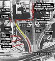
 Border West Expressway aerial detail.jpg 1,481 × 1,279; 1.59 MB
-
 Brazos River South of Sugar Land, Texas (16074200290).jpg 4,000 × 2,690; 1.14 MB
-
 Brazos River South of Sugar Land, Texas (16074201380).jpg 4,000 × 3,000; 1.89 MB
-
 Brenham tx.jpg 2,170 × 1,456; 5.7 MB
-
 Bridge of the Americas and US Border Station at El Paso Texas, aerial view.jpg 3,072 × 2,048; 742 KB
-
 Brookside Village, Texas (16074059908).jpg 4,000 × 3,000; 3.31 MB
-
 Brookside Village, Texas (16074226210).jpg 4,000 × 3,000; 2.73 MB
-
 Brookside Village, Texas (16075463379).jpg 4,000 × 3,000; 2.58 MB
-
 Brookside Village, Texas (16260762222).jpg 4,000 × 3,000; 3.09 MB
-
 Can Creek Pond in the Shape of Taiwan Formosa Island.jpg 1,360 × 2,048; 1.96 MB
-
 Carswellafb-0385.jpg 425 × 303; 50 KB
-
 Carthage, Texas (3497885177).jpg 1,600 × 1,200; 93 KB
-
 CBP Air and Marine Operations Documents Flooding (36119119813).jpg 2,048 × 1,536; 695 KB
-
 CBP Provides Support to Communities Impacted by Hurricane Harvey (36142060453).jpg 6,480 × 4,320; 19.82 MB
-
 CBP Provides Support to Communities Impacted by Hurricane Harvey (36762950306).jpg 6,480 × 4,320; 18.09 MB
-
 CE359 wikipedia.jpg 615 × 682; 103 KB
-
 City of Allen Water Tower and Storage.jpg 5,819 × 7,759; 27.41 MB
-
 ClemensFarmAerialPic.PNG 876 × 1,008; 1.01 MB
-
-
 CoffieldPrisoNFarm1995.PNG 1,453 × 1,248; 2.2 MB
-
 Comanche Peak Nuclear Power Plant.jpg 250 × 186; 32 KB
-
 ConocoPhilHQAerial2002.png 388 × 341; 220 KB
-
 Crane tx.jpg 1,957 × 915; 3.26 MB
-
 Damage Fort Worth.png 800 × 541; 328 KB
-
 DarringtonStitchmap.PNG 1,655 × 785; 1.32 MB
-
 Dealey-plaza-annotated.png 592 × 546; 114 KB
-
 Dealey-Tague.jpg 620 × 574; 225 KB
-
 E148ff db931d99d10145718100cc8d14667373.jpg 2,789 × 1,383; 2.3 MB
-
 El Paso Community College Aerial View.jpg 3,600 × 2,400; 7.28 MB
-
 El Paso Franklin Mountains and Scenic Drive aerial.jpg 1,681 × 1,364; 1.45 MB
-
 EllisEstelleUnitsTX.PNG 1,538 × 1,296; 2.27 MB
-
 Elmcreek67.jpg 3,456 × 2,304; 9.6 MB
-
 ElPasoTXbirdseye1.JPG 2,560 × 1,706; 901 KB
-
 Estados Unidos, aéreas 1989 06.jpg 1,037 × 632; 1,003 KB
-
 Estados Unidos, aéreas 1989 07.jpg 989 × 645; 1,005 KB
-
 F DJI 0117.jpg 3,987 × 2,658; 5.53 MB
-
 Farmer sprays defoliant on fields in Batesville, Texas (50238209378).jpg 4,550 × 3,640; 22.15 MB
-
 FEMA - 38449 - Aerial of damaged beach front mobile home park in Texas.jpg 4,256 × 2,832; 3.15 MB
-
 FLDS 4323.jpg 2,000 × 1,391; 1.41 MB
-
 FLDS Eldorado hi.jpg 2,048 × 1,536; 1.28 MB
-
 GalvestonTXFromTheISS.jpg 1,024 × 679; 185 KB
-
 Garden City, Texas (2912401595).jpg 1,280 × 960; 108 KB
-
 Giddings tx.jpg 1,957 × 915; 3.2 MB
-
 Grasshopper 325m Hop.png 1,914 × 1,070; 2.77 MB
-
 Guadalupe Mountains, NM.jpg 2,263 × 915; 3.56 MB
-
 Henrietta , Texas (2395835661).jpg 3,072 × 2,304; 1.07 MB
-
 Henrietta , Texas (2396671348).jpg 3,072 × 2,304; 1.19 MB
-
 High Altitude Arial View Of Downtown Dallas, Texas 10042015.jpg 2,816 × 2,112; 6.11 MB
-
 Houston area (8444355272).jpg 2,121 × 1,414; 2.4 MB
-
 IH-10-US-54 Interchange.jpeg 800 × 480; 284 KB
-
 Image of South Toledo Bend.jpg 558 × 640; 68 KB
-
 Interstate 20 Through Stanton, Midland, and Odessa, Texas (2912374507).jpg 960 × 1,280; 96 KB
-

-
 James Connally Air Force Base - Texas - 2006.jpg 754 × 755; 205 KB
-
 Jarrell tornado aerial survey 01.jpg 1,200 × 829; 142 KB
-
 Jarrell tornado aerial survey 02.jpg 1,200 × 829; 169 KB
-
 Jarrell tornado aerial survey 03.jpg 1,200 × 847; 161 KB
-
 Jarrell tornado aerial survey 04.png 1,200 × 832; 2.45 MB
-
 Jarrell tornado aerial survey 05.png 1,200 × 813; 2.53 MB
-
 Juarez Mexico and El Paso Texas (27794631963).jpg 5,760 × 3,840; 6.35 MB
-
 Lake Houston, Texas (3909161310).jpg 2,112 × 2,816; 1.83 MB
-
 Letourneauuniversity-sky-eliotlandrum.jpg 500 × 375; 70 KB
-
 Lobo Stadium.jpg 2,147 × 1,200; 1.41 MB
-
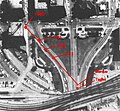
 Loop 375 Border West Expressway and I-10 in west El Paso.jpg 2,052 × 3,499; 2.6 MB
-
 McLean Texas aerial view.JPG 640 × 480; 125 KB
-
 Memphis (Panhandle), Texas (2395817665).jpg 3,072 × 2,304; 1.25 MB
-
 Memphis (Panhandle), Texas (2396651768).jpg 3,072 × 2,304; 1.17 MB
-
 Memphis (Panhandle), Texas (2396652646).jpg 3,072 × 2,304; 1.19 MB
-
 Miami-Dallas-Fort Worth flight - Dallas - Fort Worth (16029920133).jpg 4,504 × 3,003; 8.87 MB
-
 Miami-Dallas-Fort Worth flight - the City (DFW) at night (16623901046).jpg 5,407 × 3,605; 26.16 MB
-
 Midland and Odessa, Texas (2913216334).jpg 960 × 1,280; 87 KB
-
 Mokan Corridor.jpg 5,376 × 3,840; 7.43 MB
-
 Monahans texas airphoto.jpg 922 × 691; 175 KB
-
 Monahans thorntonvle tx.jpg 773 × 619; 1,007 KB
-
 Monahanstx.jpg 640 × 424; 224 KB
-
 My House Banner.jpg 3,992 × 571; 1.87 MB
-
 N524NK, Flight FLL-DFW, Downtown DALLAS (6813814252).jpg 1,000 × 750; 333 KB
-
 Natural Dam Lake, Near Big Spring, Texas (2912372595).jpg 1,280 × 960; 118 KB
-
 Natural Dam Lake, Near Big Spring, Texas (2912372633).jpg 1,280 × 960; 137 KB
-
 New Development, Pearland, Texas (16259755981).jpg 4,000 × 3,000; 2.99 MB
-
 New Development, Pearland, Texas (16259757201).jpg 4,000 × 3,000; 2.85 MB
-
 New Mexico-Texas Border East of Hobbs, New Mexico (2913167706).jpg 960 × 1,280; 97 KB
-
 North American AT-6 formation Foster-aircraft.jpg 282 × 340; 16 KB
-
 Oil Field Texas Aerial 2.jpg 3,456 × 5,184; 4.48 MB
-
 Oil Field Texas Aerial.jpg 5,184 × 3,456; 3.87 MB
-
 Oltmann 000593 172878 518217 4578 (36965567675).jpg 1,920 × 1,280; 1.23 MB
-
 Orange County, Texas (3908427723).jpg 2,112 × 2,816; 2.04 MB
-
 Orange, Texas (3909207412).jpg 2,816 × 2,066; 1.75 MB
-
 Orange, Texas 2 (3909207524).jpg 2,816 × 2,112; 2.17 MB
-
 Pearland, Texas (16074058478).jpg 4,000 × 3,000; 3.4 MB
-
 Pearland, Texas (16075449499).jpg 4,000 × 3,000; 3.17 MB
-
 Pearland, Texas (16075717477).jpg 4,000 × 3,000; 3.79 MB
-
 Pearland, Texas (16075722787).jpg 4,000 × 3,000; 3.6 MB
-
 Pearland, Texas (16235670096).jpg 4,000 × 3,000; 3.69 MB
-
 Pearland, Texas (16259758791).jpg 4,000 × 3,000; 3.45 MB
-
 Permian Basin, Texas (2912367343).jpg 1,280 × 960; 78 KB
-
 Pershing Dam Armstrong Field El Paso aerial.jpg 1,512 × 1,399; 1.97 MB
-
 Port Aransas -Mustang Island Beach - panoramio.jpg 1,600 × 1,200; 744 KB
-
 Port Aransas and the Intracoastal Waterway, Texas ISS038-E-57806.jpg 6,048 × 4,032; 2.52 MB
-
 Port Arthur Aerial photo of restoration projects.jpg 602 × 640; 112 KB
-
 Proctor Lake, Texas.jpg 650 × 435; 139 KB
-
 RamseyUnitsAerial.png 1,586 × 1,176; 2.09 MB
-
 Rankin, Texas.jpg 773 × 619; 1,019 KB
-
 Refinery storage tanks near Houston, Texas LCCN2011633531.tif 6,640 × 4,723; 179.47 MB
-
 Restoration of Lavaca Bay, Texas.jpg 1,290 × 959; 154 KB
-
 Robert Lee TX airphoto.jpg 1,410 × 940; 199 KB
-
 SDIS recon photo over Sabine Lake.jpg 2,400 × 1,594; 759 KB
-
 Seattle - Miami flight - Texas reservoir (15955300349).jpg 3,558 × 2,372; 6.61 MB
-
 Seminole, Texas (2912347487).jpg 1,280 × 960; 123 KB
-
 Seminole, Texas (2912347515).jpg 1,280 × 960; 125 KB
-
 Seminole, Texas (2912347589).jpg 1,280 × 960; 135 KB
-
 Sfot gotham city.jpg 1,000 × 736; 144 KB
-
 Shrimp Course 40 years - 4 (51298658953).jpg 2,708 × 1,500; 1.46 MB
-
 Slanton, Texas (2913213350).jpg 1,280 × 960; 105 KB
-
 South of Dalhart, Texas (2396634168).jpg 3,072 × 2,304; 1.07 MB
-
 South of Dalhart, Texas (2396635702).jpg 3,072 × 2,304; 1.06 MB
-
 Southeast New Mexico geography.jpg 2,263 × 2,430; 8.7 MB
-
 Southwest of Dalhart, Texas (2395802097).jpg 3,072 × 2,304; 1.16 MB
-
 Spectacular dawn over Dallas-Fort1.jpg 7,110 × 4,740; 1.14 MB
-
 Spectacular dawn over Dallas-Fort2.jpg 7,110 × 4,740; 1.28 MB
-
 Spectacular dawn over Dallas-Fort3.jpg 7,011 × 4,674; 1.7 MB
-
 Stanton, Texas (2913213372).jpg 1,280 × 960; 107 KB
-
 Tanks, North 77 Ranch Road, Witchita Falls , Texas (2396669022).jpg 3,072 × 2,304; 1.11 MB
-
 Texas A&M University Entrance Aerial.jpg 2,048 × 3,072; 2.42 MB
-
 Texas Aerial 1 2012-06-25.jpg 720 × 960; 249 KB
-
 Texas Aerial 10 2012-06-25.jpg 720 × 960; 243 KB
-
 Texas Aerial 11 2012-06-25.jpg 960 × 720; 252 KB
-
 Texas Aerial 12 2012-06-25.jpg 720 × 960; 233 KB
-
 Texas Aerial 13 2012-06-25.jpg 960 × 720; 260 KB
-
 Texas Aerial 14 2012-06-25.jpg 720 × 960; 222 KB
-
 Texas Aerial 15 2012-06-25.jpg 720 × 960; 225 KB
-
 Texas Aerial 16 2012-06-25.jpg 720 × 960; 228 KB
-
 Texas Aerial 17 2012-06-25.jpg 960 × 720; 213 KB
-
 Texas Aerial 18 2012-06-25.jpg 960 × 720; 219 KB
-
 Texas Aerial 19 2012-06-25.jpg 960 × 720; 229 KB
.jpg)
.jpg)


.jpg)
.jpg)
.jpg)
.jpg)
.jpg)
.jpg)
_15,_deployed_aboard_the_amphibious_assault_ship_USS_Nassau_(LHA_4),_lands_on_the_Ball_High_School_080919-N-OW936-401.jpg)


_and_Pedernales_River_01.jpg)


.jpg)


.jpg)
.jpg)


.jpg)


.jpg)


.jpg)
.jpg)


.jpg)
.jpg)
.jpg)
.jpg)


.jpg)
.jpg)
.jpg)
.jpg)


.jpg)


.jpg)


.jpg)
.jpg)

.jpg)


.jpg)


.jpg)
.jpg)


,_Texas_(2395817665).jpg)
,_Texas_(2396651768).jpg)
,_Texas_(2396652646).jpg)
.jpg)
_at_night_(16623901046).jpg)
.jpg)


.jpg)
.jpg)
.jpg)
.jpg)
.jpg)
.jpg)


.jpg)
.jpg)
.jpg)
.jpg)
.jpg)
.jpg)
.jpg)
.jpg)
.jpg)
.jpg)
.jpg)


.jpg)
.jpg)
.jpg)
.jpg)

.jpg)
.jpg)
.jpg)
.jpg)

.jpg)


.jpg)
.jpg)


.jpg)
.jpg)
.jpg)