Category:Aerial photographs of North Dakota
Jump to navigation
Jump to search
States of the United States: Alabama · Alaska · Arizona · Arkansas · California · Colorado · Connecticut · Delaware · Florida · Georgia · Hawaii · Idaho · Illinois · Indiana · Iowa · Kansas · Kentucky · Louisiana · Maine · Maryland · Massachusetts · Michigan · Minnesota · Mississippi · Missouri · Montana · Nebraska · Nevada · New Hampshire · New Jersey · New Mexico · New York · North Carolina · North Dakota · Ohio · Oklahoma · Oregon · Pennsylvania · Rhode Island · South Carolina · South Dakota · Tennessee · Texas · Utah · Vermont · Virginia · Washington · West Virginia · Wisconsin · Wyoming – District of Columbia: Washington, D.C.
insular area of the United States: American Samoa · Guam · Northern Mariana Islands · Puerto Rico · United States Virgin Islands – United States Minor Outlying Islands: Baker Island · Midway Atoll · Wake Island
insular area of the United States: American Samoa · Guam · Northern Mariana Islands · Puerto Rico · United States Virgin Islands – United States Minor Outlying Islands: Baker Island · Midway Atoll · Wake Island
Subcategories
This category has the following 4 subcategories, out of 4 total.
Media in category "Aerial photographs of North Dakota"
The following 51 files are in this category, out of 51 total.
-
-
 Aerial photo of Fort Totten, North Dakota.png 1,508 × 1,504; 1 MB
-
 Aerial photo of Harlow, North Dakota.png 1,111 × 1,106; 525 KB
-
 Aerial photo of Saint Michael, North Dakota.png 1,209 × 1,156; 674 KB
-
 Aerial photo of Tokio, North Dakota.png 902 × 903; 387 KB
-
 Aerial photograph of Temvik, North Dakota.png 1,309 × 1,309; 1.34 MB
-
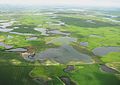
 Aerial view of Chase Lake National Wildlife Refuge (5805828980).jpg 448 × 299; 49 KB
-
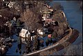
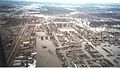
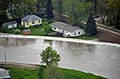
 Aerial view of flooding in a Minot, N.D., residential area.jpg 1,400 × 1,000; 725 KB
-
 Aerial view of large nesting island (5283027434).jpg 4,368 × 2,912; 12.09 MB
-
 Aerial view of main island (5805269455).jpg 448 × 299; 70 KB
-

-
 Aerial view of smaller nesting island (5282429701).jpg 4,368 × 2,912; 1,006 KB
-
 Aerial view of smaller nesting islands (5805269341).jpg 448 × 299; 45 KB
-
 Baldhill Dam NFH (49525886308).jpg 1,136 × 880; 96 KB
-
 Defense.gov photo essay 110602-A-LI073-003.jpg 4,896 × 3,264; 2.26 MB
-
 Defense.gov photo essay 110602-A-LI073-004.jpg 4,642 × 3,095; 2.08 MB
-
 Des Lacs River.jpg 4,320 × 3,240; 5.35 MB
-
 Dickinson-nd-dhs-1984.jpg 714 × 367; 39 KB
-
 Drained vs. Undrained (16903980581).jpg 5,184 × 3,456; 6 MB
-
 Dynamic Potholes (16903794662).jpg 5,184 × 3,456; 5.34 MB
-
 Fargo ND Downtown overview.jpg 2,887 × 1,805; 1.41 MB
-
 Fargo, ND - Aerial Facing East (43610135662).jpg 2,400 × 1,600; 2.3 MB
-
 Flooded areas along the Souris River Basin.jpg 1,024 × 678; 337 KB
-

-

-
 Garrison, North Dakota as seen from the air, 1920.tif 3,064 × 1,593; 9.31 MB
-
 Hamilton ND 05.jpg 3,992 × 2,242; 8.39 MB
-
 Ice Break Up (16392531013).jpg 5,184 × 3,456; 5.47 MB
-
 Larger nesting island at Chase Lake NWR (5283028840).jpg 4,368 × 2,912; 3.12 MB
-
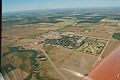 McVille, ND 58254 - panoramio.jpg 963 × 640; 79 KB
-
 Menoken Indian Village Site.jpg 226 × 150; 35 KB
-
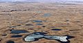 Missouri Coteau Potholes (17011808281).jpg 5,184 × 2,694; 5.95 MB
-
 ND National Guard is patrolling Minot flood areas (Image 2 of 3).jpg 2,848 × 4,288; 5.47 MB
-
 RedRiverGrandForks1997.jpg 900 × 507; 81 KB
-
 North Dakota flood relief (Image 4 of 8).jpg 1,400 × 1,000; 324 KB
-
 North Dakota flood response, North Dakota National Guard.jpg 1,286 × 854; 235 KB
-

-
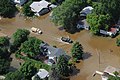
 North Dakota flooding; parts of Minot, N.D.overwhelmed by floodwaters.jpg 1,024 × 685; 442 KB
-
 Pattern Tile Drainage (16697662067).jpg 3,456 × 5,184; 7.55 MB
-
 Pattern Tile Drainage (16718838799).jpg 5,184 × 3,456; 5.73 MB
-
 Prairie Potholes (12642374104).jpg 3,456 × 2,592; 2.24 MB
-
 Prairie Potholes (12642422074).jpg 3,123 × 2,219; 2.24 MB
-
 Prairie Potholes (16718851149).jpg 5,184 × 3,456; 4.85 MB
-
 Prairie Potholes (16824912778).jpg 3,456 × 5,184; 7.46 MB
-
 Snow Geese against a Pothole Jigsaw Puzzle (16285035103).jpg 5,184 × 3,456; 9.71 MB
-
 Snow Goose Flock as Viewed from Above (16717545700).jpg 5,184 × 3,456; 6.88 MB
-
 Tatanka Wind Farm (16697676027).jpg 5,184 × 3,456; 5.07 MB
-
-
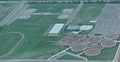
 The University of Mary (Bismarck Campus).jpg 3,882 × 1,394; 7.05 MB
-
 Topography of the Missouri Coteau and Slope (16824922638).jpg 5,184 × 3,456; 7.85 MB
-
 Water floods areas along the Souris River Basin.jpg 1,024 × 678; 404 KB
_Grand_Forks,_ND_April_1,_1997_-_Aerial_of_a_Grand_Forks_neighborhood_still_flooded_after_the_Red_River_came_though_town._FEMA-Mike_Rieger_-_DPLA_-_919038303cc3579ecf862b455169a659.jpg)


.jpg)

.jpg)
.jpg)
.jpg)
.jpg)
.jpg)
.jpg)


.jpg)
.jpg)

.jpg)


.jpg)
.jpg)


.jpg)
.jpg)

.jpg)


.jpg)
.jpg)
.jpg)
.jpg)
.jpg)
.jpg)
.jpg)
.jpg)
.jpg)

.jpg)

.jpg)