Category:Aerial photographs of Australia
Jump to navigation
Jump to search
Countries of Oceania: Australia · Fiji · Federated States of Micronesia · Kiribati · Marshall Islands · Nauru · New Zealand · Palau · Papua New Guinea · Samoa · Solomon Islands · Tonga · Tuvalu · Vanuatu
Other areas: American Samoa · Clipperton Island · Cook Islands · French Polynesia · Guam · Hawaii · New Caledonia · Northern Mariana Islands · Wallis and Futuna – Partly: British overseas territories · Indonesia · French Southern and Antarctic Lands · United States Minor Outlying Islands
Other areas: American Samoa · Clipperton Island · Cook Islands · French Polynesia · Guam · Hawaii · New Caledonia · Northern Mariana Islands · Wallis and Futuna – Partly: British overseas territories · Indonesia · French Southern and Antarctic Lands · United States Minor Outlying Islands
English: Aerial photographs of Australia.
Subcategories
This category has the following 14 subcategories, out of 14 total.
Media in category "Aerial photographs of Australia"
The following 30 files are in this category, out of 30 total.
-
 Aerial view of small outback settlement, April 1929. (7974547822).jpg 605 × 1,024; 116 KB
-
 Australian Outback from 35,000 feet (28335073920).jpg 3,456 × 4,608; 3.13 MB
-
 BareIsland Orthomosaic export SunNov26.jpg 37,502 × 31,769; 95.33 MB
-
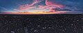
 Cape Schanck aerial panorama. April 2024.jpg 8,192 × 3,336; 4.43 MB
-
 Cocos Island Atoll.JPG 4,000 × 3,000; 4.7 MB
-
 CSIRO ScienceImage 1260 Australian landscape.jpg 2,657 × 1,771; 4.32 MB
-
 CSIRO ScienceImage 2565 Aerial view of clouds over Bass Strait at dawn.jpg 2,657 × 1,771; 2.32 MB
-
 CSIRO ScienceImage 3099 Aerial view of clouds over Bass Strait at dawn.jpg 2,657 × 1,771; 2.27 MB
-
 CSIRO ScienceImage 3100 Sunrise from the air over Bass Strait at dawn.jpg 2,657 × 1,771; 2.05 MB
-
 CSIRO ScienceImage 3608 Aerial view of clouds over Bass Strait at dawn.jpg 2,657 × 1,771; 2.37 MB
-
 Doncaster Hill. Shot on Jan 2022.jpg 4,000 × 2,250; 3.47 MB
-
 Doncaster Sunrise Panorama Jan 2022.jpg 7,930 × 3,152; 8.44 MB
-
 Doncaster Sunset Panorama.jpg 7,884 × 3,170; 6.79 MB
-
 DSC8267 (15591575812).jpg 5,000 × 3,337; 4.11 MB
-
 DSC8304 (15404730217).jpg 5,000 × 3,641; 4.18 MB
-
 DSC8328 (15404721397).jpg 5,000 × 3,337; 2.06 MB
-
 DSC8472 (15404744147).jpg 5,000 × 3,337; 3.05 MB
-
 Fairy Park in Anakie valley from the sky - panoramio.jpg 4,000 × 1,741; 4.45 MB
-
 Fraser island.png 500 × 375; 239 KB
-
 From the Air (2050390232).jpg 2,048 × 1,536; 641 KB
-
 Im Flug über Australien.jpg 1,918 × 1,440; 458 KB
-
 North Keeling Island 01.JPG 4,000 × 3,000; 5.53 MB
-
 Pastoral Finance Association building Kirribilli North Sydney 1921 Milton Kent.jpg 6,854 × 4,928; 21.07 MB
-
 Plenty from above. Facing Melbourne CBD. December 2022.jpg 8,192 × 3,322; 9.14 MB
-
 Preston aerial panorama facing north towards the Great Dividing Range. July 2023.jpg 8,192 × 3,304; 5.96 MB
-
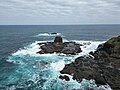 Pulpit Rock at Cape Schanck. April 2024.jpg 4,032 × 3,024; 4.14 MB
-
 Pulu Keeling Nat Park banner.jpg 4,000 × 571; 1.03 MB
-
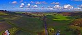
 Rochford Wines Yarra Valley from above.jpg 4,000 × 2,250; 4.54 MB
-
 The World Factbook - Australia - Flickr - The Central Intelligence Agency.jpg 1,500 × 1,125; 180 KB
-
 Window seat (16039426058).jpg 4,912 × 7,360; 10.63 MB
.jpg)
.jpg)


.jpg)
.jpg)
.jpg)
.jpg)


.jpg)


.jpg)