Category:Aerial photographs of Minnesota
Jump to navigation
Jump to search
States of the United States: Alabama · Alaska · Arizona · Arkansas · California · Colorado · Connecticut · Delaware · Florida · Georgia · Hawaii · Idaho · Illinois · Indiana · Iowa · Kansas · Kentucky · Louisiana · Maine · Maryland · Massachusetts · Michigan · Minnesota · Mississippi · Missouri · Montana · Nebraska · Nevada · New Hampshire · New Jersey · New Mexico · New York · North Carolina · North Dakota · Ohio · Oklahoma · Oregon · Pennsylvania · Rhode Island · South Carolina · South Dakota · Tennessee · Texas · Utah · Vermont · Virginia · Washington · West Virginia · Wisconsin · Wyoming – District of Columbia: Washington, D.C.
insular area of the United States: American Samoa · Guam · Northern Mariana Islands · Puerto Rico · United States Virgin Islands – United States Minor Outlying Islands: Baker Island · Midway Atoll · Wake Island
insular area of the United States: American Samoa · Guam · Northern Mariana Islands · Puerto Rico · United States Virgin Islands – United States Minor Outlying Islands: Baker Island · Midway Atoll · Wake Island
English: Aerial photographs of Minnesota.
Subcategories
This category has the following 8 subcategories, out of 8 total.
A
- Aerial photographs of Minneapolis (122 F)
Media in category "Aerial photographs of Minnesota"
The following 168 files are in this category, out of 168 total.
-
 2009-0603-07-Air-WayzataHS.jpg 2,776 × 1,996; 4.19 MB
-
 2009-0722-GeneralMills-hq.jpg 2,826 × 1,986; 3.99 MB
-
 2009-0722-MedicineLake.jpg 2,976 × 1,272; 3.2 MB
-
 2009-0722-WayzataCMS.jpg 2,214 × 1,992; 3.37 MB
-

-

-
 Aerial Between Lake City and Millville MN (29762099551).jpg 2,400 × 1,600; 2.33 MB
-
 Aerial photo of a 3M manufacturing plant.jpg 3,000 × 1,995; 955 KB
-
-
 Aerial Shakopee and Eden Prairie, Minnesota (26136405486).jpg 3,846 × 2,688; 8.77 MB
-
 Aerial view of Hendricks, Minnesota, on Lake Hendricks 2023-06-11.jpg 4,477 × 2,985; 4.68 MB
-
 Aerial view of Mendota Bridge and historic Fort Snelling 2019-05-26.jpg 4,329 × 1,443; 2.32 MB
-
 Aerial view of Prescott Bridge and BNSF Railway bridge over St. Croix River (2010).jpg 1,767 × 1,040; 1.45 MB
-

-

-
 Aerial view of Winthrop, Minnesota 2023-06-11.jpg 5,472 × 3,648; 6.61 MB
-
 An aerial shot of a large pothole in Minnesota.jpg 3,000 × 1,993; 225 KB
-
 Austin, Minnesota.jpg 6,580 × 3,126; 12.82 MB
-
 Bemidji, Minnesota aerial.jpg 3,504 × 2,336; 7.35 MB
-
 Big Island, Lake Minnetonka 2020-05-25.jpg 6,812 × 1,815; 4.55 MB
-
 Big Island, Lake Minnetonka 2021-05-09 01.jpg 9,444 × 2,353; 11.11 MB
-
 Big Island, Lake Minnetonka 2021-05-09.jpg 6,460 × 2,508; 7.54 MB
-
 Blooming Prairie, Minnesota.jpg 4,899 × 3,278; 10.9 MB
-
 Bluff Siding, Wisconsin aerial.jpg 9,172 × 3,025; 17.53 MB
-
 Broken Down Dam, Fergus Falls, Minnesota 2021-09-07 - 1.jpg 4,560 × 3,040; 8.83 MB
-
 Browns Valley flood 07.jpg 2,400 × 1,800; 609 KB
-
 Brownsville, Minnesota aerial.jpg 7,630 × 2,800; 11.2 MB
-
 Caledonia water tower.jpg 4,000 × 3,000; 7.88 MB
-
 Caledonia, Minnesota.jpg 9,849 × 3,305; 16.64 MB
-
 Camp Savage 1946.jpg 685 × 880; 92 KB
-
 Cathedral of the Sacred Heart Winona, MN - panoramio.jpg 954 × 672; 256 KB
-
 CedarBogLake-EastBethel-MN.jpg 2,916 × 1,965; 3.04 MB
-
 Cleawatermn.jpg 3,648 × 2,736; 3.1 MB
-
 Colorful Squiggly Farmland (14421010297).jpg 1,200 × 800; 724 KB
-
 Crookston Minnesota aerial view.jpg 1,500 × 1,053; 820 KB
-

-
 Downtown Forest Lake.jpg 4,000 × 2,250; 3.99 MB
-
 Downtown Stillwater 2020-06-27.jpg 4,912 × 2,456; 6.4 MB
-
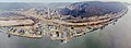
 Dresbach, Minnesota from water.jpg 9,957 × 2,764; 18.49 MB
-

-

-

-

-

-
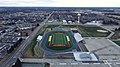 Forest Lake High School Football Stadium.jpg 4,000 × 2,250; 4 MB
-
 Forest Lake High School.jpg 4,000 × 2,250; 4.27 MB
-
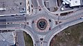 Forest Lake Roundabout.jpg 4,000 × 2,250; 4.1 MB
-

-
 Freeburg, Minnesota.jpg 4,000 × 4,454; 11.63 MB
-
 From the Air Gooseberry Falls (2885938145).jpg 3,884 × 2,600; 4.04 MB
-
 Grain bins Minnesota.jpg 4,000 × 3,000; 7.86 MB
-
 Grand Marais harbor 2020-07-31.jpg 5,472 × 3,648; 8.73 MB
-
 Harmony, Minnesota.jpg 4,963 × 3,437; 10.66 MB
-
 Hennepin county MN Lake Calhoun IMG 1769 from east.JPG 4,760 × 2,707; 5.32 MB
-
 Hennepin county MN Lake Harriet IMG 1768 from east.JPG 5,184 × 3,139; 7.4 MB
-
 Hennepin county MN Minneapolis-Bloomington IMG 1766 Richfield Super Target HW 77.JPG 2,438 × 2,680; 2.72 MB
-
 Hennepin county MN Minneapolis-BrynMawr IMG 1771 Interstate 394 from east.JPG 3,179 × 3,509; 4.02 MB
-
 Hennepin county MN Minneapolis-Fulton HW 35W IMG 1767 from east.JPG 4,985 × 3,363; 7.17 MB
-
 Hills minnesota.jpg 350 × 254; 35 KB
-
 Hopkins High School.jpg 1,050 × 916; 474 KB
-
 Houston County Courthouse 2.jpg 4,000 × 3,000; 7.51 MB
-
 I 90 bridge La Crosse.jpg 4,000 × 5,212; 13.45 MB
-
 I-35E Aerial - Near Yankee Doodle and Pilot Knob (30620049358).jpg 2,400 × 1,600; 2.18 MB
-
 I-494 East - Exits 1AB for MSP Terminals (30620048348).jpg 1,600 × 2,400; 2.28 MB
-
 I-90 Mississippi bridge-3.jpg 9,292 × 3,273; 19.87 MB
-
 I-90 Mississippi bridge-4.jpg 6,520 × 2,760; 12.85 MB
-
 ISS038-E-47957 - View of Earth.jpg 4,256 × 2,832; 1.95 MB
-
 Kings bluff front side.jpg 7,036 × 4,838; 23.35 MB
-
 Lake Country - Western Minnesota (42940156414).jpg 2,400 × 1,600; 1.85 MB
-
 Lake country from air, October 1969 (5187451237).jpg 2,808 × 1,874; 3.1 MB
-
 Lake Minnetonka - Aerial photo.jpg 1,818 × 922; 375 KB
-
 Lake Minnetonka aerial.jpg 3,069 × 1,705; 965 KB
-
 Lanesboro, Minnesota-4.jpg 4,745 × 3,278; 10.38 MB
-
 Large pothole in Minnesota.jpg 3,000 × 1,993; 562 KB
-
 Lewiston, Minnesota.jpg 5,710 × 2,929; 10.69 MB
-
 Lindström, Minnesota.jpg 1,024 × 768; 256 KB
-
 Mabel, Minnesota.jpg 4,910 × 2,993; 9.32 MB
-
 Mallofamericaa.png 992 × 653; 1.28 MB
-
 Medicine Lake Aerial, Plymouth - Downtown Minneapolis Skyline (26930432951).jpg 3,607 × 2,029; 4.73 MB
-
 Minneapolis 05042012.jpg 4,608 × 3,456; 7.03 MB
-
 Minnesota - St.Paul - NARA - 23941623.jpg 3,382 × 4,385; 1.24 MB
-
 MINNESOTA POWER AND LIGHT PLANT. THERE IS NO PRECIPITATOR ON ITS SMOKE STACK - NARA - 551566.jpg 3,000 × 2,035; 1,022 KB
-
 Minnesota River Valley Wetland.jpg 2,048 × 1,536; 1,020 KB
-
 Minnesota State Highway 26.jpg 4,000 × 3,000; 9.62 MB
-
 Mississippi River Lock and Dam number 4.jpg 2,032 × 1,320; 336 KB
-
 Mississippi River Lock and Dam number 5A.jpg 1,500 × 1,500; 692 KB
-
 Mississippi River Lock and Dam number 8.jpg 2,008 × 1,324; 266 KB
-
 MN 16 & 26 Junction.jpg 4,948 × 2,839; 7.68 MB
-
 MN 26 & 16 Junction.jpg 4,000 × 3,791; 8.76 MB
-
 MN-44 through Caledonia.jpg 4,000 × 3,000; 8.74 MB
-
 Money Creek, Minnesota.jpg 3,961 × 3,972; 13.82 MB
-
 New Hartford, Minnesota.jpg 7,124 × 2,657; 13.56 MB
-
 Nina Moose River, 1965 (5187452293).jpg 2,752 × 2,030; 3.6 MB
-
 Northern Engraving in Spring Grove.jpg 4,000 × 3,000; 7.41 MB
-
 Northlend - panoramio.jpg 1,000 × 750; 246 KB
-
 Owatonna, Minnesota.jpg 5,711 × 2,591; 9.83 MB
-
 Park Point and Industrial Zone.JPG 2,048 × 1,360; 758 KB
-
 Peterson, Minnesota.jpg 5,039 × 3,033; 11.58 MB
-
 Pickwick, Minnesota 2.jpg 5,054 × 2,666; 9.38 MB
-
 Pickwick, Minnesota.jpg 9,631 × 6,305; 30.24 MB
-
 Pierz Aerial.jpg 600 × 400; 94 KB
-
 Pilot Mound, Minnesota.jpg 4,000 × 3,000; 9.4 MB
-
 Plane image.jpg 1,742 × 3,095; 1.29 MB
-
 Queens bluff-2.jpg 4,000 × 3,000; 7.93 MB
-
 Queens bluff.jpg 4,000 × 3,000; 9.41 MB
-
 Ridgeway, Minnesota.jpg 6,480 × 2,753; 11.14 MB
-
 Rochester Minnesota downtown aerial view.jpg 1,500 × 1,202; 1.15 MB
-
 RochesterMinnesotaNW.JPG 3,456 × 2,304; 4 MB
-
 Sartell.JPG 2,592 × 1,944; 2.13 MB
-
 Silver Bay, Minnesota aerial.jpg 3,504 × 2,336; 6.1 MB
-
 SplitRockLighthouse AerialView.jpg 743 × 499; 239 KB
-
 St croix mississippi confluence prescott wi.jpg 2,852 × 1,845; 2.36 MB
-
 St Peters Catholic Church Forest Lake.jpg 4,000 × 2,250; 4.39 MB
-
 St. Mary's University athletic fields.jpg 4,000 × 3,000; 7.17 MB
-
 St. Mary's University of Winona.jpg 7,004 × 2,673; 11.95 MB
-
 StCloudExplosionAerialPhoto.jpg 796 × 540; 229 KB
-
 Stillwater Minnesota waterfront aerial view.jpg 1,500 × 1,201; 1.05 MB
-
 Stockton, Minnesota-2.jpg 4,000 × 3,000; 9.37 MB
-
 Stockton, Minnesota-3.jpg 5,944 × 3,006; 12.6 MB
-

-
 Tim Walz visits Southern Minnesota Flood damaged areas on June 25, 2024 - 10.jpg 7,008 × 4,672; 28.02 MB
-
 Tim Walz visits Southern Minnesota Flood damaged areas on June 25, 2024 - 13.jpg 7,008 × 4,672; 20.49 MB
-
 Tim Walz visits Southern Minnesota Flood damaged areas on June 25, 2024 - 14.jpg 7,008 × 4,672; 22 MB
-
 Tim Walz visits Southern Minnesota Flood damaged areas on June 25, 2024 - 15.jpg 7,008 × 4,672; 19.45 MB
-
 Tim Walz visits Southern Minnesota Flood damaged areas on June 25, 2024 - 16.jpg 7,008 × 4,672; 23.72 MB
-
 Tim Walz visits Southern Minnesota Flood damaged areas on June 25, 2024 - 17.jpg 7,008 × 4,672; 19.91 MB
-
 Tim Walz visits Southern Minnesota Flood damaged areas on June 25, 2024 - 18.jpg 7,008 × 4,672; 20.81 MB
-
 Tim Walz visits Southern Minnesota Flood damaged areas on June 25, 2024 - 19.jpg 7,008 × 4,672; 21.3 MB
-
 Tim Walz visits Southern Minnesota Flood damaged areas on June 25, 2024 - 20.jpg 7,008 × 4,672; 22.8 MB
-
 Tim Walz visits Southern Minnesota Flood damaged areas on June 25, 2024 - 27.jpg 7,008 × 4,672; 20.12 MB
-
 Tim Walz visits Southern Minnesota Flood damaged areas on June 25, 2024 - 28.jpg 7,008 × 4,672; 21.26 MB
-
 Tim Walz visits Southern Minnesota Flood damaged areas on June 25, 2024 - 29.jpg 7,008 × 4,672; 22.11 MB
-
 Tim Walz visits Southern Minnesota Flood damaged areas on June 25, 2024 - 30.jpg 7,008 × 4,672; 22.04 MB
-
 Tim Walz visits Southern Minnesota Flood damaged areas on June 25, 2024 - 32.jpg 7,008 × 4,672; 20.4 MB
-
 Tim Walz visits Southern Minnesota Flood damaged areas on June 25, 2024 - 33.jpg 7,008 × 4,672; 21.75 MB
-
 Tim Walz visits Southern Minnesota Flood damaged areas on June 25, 2024 - 5.jpg 7,008 × 4,672; 20.61 MB
-
 Tim Walz visits Southern Minnesota Flood damaged areas on June 25, 2024 - 6.jpg 7,008 × 4,672; 21.62 MB
-
 Tim Walz visits Southern Minnesota Flood damaged areas on June 25, 2024 - 7.jpg 7,008 × 4,672; 21.94 MB
-
 Treasure Island Amphitheater 01.jpg 4,086 × 2,515; 2.43 MB
-
 Two Harbors Minnesota aerial view.jpg 1,500 × 1,050; 674 KB
-
 US 218.jpg 4,000 × 3,000; 11.67 MB
-
 US-63.jpg 4,000 × 3,000; 8.35 MB
-
 Valleyfair aerial view (cropped).jpg 510 × 480; 150 KB
-
 Valleyfair aerial view.jpg 640 × 480; 175 KB
-
 View from Space Tower at the Minnesota State Fair 01.jpg 4,032 × 3,024; 5.27 MB
-
 View from Space Tower at the Minnesota State Fair 02.jpg 4,000 × 2,992; 3.98 MB
-
 View from Space Tower at the Minnesota State Fair 03.jpg 4,032 × 3,024; 2.39 MB
-
 View from Space Tower at the Minnesota State Fair 04.jpg 4,000 × 2,992; 3.59 MB
-
 View from Space Tower at the Minnesota State Fair 05.jpg 4,032 × 3,024; 2.57 MB
-
 View from Space Tower at the Minnesota State Fair 06.jpg 4,032 × 3,024; 2.82 MB
-
 View from Space Tower at the Minnesota State Fair 07.jpg 4,000 × 2,992; 3.81 MB
-
 View from Space Tower at the Minnesota State Fair 08.jpg 4,032 × 3,024; 3.19 MB
-
 View from Space Tower at the Minnesota State Fair 09.jpg 4,032 × 3,024; 2.59 MB
-
 View from Space Tower at the Minnesota State Fair 10.jpg 3,024 × 4,032; 3.43 MB
-
 View from Space Tower at the Minnesota State Fair 11.jpg 4,032 × 3,024; 2.11 MB
-
 View from Space Tower at the Minnesota State Fair 12.jpg 4,032 × 3,024; 3.48 MB
-
 View from Space Tower at the Minnesota State Fair 13.jpg 4,032 × 3,024; 4.02 MB
-
 View from Space Tower at the Minnesota State Fair 14.jpg 4,032 × 3,024; 4.01 MB
-
 View from Space Tower at the Minnesota State Fair 15.jpg 4,032 × 3,024; 4.42 MB
-
 View from Space Tower at the Minnesota State Fair 16.jpg 4,032 × 3,024; 3.95 MB
-
 View from Space Tower at the Minnesota State Fair 17.jpg 4,032 × 3,024; 4.16 MB
-
 View from Space Tower at the Minnesota State Fair 18.jpg 4,032 × 3,024; 5.03 MB
-
 View from Space Tower at the Minnesota State Fair 19.jpg 4,032 × 3,024; 4.95 MB
-
 View from Space Tower at the Minnesota State Fair 20.jpg 4,032 × 3,024; 5.06 MB
-
 View from Space Tower at the Minnesota State Fair 21.jpg 4,032 × 3,024; 3.29 MB
-
 Winona skyline.jpg 9,639 × 3,070; 17.03 MB
-
 Winona State University from football field.jpg 9,667 × 5,318; 26.21 MB
-
 Winona State University.jpg 9,737 × 4,845; 25.03 MB


.jpg)


.jpg)

.jpg)


.jpg)


.jpg)


.jpg)
.jpg)


.jpg)
.jpg)


.jpg)


.jpg)


.jpg)


