Category:Aerial photographs of New Zealand
Jump to navigation
Jump to search
Countries of Oceania: Australia · Fiji · Federated States of Micronesia · Kiribati · Marshall Islands · Nauru · New Zealand · Palau · Papua New Guinea · Samoa · Solomon Islands · Tonga · Tuvalu · Vanuatu
Other areas: American Samoa · Clipperton Island · Cook Islands · French Polynesia · Guam · Hawaii · New Caledonia · Northern Mariana Islands · Wallis and Futuna – Partly: British overseas territories · Indonesia · French Southern and Antarctic Lands · United States Minor Outlying Islands
Other areas: American Samoa · Clipperton Island · Cook Islands · French Polynesia · Guam · Hawaii · New Caledonia · Northern Mariana Islands · Wallis and Futuna – Partly: British overseas territories · Indonesia · French Southern and Antarctic Lands · United States Minor Outlying Islands
Subcategories
This category has the following 15 subcategories, out of 15 total.
A
F
S
T
Media in category "Aerial photographs of New Zealand"
The following 200 files are in this category, out of 257 total.
(previous page) (next page)-
 1946 aerial image of Verdon College site.jpg 2,241 × 1,881; 1.01 MB
-
 1956 aerial image of Verdon College site.jpg 1,261 × 1,001; 231 KB
-
 1962 aerial image of Verdon College site.jpg 1,887 × 1,381; 849 KB
-
 1974 aerial image of Verdon College site.jpg 1,797 × 1,317; 768 KB
-
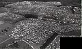
 1979 Festival Aerial Image.jpg 800 × 426; 116 KB
-
 1979 Festival main.jpg 473 × 280; 81 KB
-
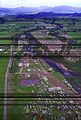
 1979 Festival parking and camping.jpg 447 × 198; 58 KB
-
 1981 aerial image of Verdon College site.jpg 3,176 × 2,342; 1,019 KB
-
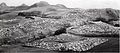
 1981 Nambassa Festival at Waitawheta Valley near Waikino.jpg 473 × 700; 321 KB
-
 1988 aerial image of Verdon College site.jpg 1,229 × 895; 344 KB
-
 2013-2014 satellite image of Verdon College.jpg 1,115 × 844; 190 KB
-
 2017 satellite image of Verdon College.jpg 1,110 × 828; 276 KB
-
 2017-Marley-hill-fire-startpoint.png 2,000 × 2,000; 8.38 MB
-
 Abeam Ruapehu - Flickr - PhillipC.jpg 1,712 × 1,064; 3.01 MB
-
 Abel Tasman National Park, Nelson, NewZealand, 26th. Nov. 2010 - Flickr - PhillipC.jpg 4,288 × 2,848; 3.75 MB
-
 Above The Treeline Southern Alps I.jpg 1,600 × 1,200; 340 KB
-
 Above The Treeline Southern Alps II.jpg 1,600 × 1,200; 434 KB
-
 Aerial Photo of Alexandra, New Zealand.jpg 4,000 × 2,078; 2.26 MB
-
 Aerial Photo of Debris (14714239936).jpg 4,164 × 4,067; 8.14 MB
-
 Aerial South.JPG 319 × 480; 36 KB
-
 Aerial view Kaitorete Spit.jpg 2,314 × 1,496; 4.11 MB
-
 Aerial view Lake Ellesmere 2.jpg 3,872 × 2,592; 7.48 MB
-
 Aerial view of a New Zealand coast.jpg 5,464 × 3,643; 4.2 MB
-
 Aerial view of Blenheim, ca 1938 (4399845194).jpg 5,138 × 3,856; 6.58 MB
-
 Aerial view of Lake Tasman.jpg 3,072 × 2,304; 1.98 MB
-
 Aerial View of Meola Reef.jpg 1,720 × 987; 1.02 MB
-
 Aerial view of Petone, looking east (4399845336).jpg 3,289 × 2,443; 2.27 MB
-
 Aerial view of Tolaga Bay by Whites Aviation, 1958.jpg 4,861 × 4,529; 10.44 MB
-
 Aerial view of Warkworth (AM 79642-1).jpg 1,275 × 956; 821 KB
-
 Aerial view of Warkworth and surroundings (AM 79641-1).jpg 1,275 × 954; 857 KB
-
 Aerial-Ohope Bch.JPG 3,072 × 2,304; 2.69 MB
-

-
 Another New Zealand landfall, 9 Oct. 2010 - Flickr - PhillipC.jpg 3,825 × 2,384; 1.2 MB
-
 Aoraki Mount Cook and Mount Tasman, Southern Alps, New Zealand, 22 July 2005.jpg 3,264 × 2,176; 8.15 MB
-
 Aoraki Mount Cook National Park - Tasman Glacier - aerial view.jpg 1,425 × 2,100; 1.08 MB
-
 Approaching Ruapehu - Flickr - PhillipC.jpg 1,492 × 982; 2.36 MB
-
 Ashburton NZ aerial.jpg 1,600 × 1,200; 1.94 MB
-
 Ashburton Southern Alps.jpg 2,020 × 2,658; 1.19 MB
-
 Barrhill 2012-13 aerial.jpg 1,076 × 1,828; 212 KB
-
 Bay near Rarangi - Marlborough.jpg 3,264 × 2,176; 6.66 MB
-
 Bay of Plenty farmlands.jpg 1,000 × 750; 335 KB
-
 Beaumont, New Zealand aerial photo 2006.jpg 1,327 × 932; 529 KB
-
 Blenheim New Zeland.jpg 1,865 × 1,049; 437 KB
-
 Canterbury Northwester.jpg 3,264 × 2,176; 5.37 MB
-
 Cape Campbell Sth Island NZ.jpg 1,280 × 868; 82 KB
-
 Cape Campbell sunrise.jpg 2,984 × 1,964; 6.32 MB
-
 Cape Foulwind And Holcim Cement Westport.jpg 1,800 × 1,200; 1,006 KB
-
 Cape Terawhiti.jpg 3,264 × 2,176; 3.98 MB
-
 Cardrona01 gobeirne.jpg 1,944 × 2,592; 1.41 MB
-
 Central North Island - Flickr - PhillipC.jpg 1,516 × 1,004; 1.52 MB
-
 Central North Island volcanoes, New Zealand - Flickr - PhillipC.jpg 1,408 × 848; 1.47 MB
-
 Central Otago, New Zealand, 22 July 2005.jpg 3,264 × 2,176; 5.44 MB
-
 Christchurch sunrise 07.35 - Flickr - PhillipC.jpg 597 × 418; 44 KB
-
 Clarence River mouth.jpg 2,864 × 1,924; 5.24 MB
-
 Clevedon, Auckland, New Zealand, 1 April 2011 - Flickr - PhillipC.jpg 4,288 × 2,848; 2.33 MB
-
 Cloudy Bay - Marlborough.jpg 3,450 × 2,348; 7.17 MB
-
 Cook Strait 17.55 - Flickr - PhillipC.jpg 606 × 301; 33 KB
-
 Cook Strait and the South Island from overhead Wellington, 1979 - Flickr - PhillipC.jpg 3,126 × 1,989; 1.52 MB
-
 Cornerstone Christian School - Gymnasium Construction - March 2018.jpg 3,394 × 2,156; 1.3 MB
-
 Craggy Range Winery.jpg 500 × 333; 162 KB
-
 Cromwell NZ aerial.JPG 2,592 × 1,944; 4.73 MB
-
 Dappled Cook Strait, New Zealand, 1 April 2011 - Flickr - PhillipC.jpg 3,810 × 2,367; 1.87 MB
-
 Descent into Christchurch 07.20 - Flickr - PhillipC.jpg 598 × 447; 66 KB
-
 Downtown Invercargill, Southland, New Zealand - Flickr - PhillipC.jpg 3,136 × 2,040; 4.69 MB
-
 DSC 9290 (15513070919).jpg 4,912 × 7,360; 5.46 MB
-
 DSC 9293 (15700532772).jpg 7,360 × 4,912; 7.26 MB
-
 DSC 9296 (15513056389).jpg 5,700 × 4,355; 3.93 MB
-
 DSC 9298 (15698916705).jpg 4,688 × 6,944; 5.87 MB
-
 DSC 9301 (15079578183).jpg 7,360 × 4,912; 8.3 MB
-
 DSC 9311 (15513717237).jpg 7,360 × 4,912; 7.95 MB
-
 Duders Beach and Regional Park Aerial view (Whakakaiwhara Point).jpg 727 × 483; 277 KB
-
 Duders Beach and Regional Park Aerial view.jpg 4,633 × 3,079; 8.46 MB
-
 East Coast erosion, Poverty Bay, New Zealand, 13th. Dec. 2010 - Flickr - PhillipC.jpg 4,288 × 2,848; 4.48 MB
-
 Eastern Beach Aerial Photograph.jpg 1,800 × 1,349; 2.87 MB
-
 En route Wellington to Christchurch.jpg 3,244 × 2,269; 3.77 MB
-
 Feilding Drone View.jpg 3,968 × 2,976; 2.43 MB
-
 Finals of JQ281, AKL - ZQN (7840596908).jpg 3,872 × 2,592; 6.23 MB
-
 Flight from New Zealand to Australia. Martins Bay - panoramio.jpg 2,048 × 1,151; 391 KB
-
 Flight from Rotorua to Queenstown - panoramio (3).jpg 2,048 × 1,151; 426 KB
-
 Flight from Rotorua to Queenstown. South Island - panoramio.jpg 2,048 × 1,151; 522 KB
-
 Flying over the South Island (7).jpg 4,912 × 3,264; 2.59 MB
-
 Flying over the westcoast - panoramio.jpg 600 × 449; 19 KB
-
 Foothills And Fields Of Southern Alps I.jpg 1,600 × 1,200; 298 KB
-
 Foothills And Fields Of Southern Alps II.jpg 1,600 × 1,200; 188 KB
-
 Foothills And Fields Of Southern Alps III.jpg 1,200 × 1,600; 234 KB
-
 Formation passing Patea, 1991 - Flickr - PhillipC.jpg 784 × 521; 531 KB
-
 Franz Josef Glacier Crevasses.jpg 1,600 × 1,200; 384 KB
-
 Franz Josef Glacier Ice Seracs.jpg 1,600 × 1,200; 218 KB
-
 Franz Josef Glacier Neve Area.jpg 1,200 × 1,600; 367 KB
-
 Golden Bay and Farewell Spit, New Zealand, 26th. Nov. 2010 - Flickr - PhillipC.jpg 4,288 × 2,848; 2.71 MB
-
 Golden Downs plantation forest, Nelson 1978 - Flickr - PhillipC.jpg 804 × 525; 532 KB
-
 Haast Road, 1965.jpg 3,214 × 2,368; 779 KB
-
 Harbour Opua above.jpg 2,272 × 1,704; 1.01 MB
-
 Hokianga.jpg 1,152 × 784; 270 KB
-
 HokiangaLiteSml.jpg 510 × 634; 284 KB
-
 Howick from above.jpg 1,800 × 951; 2.17 MB
-
 Huntly and the Waikato, New Zealand 1991.jpg 1,776 × 1,116; 3.46 MB
-
 Hydro Canals, South Mackenzie Basin.jpg 1,600 × 1,200; 175 KB
-
 Inangahua College, Reefton, West Coast, New Zealand, 1976.jpg 1,799 × 1,199; 710 KB
-
 Islands Northwest Of Waiheke Island (cropped).jpg 1,302 × 770; 601 KB
-
 Islands Northwest Of Waiheke Island.jpg 1,600 × 1,200; 1.13 MB
-
 Kaiapoi empty red zone 008.JPG 3,264 × 2,448; 3.43 MB
-
 Kaiapoi empty red zone 009.JPG 3,264 × 2,448; 3.34 MB
-
 Kaikoura NZ aerial.jpg 1,400 × 1,050; 1.09 MB
-
 Kaikoura Peninsula.jpg 3,264 × 2,176; 5.96 MB
-
 Kapiti and Paraparaumu, New Zealand, 6 July 2005 - Flickr - PhillipC.jpg 2,872 × 1,908; 1.32 MB
-
 Kaweka 27 April 2005 - Flickr - PhillipC.jpg 2,592 × 1,944; 2.81 MB
-
 Kawhia Harbour.jpg 5,408 × 3,600; 14.96 MB
-
 Kinleith Mill, Tokoroa, New Zealand.jpg 617 × 459; 142 KB
-
 Lake Alice aerial view.jpg 600 × 450; 48 KB
-
 Lake Lyndon area - panoramio.jpg 4,000 × 3,000; 3.35 MB
-
 Lake Rotorua from air.JPG 2,358 × 1,475; 988 KB
-
 Lake Tasman and Mount Cook 101 5770.jpg 3,072 × 2,304; 4.65 MB
-
 Lake Taupo, New Zealand, 1990 - Flickr - PhillipC.jpg 2,399 × 1,599; 1.55 MB
-
 Lake Wakatipu, New Zealand (7187558802).jpg 4,608 × 3,072; 3.39 MB
-
 LakeGrassmereNZAerial.jpg 1,000 × 750; 752 KB
-
 LakeOkataina.jpg 1,536 × 1,024; 485 KB
-
 LakeRotokakahi.jpg 1,536 × 1,024; 451 KB
-
 Land, sea and sky (405552013).jpg 2,592 × 3,872; 5.77 MB
-
 Levin and Lake Horowhenua, New Zealand, 26 October 2005 (56447901).jpg 3,264 × 2,176; 7.49 MB
-
 Little Barrier Island From Above Great.jpg 1,600 × 1,200; 1.01 MB
-
 Lockheed C-121J in flight 1965.jpg 789 × 622; 76 KB
-
 Logging tracks - Marlborough.jpg 3,264 × 2,176; 6.12 MB
-
 Looking down the Franz Josef Glacier from above the Melchior Glacier.jpg 3,072 × 2,304; 2 MB
-
 Looking east from East Egmont - Flickr - 111 Emergency (1).jpg 1,280 × 852; 119 KB
-
 Looking east from East Egmont - Flickr - 111 Emergency.jpg 1,280 × 852; 180 KB
-
 Looking northeast from above Flaxmere.jpg 8,028 × 2,252; 5.19 MB
-
 Lower Tasman Glacier.jpg 2,304 × 3,072; 2.37 MB
-
 Mackenzie Country, Canterbury, New Zealand, 22 July 2005.jpg 3,264 × 2,176; 3.4 MB
-
 Mana and Kapiti islands 18.00 - Flickr - PhillipC.jpg 543 × 367; 44 KB
-
 Mana Island 18.00 - Flickr - PhillipC.jpg 600 × 369; 65 KB
-
 Manawatu Plains, New Zealand, 22nd. Nov. 2010 - Flickr - PhillipC.jpg 3,654 × 2,579; 1.26 MB
-
 Mapua new zealand.jpg 421 × 296; 49 KB
-
 Maraetai Aerial.jpg 1,800 × 1,349; 2.17 MB
-
 Marlborough - Port Underwood.jpg 3,264 × 2,176; 5.31 MB
-
 Marlborough Vineyards.jpg 1,987 × 1,117; 361 KB
-
 Mataura Paper Mill, New Zealand.jpg 692 × 277; 90 KB
-
 Mid Dome, aerial view.jpg 3,072 × 1,728; 1,004 KB
-
 Motuihe Island From Above West 01.jpg 1,600 × 1,200; 993 KB
-
 Motuihe Island From Above West 02.jpg 1,600 × 1,200; 970 KB
-
 Mount Aspiring, Otago, New Zealand, 22 July 2005.jpg 2,644 × 1,816; 6.04 MB
-
 Mount Hutt aerial view.jpg 3,296 × 2,100; 4.92 MB
-
 Mount Manakau – from the air.jpg 3,392 × 2,118; 4.16 MB
-
 Mount Maunganui Sunrise Aerial.jpg 1,600 × 1,199; 2.06 MB
-
 Mount Taranaki 2.jpg 1,698 × 1,139; 338 KB
-
 Mount Taranaki aerial view fog.jpg 2,592 × 3,872; 5.03 MB
-
 Mount Taranaki Egmont National Park aerial view.jpg 3,264 × 2,448; 8.5 MB
-
 Mount Taranaki from Air 31 January 2018.jpg 2,736 × 4,864; 3.45 MB
-
 MountTarawera2.jpg 1,024 × 1,536; 352 KB
-
 MountTarawera3.jpg 1,536 × 1,024; 474 KB
-
 MountTaraweraCrater.jpg 1,536 × 1,024; 373 KB
-
 MountTerawera1.jpg 1,536 × 1,024; 450 KB
-

-
 Mt Taranaki.jpg 1,662 × 1,066; 2.27 MB
-
 Mt Tasman helicopter view from SE above Grand Plateau NZ Fri Nov 28 2008 crop.jpg 3,646 × 2,279; 4.62 MB
-
 Mt. Aspiring (en route Queenstown to Ashburton) - Flickr - PhillipC.jpg 1,551 × 1,038; 2.73 MB
-
 Mtcook1600x1200.jpg 1,600 × 1,200; 203 KB
-
 MtTaranaki 1.JPG 640 × 480; 43 KB
-
 Murchison New Zealand 1978.jpg 812 × 528; 711 KB
-
 Musick Point Seen From Above West.jpg 1,600 × 1,200; 981 KB
-
 N end of the South Island - Farewell spit (5796036938).jpg 2,103 × 1,426; 1.32 MB
-
 N2 Central Otago, New Zealand, 22 July 2005.jpg 3,264 × 2,176; 6.14 MB
-
 Near Tapawera New Zealand 1979.jpg 776 × 517; 609 KB
-
 New Zealand landfall - Auckland West Coast, 16 Aug. 2010 - Flickr - PhillipC (1).jpg 3,695 × 2,279; 1.87 MB
-
 New Zealand landfall - Auckland West Coast, 16 Aug. 2010 - Flickr - PhillipC.jpg 2,154 × 3,590; 1.64 MB
-
 New Zealand landfall - Kaipara Harbour, 16 Aug. 2010 - Flickr - PhillipC.jpg 3,825 × 2,384; 1.45 MB
-
 New Zealand moutain ranges.jpg 4,272 × 2,848; 9.15 MB
-
 New Zealand, South Island, 1997.jpg 4,519 × 3,006; 596 KB
-
 New Zealand, Top of the South Island (Nelson), Skydiving.jpg 2,880 × 2,160; 1.12 MB
-
 Nugget Point lighthouse aerial view.jpg 6,561 × 2,790; 18.54 MB
-
 NZ Defence Force assistance to OP Rena - Flickr - NZ Defence Force (17).jpg 4,256 × 2,832; 5.27 MB
-
 NZ Defence Force assistance to OP Rena - Flickr - NZ Defence Force (18).jpg 4,256 × 2,832; 5.73 MB
-
 NZ Defence Force assistance to OP Rena - Flickr - NZ Defence Force (19).jpg 4,256 × 2,832; 6.7 MB
-
 NZ Defence Force assistance to OP Rena - Flickr - NZ Defence Force (20).jpg 3,883 × 2,588; 4.43 MB
-
 NZ Defence Force assistance to OP Rena.jpg 4,053 × 2,702; 8.52 MB
-
 NZ's South Island as seen from SQ 777 (21562497615).jpg 3,456 × 4,608; 3.35 MB
-
 NZV8s at Levels 2013.jpg 1,328 × 737; 1.02 MB
-
 OH 07-0815-34 - Flickr - NZ Defence Force.jpg 1,173 × 1,800; 382 KB
-
 OH 08-0558-85 - Flickr - NZ Defence Force.jpg 4,256 × 2,832; 5.76 MB
-
 Ohakune from the Air - Helicopter - panoramio.jpg 2,160 × 1,440; 1.32 MB
-
 Ohoka MRD.jpg 2,155 × 2,467; 1.23 MB
-
 Ohope overview.JPG 3,069 × 2,160; 2.77 MB
-
 Omarama NewZealand.JPG 1,600 × 1,200; 884 KB
-
 Orongorongo River, Wairarapa 27 April 2005 - Flickr - PhillipC.jpg 2,436 × 1,852; 2.97 MB
-
 Out of the gloom, Wellington, New Zealand, 17 Oct. 2010 - Flickr - PhillipC.jpg 3,825 × 2,384; 987 KB
-
 Outram New Zealand from the air.JPG 2,592 × 1,944; 1.32 MB
-
 Outram, Otago, New Zealand, 30 May 2007 - Flickr - PhillipC.jpg 3,872 × 2,592; 5.59 MB
-
 Palmerston North aerial photograph 12 Sep 1963.jpg 1,044 × 748; 321 KB
-
 Panorama of LowerHutt and Wainuiomata.jpg 19,254 × 4,790; 46.51 MB
-
 Patea, Taranaki, New Zealand, 12 April 2008.jpg 3,393 × 2,033; 5.94 MB
-
 Pencarrow Head, Wellington 27 April 2005 - Flickr - PhillipC.jpg 2,592 × 1,944; 3.33 MB
-
 Petone 18.05 - Flickr - PhillipC.jpg 507 × 357; 81 KB
-
 Petone and Lower Hutt, New Zealand, 6 July 2005 - Flickr - PhillipC.jpg 3,264 × 2,176; 1.88 MB
-
 Photo of Pahiatua, and Life at the Camp (10806515755).jpg 3,780 × 1,926; 1.15 MB
-
 Plimmerton and Pauatahanui, New Zealand, 3rd. Dec. 2010 - Flickr - PhillipC.jpg 4,288 × 2,848; 3.58 MB
-

-
 Pukekohe CBD Drone Aerial.jpg 1,500 × 1,006; 1.68 MB
-
 Pukekohe Racing Circuit (27847541093).jpg 4,146 × 2,984; 4.44 MB
-
 Queenstown view of the mountains from a helicopter.jpg 406 × 270; 20 KB
-
 Raetihi - panoramio - Duane Wilkins (5).jpg 2,160 × 1,440; 1.39 MB


.jpg)


.jpg)


.jpg)

.jpg)
.jpg)

.jpg)


.jpg)
.jpg)
.jpg)
.jpg)
.jpg)
.jpg)
.jpg)


.jpg)

.jpg)

.jpg)


.jpg)


.jpg)


.jpg)
.jpg)


.jpg)


_-_Flickr_-_PhillipC.jpg)


.jpg)


.jpg)


,_Skydiving.jpg)

.jpg)
.jpg)
.jpg)
.jpg)

.jpg)


.jpg)


.jpg)

.jpg)