Category:Aerial photographs of Glacier National Park
Jump to navigation
Jump to search
Subcategories
This category has only the following subcategory.
Media in category "Aerial photographs of Glacier National Park"
The following 25 files are in this category, out of 25 total.
-
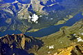 Aerial - east part of St. Mary Lake (MT) 01 - white balanced (10321675094).jpg 4,288 × 2,848; 8.26 MB
-
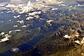
 Aerial - Glacier National Park 01 (10322640886).jpg 4,288 × 2,848; 4.69 MB
-
 Aerial - Glacier National Park 01 - white balanced (10321915685).jpg 4,288 × 2,848; 5.99 MB
-
 Aerial - Glacier National Park 02 (10323321986).jpg 2,848 × 4,288; 5.25 MB
-
 Aerial - Glacier National Park 02 - white balanced (10321869064).jpg 2,848 × 4,288; 6.65 MB
-
 Aerial - Glacier National Park 03 (10322769273).jpg 4,288 × 2,848; 5.41 MB
-
 Aerial - Glacier National Park 03 - white balanced (10321856565).jpg 4,288 × 2,848; 7.55 MB
-
 Aerial - Lake McDonald (MT) 01 (10323341516).jpg 2,848 × 4,288; 4.8 MB
-
 Aerial - Lake McDonald (MT) 01 - white balanced (10321970205).jpg 2,848 × 4,288; 5.18 MB
-
 Aerial - Lake McDonald (MT) 02 (10322629224).jpg 4,288 × 2,848; 4.86 MB
-
 Aerial - Lake McDonald (MT) 02 - white balanced (10321946125).jpg 4,288 × 2,848; 6.42 MB
-
 Aerial View of Sunset over Forest Slope.jpg 2,048 × 1,360; 2.54 MB
-

-
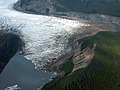 Finger Glacier - panoramio.jpg 2,552 × 1,912; 2.27 MB
-
 Flying from Juneau to Haines - panoramio.jpg 3,264 × 2,448; 927 KB
-
 Glacier is covered in patches by fog and clouds (e2e187bf-ea2c-4d58-bdb3-16ca83b2a5dd).JPG 3,456 × 2,304; 2.89 MB
-
 Glacier National Park map.jpg 576 × 856; 67 KB
-
 GlacierNP L7 20010701.jpg 540 × 540; 124 KB
-

-
-
 La Perouse Glacier - panoramio.jpg 2,552 × 1,912; 1.91 MB
-
 Line5091 - Flickr - NOAA Photo Library.jpg 3,008 × 2,000; 874 KB
-
 Mt Watson - panoramio.jpg 2,376 × 1,780; 1.48 MB
-
 Snow Capped Peak by slonecker.jpg 800 × 1,200; 1.14 MB
-

_01_-_white_balanced_(10321675094).jpg)
.jpg)
.jpg)
.jpg)
.jpg)
.jpg)
.jpg)
_01_(10323341516).jpg)
_01_-_white_balanced_(10321970205).jpg)
_02_(10322629224).jpg)
_02_-_white_balanced_(10321946125).jpg)

.jpg)


.JPG)


.jpg)
.jpg)


.jpg)