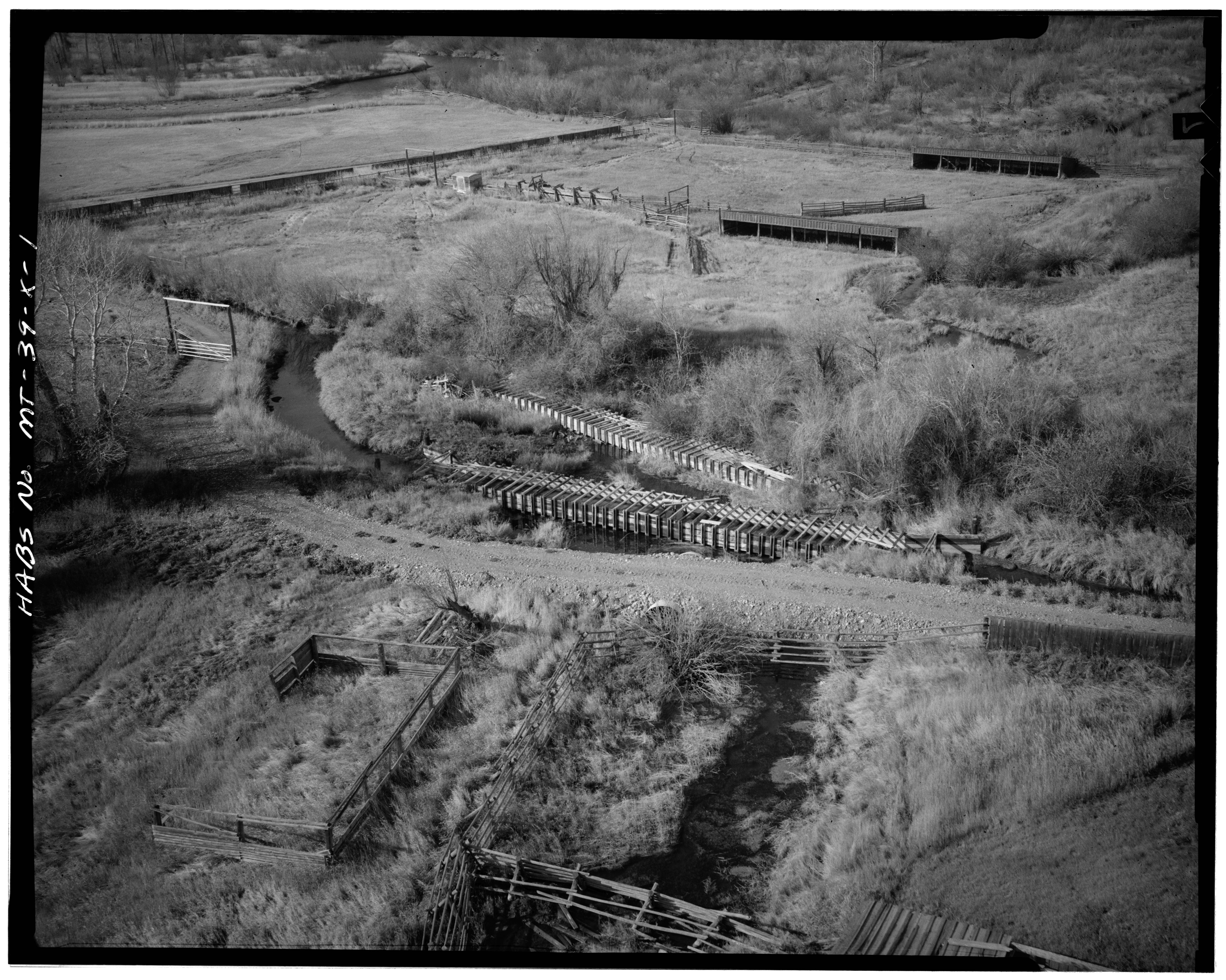
File:AERIAL VIEW OF BOTH ACTIVE AND INACTIVE FLUMES, TAKEN FROM EAST, NOTE STOCK SHELTERS IN BACKGROUND AND HAYSTACKS AND STORAGE IN FOREGROUND - Grant-Kohrs Ranch, Flumes, Highway HABS MONT,39-DELO,1-X-1.tif
Jump to navigation
Jump to search

Size of this JPG preview of this TIF file: 750 × 600 pixels. Other resolutions: 300 × 240 pixels | 600 × 480 pixels | 960 × 768 pixels | 1,280 × 1,024 pixels | 2,560 × 2,047 pixels | 5,000 × 3,999 pixels.
Original file (5,000 × 3,999 pixels, file size: 19.07 MB, MIME type: image/tiff)
Captions
Captions
Add a one-line explanation of what this file represents
Summary
[edit]| AERIAL VIEW OF BOTH ACTIVE AND INACTIVE FLUMES, TAKEN FROM EAST, NOTE STOCK SHELTERS IN BACKGROUND AND HAYSTACKS AND STORAGE IN FOREGROUND - Grant-Kohrs Ranch, Flumes, Highway 10, Deer Lodge, Powell County, MT | ||||
|---|---|---|---|---|
| Photographer |
Related names:
|
|||
| Title |
AERIAL VIEW OF BOTH ACTIVE AND INACTIVE FLUMES, TAKEN FROM EAST, NOTE STOCK SHELTERS IN BACKGROUND AND HAYSTACKS AND STORAGE IN FOREGROUND - Grant-Kohrs Ranch, Flumes, Highway 10, Deer Lodge, Powell County, MT |
|||
| Depicted place | Montana; Powell County; Deer Lodge | |||
| Date | Taken in 1974 | |||
| Dimensions | 4 x 5 in. | |||
| Current location |
Library of Congress Prints and Photographs Division Washington, D.C. 20540 USA http://hdl.loc.gov/loc.pnp/pp.print |
|||
| Accession number |
HABS MONT,39-DELO,1-X-1 |
|||
| Credit line |
|
|||
| Notes |
|
|||
| References |
|
|||
| Source | https://www.loc.gov/pictures/item/mt0070.photos.100912p | |||
| Permission (Reusing this file) |
|
|||

| Object location | | View this and other nearby images on: OpenStreetMap |
|---|
File history
Click on a date/time to view the file as it appeared at that time.
| Date/Time | Thumbnail | Dimensions | User | Comment | |
|---|---|---|---|---|---|
| current | 18:00, 28 July 2014 |  | 5,000 × 3,999 (19.07 MB) | Fæ (talk | contribs) | GWToolset: Creating mediafile for Fæ. HABS 24 July 2014 (2001:2300) |
You cannot overwrite this file.
File usage on Commons
The following page uses this file: