Category:1982 maps
Jump to navigation
Jump to search
| ← · 1980 · 1981 · 1982 · 1983 · 1984 · 1985 · 1986 · 1987 · 1988 · 1989 · → |
Deutsch: Karten mit Bezug zum Jahr 1982
English: Maps related to the year 1982
Español: Mapas relativos al año 1982
Français : Cartes concernant l’an 1982
Русский: Карты 1982 года
Subcategories
This category has the following 8 subcategories, out of 8 total.
Media in category "1982 maps"
The following 94 files are in this category, out of 94 total.
-
 1982 Jordan Water Development (30583894020).jpg 1,353 × 1,682; 454 KB
-
 1982 Pakistan Afghan Refugees (30796774281).jpg 5,294 × 5,576; 23.17 MB
-
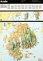 Acadia National Park, Maine LOC 85691483.jpg 4,889 × 6,886; 6.38 MB
-
 Acadia National Park, Maine LOC 85691483.tif 4,889 × 6,886; 96.32 MB
-
 Agricultural Research Center, Beltsville, Maryland LOC 88693214.jpg 9,384 × 2,735; 3.77 MB
-
 Agricultural Research Center, Beltsville, Maryland LOC 88693214.tif 9,384 × 2,735; 73.43 MB
-
 Andorra. LOC 82694320.jpg 2,397 × 3,133; 704 KB
-
 Andorra. LOC 82694320.tif 2,397 × 3,133; 21.49 MB
-
 Antarctic region. LOC 2011587029.jpg 3,163 × 4,189; 1.84 MB
-
 Antarctic region. LOC 2011587029.tif 3,163 × 4,189; 37.91 MB
-
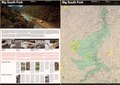
 Big South Fork, Kentucky-Tennessee LOC 83693532.jpg 10,033 × 7,083; 12 MB
-
 Big South Fork, Kentucky-Tennessee LOC 83693532.tif 10,033 × 7,083; 203.32 MB
-
 Blue Ridge Parkway, Virginia and North Carolina LOC 96680209.jpg 5,244 × 14,192; 11.24 MB
-
 Blue Ridge Parkway, Virginia and North Carolina LOC 96680209.tif 5,244 × 14,192; 212.93 MB
-
 Central America. LOC 2011586138.jpg 4,006 × 3,157; 1.5 MB
-
 Central America. LOC 2011586138.tif 4,006 × 3,157; 36.18 MB
-
 Chattahoochee National Forest (Armuchee Ranger District), Georgia, 1982 LOC 83692943.jpg 12,177 × 7,593; 12.98 MB
-
 Chattahoochee National Forest (Armuchee Ranger District), Georgia, 1982 LOC 83692943.tif 12,177 × 7,593; 264.53 MB
-
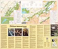 Cherokee National Forest, Tennessee LOC 85696193.jpg 7,863 × 6,700; 8.03 MB
-
 Cherokee National Forest, Tennessee LOC 85696193.tif 7,863 × 6,700; 150.72 MB
-

-
 Chesapeake Bay watershed, percent change in farming of prime farmland 1982-1992 LOC 95684471.tif 2,606 × 3,348; 24.96 MB
-
 Cumberland Gap, National Historical Park, Ky-Va-Tenn LOC 85696191.jpg 10,042 × 4,698; 8.32 MB
-
 Cumberland Gap, National Historical Park, Ky-Va-Tenn LOC 85696191.tif 10,042 × 4,698; 134.98 MB
-
 Eastern New Orleans to Gulfport MS 1982 Detail.jpg 1,200 × 800; 1.09 MB
-
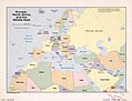 Europe, North Africa, and the Middle East. LOC 2011587038.jpg 4,189 × 3,194; 1.64 MB
-
 Europe, North Africa, and the Middle East. LOC 2011587038.tif 4,189 × 3,194; 38.28 MB
-

-

-

-

-
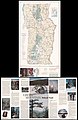
 Great Smoky Mountains National Park, North Carolina-Tennessee, trail map LOC 82693902.jpg 7,146 × 10,113; 8.66 MB
-
 Great Smoky Mountains National Park, North Carolina-Tennessee, trail map LOC 82693902.tif 7,146 × 10,113; 206.76 MB
-
 Green Mountain National Forest, Vermont - 1982 LOC 90680379.jpg 9,783 × 15,000; 16.13 MB
-
 Green Mountain National Forest, Vermont - 1982 LOC 90680379.tif 9,783 × 15,000; 419.84 MB
-
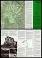
 Guadalupe Mountains National Park, Texas LOC 85696190.jpg 5,088 × 6,973; 6.03 MB
-
 Guadalupe Mountains National Park, Texas LOC 85696190.tif 5,088 × 6,973; 101.51 MB
-
 Harpers Ferry National Historical Park, West Virginia LOC 83692555.jpg 10,388 × 4,962; 6.86 MB
-
 Harpers Ferry National Historical Park, West Virginia LOC 83692555.tif 10,388 × 4,962; 147.47 MB
-
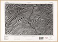 Harrisburg, radar image mosaic LOC 87695537.jpg 9,774 × 7,074; 13.66 MB
-
 Harrisburg, radar image mosaic LOC 87695537.tif 9,774 × 7,074; 197.82 MB
-
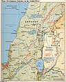
 Israel and neighboring states. LOC 2011586062.jpg 3,138 × 4,191; 1.23 MB
-
 Israel and neighboring states. LOC 2011586062.tif 3,138 × 4,191; 37.63 MB
-

-

-
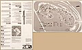
 Map of Paradise City, 1879 LOC ncr002106.jpg 2,732 × 4,022; 997 KB
-
 Map of Paradise City, 1879 LOC ncr002106.tif 2,732 × 4,022; 31.44 MB
-
 Map of Spring City, 1878 LOC ncr002107.jpg 4,074 × 2,752; 1.02 MB
-
 Map of Spring City, 1878 LOC ncr002107.tif 4,074 × 2,752; 32.08 MB
-
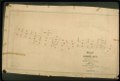
 Map of the Dutch Fred (Flat) Mine LOC ncr001856.jpg 3,978 × 2,720; 1.95 MB
-
 Map of the Dutch Fred (Flat) Mine LOC ncr001856.tif 3,978 × 2,720; 30.96 MB
-

-
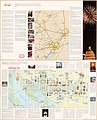 Meiguo shou du Huashengdun, Gelunbiya Tequ = Washington, DC LOC 91683052.jpg 6,894 × 8,552; 8.22 MB
-
 Meiguo shou du Huashengdun, Gelunbiya Tequ = Washington, DC LOC 91683052.tif 6,894 × 8,552; 168.68 MB
-
 Monaco. LOC 2005631071.jpg 2,250 × 2,858; 606 KB
-
 Monaco. LOC 2005631071.tif 2,250 × 2,858; 18.4 MB
-
 Murderkill watershed, Kent County, Delaware LOC 82696214.jpg 4,612 × 3,372; 1.48 MB
-
 Murderkill watershed, Kent County, Delaware LOC 82696214.tif 4,612 × 3,372; 44.49 MB
-
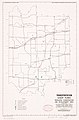
 National forests in North Carolina LOC 98683607.jpg 8,865 × 7,431; 11.97 MB
-
 National forests in North Carolina LOC 98683607.tif 8,865 × 7,431; 188.47 MB
-
 North Korea. LOC 2011585046.jpg 3,112 × 4,076; 1.78 MB
-
 North Korea. LOC 2011585046.tif 3,112 × 4,076; 36.29 MB
-
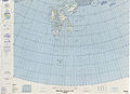 Operational Navigation Chart B-1, 3rd edition.jpg 9,254 × 6,672; 10.24 MB
-
 Operational Navigation Chart F-2, 13th edition.jpg 9,254 × 6,726; 20.82 MB
-

-

-
 Prime farmlands of Oklahoma LOC 82692884.jpg 6,073 × 4,809; 2.41 MB
-
 Prime farmlands of Oklahoma LOC 82692884.tif 6,073 × 4,809; 83.56 MB
-
 Rhode Island conservation district map LOC 82693109.jpg 2,482 × 3,264; 977 KB
-
 Rhode Island conservation district map LOC 82693109.tif 2,482 × 3,264; 23.18 MB
-
 Seismicity of the earth, 1960-1980 LOC 85694236.jpg 4,366 × 2,400; 2.77 MB
-
 Seismicity of the earth, 1960-1980 LOC 85694236.tif 4,366 × 2,400; 29.98 MB
-
 Skythisches Reich.jpg 700 × 579; 142 KB
-
 Southeast, national parks and national forests LOC 82693641.jpg 10,058 × 4,704; 8.2 MB
-
 Southeast, national parks and national forests LOC 82693641.tif 10,058 × 4,704; 135.36 MB
-
 Spaceship Earth, 1982.jpg 3,786 × 2,492; 2.91 MB
-
 Status of soil surveys, Virginia. LOC 82693110.jpg 6,381 × 4,357; 1.83 MB
-
 Status of soil surveys, Virginia. LOC 82693110.tif 6,381 × 4,357; 79.54 MB
-
 Route of the 1982 Tour de France.png 3,198 × 3,204; 2.71 MB
-
-

-
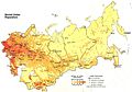 USSR population density map 1982.jpg 1,470 × 1,024; 239 KB
-
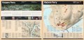
 Vicksburg National Military Park, Mississippi LOC 84697576.jpg 5,054 × 7,033; 6.55 MB
-
 Vicksburg National Military Park, Mississippi LOC 84697576.tif 5,054 × 7,033; 101.69 MB
-
 Washington DC LOC 83692893.jpg 6,886 × 8,367; 8.98 MB
-
 Washington DC LOC 83692893.tif 6,886 × 8,367; 164.84 MB
-
 Washington, D.C., and vicinity, 1-100 000-scale satellite image map LOC 84693484.jpg 14,620 × 10,836; 31.24 MB
-
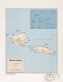
 Western Samoa. LOC 93682293.jpg 3,177 × 4,165; 1.11 MB
-
 Western Samoa. LOC 93682293.tif 3,177 × 4,165; 37.86 MB
-
 White Mountain National Forest, New Hampshire-Maine LOC 90685275.tif 9,600 × 11,100; 304.87 MB
-
 World Factbook (1982) Comoros.jpg 586 × 587; 90 KB
-
 Zoo - (Washington D.C.) LOC 82696693.jpg 9,262 × 5,677; 5.84 MB
-
 Zoo - (Washington D.C.) LOC 82696693.tif 9,262 × 5,677; 150.43 MB
-
 Схема заповедника Ерментау.jpg 2,462 × 3,504; 2.07 MB
.jpg)
.jpg)


,_Georgia,_1982_LOC_83692943.jpg)


_Mine_LOC_ncr001856.jpg)


_Comoros.jpg)
_LOC_82696693.jpg)
