File:Pinewood Flood Plain Management Study, Jefferson County, Arkansas, Flood Plain Management Area - Piney Creek LOC 85693547.tif
Jump to navigation
Jump to search

Size of this JPG preview of this TIF file: 604 × 600 pixels. Other resolutions: 242 × 240 pixels | 483 × 480 pixels | 773 × 768 pixels | 1,031 × 1,024 pixels | 2,062 × 2,048 pixels | 6,779 × 6,734 pixels.
Original file (6,779 × 6,734 pixels, file size: 130.61 MB, MIME type: image/tiff)
Captions
Captions
Add a one-line explanation of what this file represents
Summary
[edit]| Description |
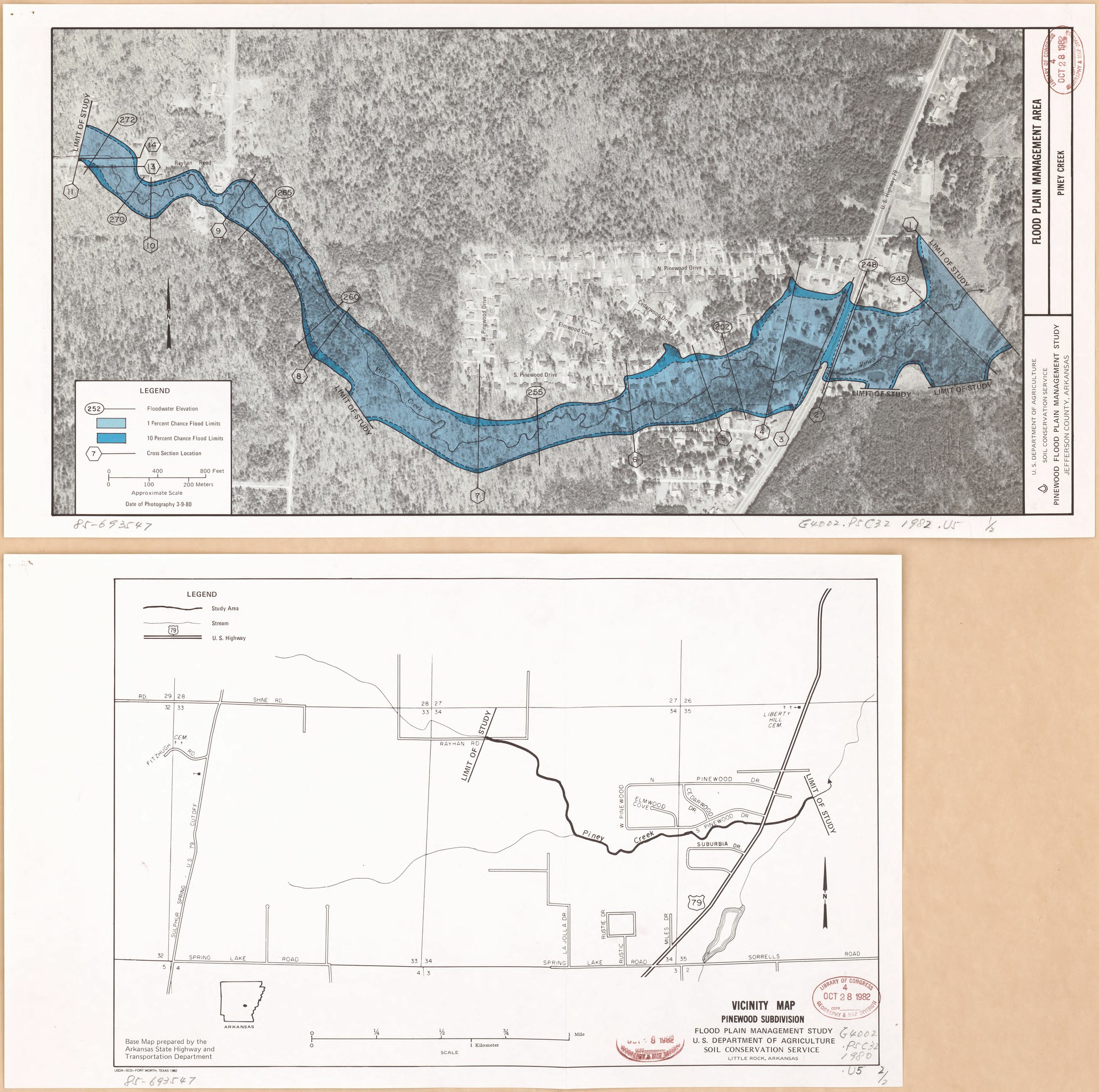
English: Shows degree of flood probability. "Date of photography 3-9-80." Accompanied by: Vicinity map, Pinewood Subdivision. 1 sheet : location map ; 26 cm. Available also through the Library of Congress Web site as a raster image. |
||
| Title | Pinewood Flood Plain Management Study, Jefferson County, Arkansas, Flood Plain Management Area : Piney Creek | ||
| Shelf ID | G4002.P5C32 1982 .U5 | ||
| Date | |||
| Source | https://www.loc.gov/item/85693547/ | ||
| Author | United States. Soil Conservation Service | ||
| Permission (Reusing this file) |
|
||
| Other versions |
|
||
| Location | Piney Creek · Jefferson County · United States · Piney Creek (Jefferson County) · Arkansas · Piney Creek (Jefferson County). | ||
| Part of | American Memory · Catalog · Geography And Map Division · Additional Conservation And Environment Cartographic Items | ||
| Subject | Floodplains · United States · Maps · Piney Creek (Jefferson County) · Arkansas · Piney Creek (Jefferson County, Ark.) · Remote-Sensing Maps · Flood Forecasting |


Licensing
[edit]| This work is from the Library of Congress. According to the library, there are no known copyright restrictions on the use of this work. |  |
File history
Click on a date/time to view the file as it appeared at that time.
| Date/Time | Thumbnail | Dimensions | User | Comment | |
|---|---|---|---|---|---|
| current | 22:15, 4 February 2019 |  | 6,779 × 6,734 (130.61 MB) | Fæ (talk | contribs) | LOC Maps https://www.loc.gov/item/85693547/ #2353 |
You cannot overwrite this file.
File usage on Commons
The following page uses this file: