Category:1986 maps
Jump to navigation
Jump to search
| ← · 1980 · 1981 · 1982 · 1983 · 1984 · 1985 · 1986 · 1987 · 1988 · 1989 · → |
Deutsch: Karten mit Bezug zum Jahr 1986
English: Maps related to the year 1986
Español: Mapas relativos al año 1986
Français : Cartes concernant l’an 1986
Русский: Карты 1986 года
Subcategories
This category has the following 9 subcategories, out of 9 total.
Media in category "1986 maps"
The following 75 files are in this category, out of 75 total.
-
 1986 map showing the Soviet Military Forces.jpg 9,899 × 6,501; 12.6 MB
-

-
 Andalusian Parliament Elections 1986.svg 1,000 × 700; 860 KB
-
 Antarctica, research stations and territorial claims. LOC 91682864.jpg 3,422 × 4,414; 2.03 MB
-
 Antarctica, research stations and territorial claims. LOC 91682864.tif 3,422 × 4,414; 43.22 MB
-
 Antarctica. LOC 91682862.jpg 2,485 × 3,259; 1.28 MB
-
 Antarctica. LOC 91682862.tif 2,485 × 3,259; 23.17 MB
-

-

-

-

-
 Azimuthal equidistant projection centered on Kabul, Afghanistan. LOC 2005631236.jpg 2,159 × 3,029; 723 KB
-
 Azimuthal equidistant projection centered on Kabul, Afghanistan. LOC 2005631236.tif 2,159 × 3,029; 18.71 MB
-
 Bienvenue à Washington. LOC 91680375.jpg 6,926 × 8,585; 9.41 MB
-
 Bienvenue à Washington. LOC 91680375.tif 6,926 × 8,585; 170.12 MB
-
 Buffalo River, national river, Arkansas LOC 87692865.jpg 10,039 × 4,748; 7.67 MB
-
 Buffalo River, national river, Arkansas LOC 87692865.tif 10,039 × 4,748; 136.37 MB
-

-

-

-

-
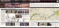
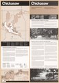
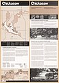 Chickasaw National Recreation Area, Oklahoma LOC 86694140.jpg 5,156 × 7,180; 5.06 MB
-
 Chickasaw National Recreation Area, Oklahoma LOC 86694140.tif 5,156 × 7,180; 105.92 MB
-
 Cumberland Gap, National Historical Park, Ky-Va-Tenn LOC 86694277.jpg 10,047 × 4,742; 8.82 MB
-
 Cumberland Gap, National Historical Park, Ky-Va-Tenn LOC 86694277.tif 10,047 × 4,742; 136.31 MB
-
 Cuyahoga Valley National Recreation Area, Ohio LOC 89694605.jpg 10,240 × 7,171; 10.96 MB
-
 Cuyahoga Valley National Recreation Area, Ohio LOC 89694605.tif 10,240 × 7,171; 210.09 MB
-

-

-
 Easter Island (Chile). LOC 2005631609.jpg 2,538 × 3,268; 571 KB
-
 Easter Island (Chile). LOC 2005631609.tif 2,538 × 3,268; 23.73 MB
-

-

-
 Europe, North Africa, and Southwest Asia. LOC 87695539.jpg 5,949 × 4,388; 2.53 MB
-
 Europe, North Africa, and Southwest Asia. LOC 87695539.tif 5,949 × 4,388; 74.69 MB
-
 Fort Davis LOC 2003629346.jpg 6,094 × 5,678; 4.41 MB
-
 Fort Davis LOC 2003629346.tif 6,094 × 5,678; 99 MB
-
 Fort Raleigh National Historic Site, North Carolina LOC 96683867.jpg 5,116 × 7,256; 5.37 MB
-
 Fort Raleigh National Historic Site, North Carolina LOC 96683867.tif 5,116 × 7,256; 106.21 MB
-

-
 George Washington Memorial Parkway, Virginia, Maryland, District of Columbia LOC 89694179.tif 6,641 × 9,673; 183.79 MB
-
 Harpers Ferry National Historical Park, West Virginia LOC 96684101.jpg 10,326 × 4,986; 7.17 MB
-
 Harpers Ferry National Historical Park, West Virginia LOC 96684101.tif 10,326 × 4,986; 147.3 MB
-
 High Island, Michigan, USGS Topo Map 1 24000 1986.tif 4,725 × 6,772; 9.14 MB
-
 Indian Ocean area. LOC 86695650.jpg 12,909 × 10,191; 14.35 MB
-
 Indian Ocean area. LOC 86695650.tif 12,909 × 10,191; 376.38 MB
-
 Korean Peninsula. LOC 87692537.jpg 6,988 × 10,199; 10.54 MB
-
 Korean Peninsula. LOC 87692537.tif 6,988 × 10,199; 203.91 MB
-
 MapaMacau1986.jpg 1,048 × 1,234; 160 KB
-
 Middle America. LOC 2011586150.jpg 4,321 × 3,366; 1.93 MB
-
 Middle America. LOC 2011586150.tif 4,321 × 3,366; 41.61 MB
-
 North Cascades LOC 86695643.jpg 11,768 × 8,844; 24.08 MB
-
 North Cascades LOC 86695643.tif 11,768 × 8,844; 297.76 MB
-
 Petersburg National Battlefield, Virginia LOC 95682630.jpg 13,453 × 6,412; 15.92 MB
-
 Petersburg National Battlefield, Virginia LOC 95682630.tif 13,453 × 6,412; 246.79 MB
-
 Pisgah National Forest (Pisgah Ranger District), North Carolina - 1982 LOC 97683416.jpg 9,784 × 8,163; 12.9 MB
-
 Pisgah National Forest (Pisgah Ranger District), North Carolina - 1982 LOC 97683416.tif 9,784 × 8,163; 228.5 MB
-
 Regeneration outlook on BLM lands in the Siskiyou Mountains (1986) (20385960428).jpg 2,906 × 2,502; 1.18 MB
-
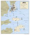
 Southern Lebanon border area. LOC 86694248.jpg 8,185 × 4,788; 5.47 MB
-
 Southern Lebanon border area. LOC 86694248.tif 8,185 × 4,788; 112.12 MB
-
 Southwest Asia. LOC 2011585052.jpg 4,207 × 3,320; 1.86 MB
-
 Southwest Asia. LOC 2011585052.tif 4,207 × 3,320; 39.96 MB
-

-
 Status of soil surveys, New Hampshire - August 1986 LOC 87694336.jpg 5,255 × 7,717; 4.4 MB
-
 Status of soil surveys, New Hampshire - August 1986 LOC 87694336.tif 5,255 × 7,717; 116.02 MB
-
 Suitland Federal Center ; Washington metropolitan area and vicinity. LOC 87693177.jpg 7,363 × 5,509; 4.57 MB
-
 Suitland Federal Center ; Washington metropolitan area and vicinity. LOC 87693177.tif 7,363 × 5,509; 116.05 MB
-
 U.S. Department of Agriculture, National Arboretum, Washington, D.C. - 1986 LOC 89697500.jpg 4,949 × 5,606; 4.75 MB
-
 U.S. Department of Agriculture, National Arboretum, Washington, D.C. - 1986 LOC 89697500.tif 4,949 × 5,606; 79.38 MB
-
 W. Kerr Scott Dam & Reservoir. LOC 94684585.jpg 10,310 × 5,432; 9.13 MB
-
 W. Kerr Scott Dam & Reservoir. LOC 94684585.tif 10,310 × 5,432; 160.23 MB
-
 Welcome to Washington LOC 88694417.jpg 6,886 × 8,572; 9.42 MB
-
 Welcome to Washington LOC 88694417.tif 6,886 × 8,572; 168.88 MB
-
 Zoo map - (Washington D.C.) LOC 87693106.jpg 9,331 × 5,681; 5.42 MB
-
 Zoo map - (Washington D.C.) LOC 87693106.tif 9,331 × 5,681; 151.66 MB


_Merritt_Island_National_Wildlife_Refuge,_Florida._LOC_91685103.jpg)


._LOC_2005631609.jpg)


,_North_Carolina_-_1982_LOC_97683416.jpg)
_(20385960428).jpg)


_LOC_87693106.jpg)