Category:1989 maps
Jump to navigation
Jump to search
| ← · 1980 · 1981 · 1982 · 1983 · 1984 · 1985 · 1986 · 1987 · 1988 · 1989 · → |
Deutsch: Karten mit Bezug zum Jahr 1989
English: Maps related to the year 1989
Español: Mapas relativos al año 1989
Français : Cartes concernant l’an 1989
Русский: Карты 1989 года
Subcategories
This category has the following 8 subcategories, out of 8 total.
Media in category "1989 maps"
The following 163 files are in this category, out of 163 total.
-
 (Wa-shin-ton) DC. LOC 91682174.jpg 6,862 × 8,570; 8.78 MB
-
 (Wa-shin-ton) DC. LOC 91682174.tif 6,862 × 8,570; 168.25 MB
-
 1989 Mahalli İdareler Seçimleri BB.png 1,894 × 2,244; 311 KB
-
 Acidic substrata potential map - (Camden County, New Jersey) LOC 89696690.jpg 6,163 × 7,082; 5.11 MB
-
 Acidic substrata potential map - (Camden County, New Jersey) LOC 89696690.tif 6,163 × 7,082; 124.87 MB
-
 Acidic substrata potential map - (Mercer County, New Jersey) LOC 89696692.jpg 5,597 × 6,466; 4.48 MB
-
 Acidic substrata potential map - (Mercer County, New Jersey) LOC 89696692.tif 5,597 × 6,466; 103.54 MB
-
 Acidic substrata potential map - (Middlesex County, New Jersey) LOC 89696691.jpg 6,218 × 6,777; 5.55 MB
-
 Acidic substrata potential map - (Middlesex County, New Jersey) LOC 89696691.tif 6,218 × 6,777; 120.56 MB
-
 Acidic substrata potential map - (Monmouth County, New Jersey) LOC 89696689.jpg 6,645 × 7,751; 7 MB
-
 Acidic substrata potential map - (Monmouth County, New Jersey) LOC 89696689.tif 6,645 × 7,751; 147.36 MB
-
 America's Industrial Heritage Project, southwestern Pennsylvania LOC 92680007.jpg 7,723 × 11,600; 11.65 MB
-
 America's Industrial Heritage Project, southwestern Pennsylvania LOC 92680007.tif 7,723 × 11,600; 256.31 MB
-

-
 Azimuthal equidistant projection centered on Abīs al Mustajaddah, Egypt, 31⁰08ʹN, 30⁰06ʹE. LOC 90682564.tif 11,108 × 12,638; 401.64 MB
-
 Big Bend National Park, Texas LOC 90681683.jpg 10,073 × 7,136; 11.75 MB
-
 Big Bend National Park, Texas LOC 90681683.tif 10,073 × 7,136; 205.65 MB
-
 Big Bend, general information. LOC 90681755.jpg 6,608 × 5,248; 4.78 MB
-
 Buffalo National River - official map and guide LOC 89695065.jpg 10,039 × 4,762; 7.78 MB
-
 Buffalo National River - official map and guide LOC 89695065.tif 10,039 × 4,762; 136.77 MB
-
 Cape Cod National Seashore, Massachusetts LOC 89696721.jpg 5,100 × 7,200; 5.1 MB
-
 Cape Cod National Seashore, Massachusetts LOC 89696721.tif 5,100 × 7,200; 105.06 MB
-
 Cape Hatteras National Seashore, North Carolina LOC 2008622105.jpg 5,209 × 7,140; 6.02 MB
-
 Cape Hatteras National Seashore, North Carolina LOC 2008622105.tif 5,209 × 7,140; 106.41 MB
-
 Cape Hatteras National Seashore, North Carolina LOC 93681898.jpg 5,265 × 7,134; 6.22 MB
-
 Cape Hatteras National Seashore, North Carolina LOC 93681898.tif 5,265 × 7,134; 107.46 MB
-

-
-
 Catoctin Mountains, Catoctin Mountain Park, Cunningham Falls State Park, Maryland LOC 92683915.tif 5,142 × 7,060; 103.86 MB
-

-
 Catoctin Mountains, Catoctin Mountain Park, Cunningham Falls State Park, Maryland LOC 94681512.tif 5,092 × 7,060; 102.85 MB
-
 Chalmette - a unit of Jean Lafitte National Historical Park, Louisiana LOC 93682549.jpg 5,443 × 4,953; 3.86 MB
-
 Chalmette, a unit of Jean Lafitte National Historical Park LOC 2014590125.tif 5,388 × 4,979; 76.75 MB
-
 Chattahoochee River National Recreation Area, Georgia LOC 91685095.jpg 5,176 × 7,122; 6.6 MB
-
 Chattahoochee River National Recreation Area, Georgia LOC 91685095.tif 5,176 × 7,122; 105.47 MB
-
 Chechens1989ru.PNG 6,199 × 3,547; 1.23 MB
-
 Chengdu 1989 CIA.jpg 12,359 × 11,004; 13.35 MB
-
 Chengdu. LOC 89695103.jpg 12,359 × 11,004; 12.59 MB
-
 Chengdu. LOC 89695103.tif 12,359 × 11,004; 389.09 MB
-

-

-
-
 Croatan National Forest, North Carolina - 1989 LOC 97683407.jpg 7,224 × 13,254; 12.15 MB
-
 Croatan National Forest, North Carolina - 1989 LOC 97683407.tif 7,224 × 13,254; 273.93 MB
-
-
-

-

-

-

-
 Delta and Homochitto national forests, Mississippi LOC 96681278.jpg 7,187 × 8,055; 9.24 MB
-
 Distribution of religions - (Arab countries). LOC 89691389.jpg 7,929 × 3,951; 4.53 MB
-
 Distribution of religions - (Arab countries). LOC 89691389.tif 7,929 × 3,951; 89.63 MB
-
 Dobro pozhalovatʹ v g. Vashington LOC 89694353.jpg 6,872 × 8,587; 9.53 MB
-
 Ethnic composition of Albania, municipality data of 1989 census.gif 2,090 × 4,491; 220 KB
-
 Flood control and shore protection projects in North Carolina LOC 2005630694.jpg 4,494 × 3,377; 1.6 MB
-
 Flood control and shore protection projects in North Carolina LOC 2005630694.tif 4,494 × 3,377; 43.42 MB
-
 Fredericksburg-Spotsylvania National Military Park LOC 93681944.jpg 13,529 × 6,444; 16.59 MB
-
 Fredericksburg-Spotsylvania National Military Park LOC 93681944.tif 13,529 × 6,444; 249.43 MB
-
 Gateway National Recreation Area, New York-New Jersey LOC 90680227.jpg 10,185 × 7,160; 7.59 MB
-
 Gateway National Recreation Area, New York-New Jersey LOC 90680227.tif 10,185 × 7,160; 208.64 MB
-
 General soil map, Chambers County, Texas LOC 89697206.tif 7,713 × 11,702; 258.23 MB
-
 General soil map, Colorado County, Texas LOC 89697263.tif 7,618 × 5,789; 126.17 MB
-
 General soil map, De Soto Parish, Louisiana LOC 93684052.jpg 8,713 × 5,824; 5.24 MB
-
 General soil map, Harrison County, Texas LOC 89697207.tif 6,987 × 8,833; 176.57 MB
-
 General soil map, Hopkins County, Texas LOC 87693866.tif 7,308 × 11,359; 237.5 MB
-
 General soil map, Polk and San Jacinto counties, Texas LOC 89697264.tif 11,582 × 7,621; 252.53 MB
-

-
 General soil map, Wharton County, Soil and Water Conservation District, TX-SWCD-192 LOC 89697209.tif 7,629 × 5,806; 126.73 MB
-
 Great Falls Park, Virginia LOC 95682637.jpg 6,838 × 6,382; 10.32 MB
-
 Great Falls Park, Virginia LOC 95682637.tif 6,838 × 6,382; 124.86 MB
-
 Great Smoky Mountains National Park, North Carolina-Tennessee LOC 93681890.jpg 4,676 × 2,516; 3.1 MB
-
 Great Smoky Mountains National Park, North Carolina-Tennessee LOC 93681890.tif 4,676 × 2,516; 33.66 MB
-
 Ground water pollution potential, Virginia LOC 92681530.jpg 3,107 × 2,391; 913 KB
-
 Ground water pollution potential, Virginia LOC 92681530.tif 3,107 × 2,391; 21.25 MB
-
 Guadalupe Mountains - official map and guide LOC 89697260.jpg 5,275 × 9,699; 8.21 MB
-
 Guadalupe Mountains - official map and guide LOC 89697260.tif 5,275 × 9,699; 146.38 MB
-
 Gulf Islands LOC 89695066.jpg 10,098 × 4,713; 6.97 MB
-
 Gulf Islands LOC 89695066.tif 10,098 × 4,713; 136.16 MB
-
 Harpers Ferry National Historical Park, West Virginia LOC 93685037.jpg 10,403 × 5,003; 7.08 MB
-
 Harpers Ferry National Historical Park, West Virginia LOC 93685037.tif 10,403 × 5,003; 148.91 MB
-
 Homochitto National Forest, Mississippi LOC 96681346.jpg 7,192 × 8,063; 9.61 MB
-
 Homochitto National Forest, Mississippi LOC 96681346.tif 7,192 × 8,063; 165.91 MB
-
 Hydrologic unit map-1989, State of West Virginia LOC 2005630517.jpg 11,242 × 10,298; 11.87 MB
-
-

-

-

-
 J.N. Ding Darling National Wildlife Refuge. LOC 2002621278.jpg 4,896 × 2,974; 1.52 MB
-
 John W. Flannagan Dam & Reservoir LOC 98686801.jpg 9,540 × 7,184; 5.53 MB
-
 John W. Flannagan Dam & Reservoir LOC 98686801.tif 9,540 × 7,184; 196.08 MB
-
 Lake Texoma - Denison Dam, Red River, Texas & Oklahoma LOC 90681975.jpg 7,366 × 10,407; 11.19 MB
-
 Lake Texoma - Denison Dam, Red River, Texas & Oklahoma LOC 90681975.tif 7,366 × 10,407; 219.32 MB
-
 Land rights-watershed structures, Carroll County, Georgia LOC 2012588221.tif 6,194 × 5,521; 97.84 MB
-
 Mainland southeast Asia. LOC 2005631512.jpg 2,437 × 3,112; 609 KB
-
 Mainland southeast Asia. LOC 2005631512.tif 2,437 × 3,112; 21.7 MB
-
 Major coca cultivation areas and trafficking routes, 1989 - (world map). LOC 2010593019.tif 7,781 × 4,405; 98.06 MB
-
 Major ethnic groups in predominantly Muslim areas. LOC 89691388.jpg 7,954 × 3,957; 3.73 MB
-
 Major ethnic groups in predominantly Muslim areas. LOC 89691388.tif 7,954 × 3,957; 90.05 MB
-
 Major ethnics groups in Moldova 1989.jpg 1,035 × 1,276; 205 KB
-

-

-

-

-
 Manassas National Battlefield Park, Virginia LOC 96680216.jpg 5,265 × 9,734; 8.95 MB
-
 Manassas National Battlefield Park, Virginia LOC 96680216.tif 5,265 × 9,734; 146.63 MB
-
 Montour County, Pennsylvania LOC 90685068.jpg 7,029 × 9,769; 8.36 MB
-
 Montour County, Pennsylvania LOC 90685068.tif 7,029 × 9,769; 196.46 MB
-
 Morristown National Historical Park, New Jersey, official map and guide LOC 2005626276.jpg 10,104 × 4,814; 6.34 MB
-
 Morristown National Historical Park, New Jersey, official map and guide LOC 2005626276.tif 10,104 × 4,814; 139.16 MB
-
 Mount Vernon Trail, George Washington Memorial Parkway LOC 95682551.jpg 6,820 × 6,379; 7.56 MB
-
 Mount Vernon Trail, George Washington Memorial Parkway LOC 95682551.tif 6,820 × 6,379; 124.47 MB
-
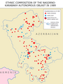 Nagorno Karabakh Ethnic Map 1989.png 737 × 979; 84 KB
-
 National forests in Alabama LOC 89697203.tif 10,272 × 6,927; 203.57 MB
-
 National parks in greater New York City LOC 89692896.jpg 5,304 × 4,838; 3.24 MB
-
 National parks in greater New York City LOC 89692896.tif 5,304 × 4,838; 73.42 MB
-
 National parks in greater New York City LOC 91680224.jpg 5,302 × 4,890; 4.01 MB
-
 National parks in greater New York City LOC 91680224.tif 5,302 × 4,890; 74.18 MB
-
 National parks in greater New York City LOC 92680016.jpg 5,314 × 4,861; 3.9 MB
-
 National parks in greater New York City LOC 92680016.tif 5,314 × 4,861; 73.9 MB
-
 Navigation projects in North Carolina LOC 2009581037.jpg 4,480 × 3,360; 1.47 MB
-
 Navigation projects in North Carolina LOC 2009581037.tif 4,480 × 3,360; 43.07 MB
-
 Netherlands Antilles and Aruba. LOC 2005631608.jpg 3,260 × 2,534; 711 KB
-
 Netherlands Antilles and Aruba. LOC 2005631608.tif 3,260 × 2,534; 23.63 MB
-
 New River Gorge National River trails LOC 99443788.tif 11,077 × 10,869; 344.46 MB
-
 Northeastern Africa. LOC 90680808.jpg 14,275 × 13,127; 30.24 MB
-
 Northern Mariana Islands (United States). LOC 91686576.jpg 2,550 × 3,284; 597 KB
-
 Northern Mariana Islands (United States). LOC 91686576.tif 2,550 × 3,284; 23.96 MB
-
 Padre Island National Seashore, Texas - official map and guide LOC 90681584.jpg 5,296 × 7,133; 6.42 MB
-
 Padre Island National Seashore, Texas - official map and guide LOC 90681584.tif 5,296 × 7,133; 108.08 MB
-
 Pea Ridge National Military Park, Arkansas official map and guide LOC 2011590419.jpg 5,044 × 4,705; 3.88 MB
-
 Pea Ridge National Military Park, Arkansas official map and guide LOC 2011590419.tif 5,044 × 4,705; 67.9 MB
-
 Petersburg National Battlefield, Virginia LOC 95682632.jpg 13,481 × 6,436; 16.12 MB
-
 Petersburg National Battlefield, Virginia LOC 95682632.tif 13,481 × 6,436; 248.23 MB
-
 REVILLAGIGEDO CHANNEL NOAA 17434-11-1989.jpg 13,637 × 17,606; 35.41 MB
-
 RG varig 1989 brazil domestic routes.jpg 1,103 × 1,500; 415 KB
-
 RG varig 1989 route map america.jpg 1,140 × 1,500; 362 KB
-
 Richmond National Battlefield Park, Virginia LOC 93685554.jpg 13,464 × 6,387; 16.53 MB
-
 San Antonio missions - official map and guide LOC 89697232.jpg 5,063 × 9,487; 6.5 MB
-
 San Antonio missions - official map and guide LOC 89697232.tif 5,063 × 9,487; 137.42 MB
-
 SCS administrative divisions and offices, Texas LOC 92682543.jpg 6,717 × 5,034; 2.48 MB
-
 SCS administrative divisions and offices, Texas LOC 92682543.tif 6,717 × 5,034; 96.74 MB
-

-
 SCS watershed protection and SCS administration divisions and offices, Texas LOC 92682542.tif 6,691 × 5,029; 96.27 MB
-
 South Korea. LOC 2011585048.jpg 3,255 × 4,273; 1.95 MB
-
 South Korea. LOC 2011585048.tif 3,255 × 4,273; 39.79 MB
-
 South Korea. LOC 2011585049.jpg 3,218 × 4,212; 1.91 MB
-
 South Korea. LOC 2011585049.tif 3,218 × 4,212; 38.78 MB
-
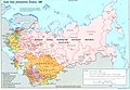 Soviet Union Administrative Divisions 1989.jpg 1,887 × 1,313; 397 KB
-

-
 Status of floodplain management and flood insurance, Maryland - January 1989 LOC 89694164.tif 5,192 × 3,405; 50.58 MB
-
 Status of river basin studies, Maryland - January 1989 LOC 89694165.jpg 5,196 × 3,432; 2.22 MB
-
 Status of river basin studies, Maryland - January 1989 LOC 89694165.tif 5,196 × 3,432; 51.02 MB
-
 Suitland Federal Center and vicinity ; Washington metropolitan area LOC 90685665.jpg 7,349 × 5,527; 4.72 MB
-
 Suitland Federal Center and vicinity ; Washington metropolitan area LOC 90685665.tif 7,349 × 5,527; 116.21 MB
-
 The Great Western Trail corridor LOC 97682184.jpg 8,588 × 5,224; 4.41 MB
-
 The Great Western Trail corridor LOC 97682184.tif 8,588 × 5,224; 128.36 MB
-
 Western Sahara. LOC 89692607.jpg 2,172 × 2,964; 564 KB
-
 Western Sahara. LOC 89692608.tif 2,214 × 2,957; 18.73 MB
-
 White Mountain National Forest, New Hampshire-Maine - 1984 LOC 89696915.jpg 10,097 × 10,794; 17.35 MB
-
 White Mountain National Forest, New Hampshire-Maine - 1984 LOC 89697512.jpg 10,725 × 21,900; 30.34 MB
-
 White Mountain National Forest, New Hampshire-Maine - 1984 LOC 89697512.tif 10,725 × 21,900; 671.99 MB
-
 World operators T-72.PNG 1,425 × 625; 38 KB
_DC._LOC_91682174.jpg)

_LOC_89696690.jpg)
_LOC_89696692.jpg)
_LOC_89696691.jpg)
_LOC_89696689.jpg)


._LOC_89691389.jpg)


._LOC_94685550.jpg)


._LOC_2010593018.jpg)
._LOC_2010593020.jpg)


._LOC_91686576.jpg)


