Category:1985 maps
Jump to navigation
Jump to search
| ← · 1980 · 1981 · 1982 · 1983 · 1984 · 1985 · 1986 · 1987 · 1988 · 1989 · → |
Deutsch: Karten mit Bezug zum Jahr 1985
English: Maps related to the year 1985
Español: Mapas relativos al año 1985
Français : Cartes concernant l’an 1985
Русский: Карты 1985 года
Subcategories
This category has the following 9 subcategories, out of 9 total.
Media in category "1985 maps"
The following 89 files are in this category, out of 89 total.
-
 1985 Pacific hurricane season map.png 1,254 × 1,522; 1.25 MB
-
 Antarctic region. LOC 2011587031.jpg 3,342 × 4,379; 1.81 MB
-
 Antarctic region. LOC 2011587031.tif 3,342 × 4,379; 41.87 MB
-
 Antietam National Battlefield, Maryland LOC 86694826.jpg 5,076 × 4,661; 4.3 MB
-
 Antietam National Battlefield, Maryland LOC 86694826.tif 5,076 × 4,661; 67.69 MB
-
 Assateague LOC 85691226.jpg 9,866 × 4,257; 8.58 MB
-
 Assateague LOC 85691226.tif 9,866 × 4,257; 120.16 MB
-
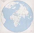 Azimuthal equidistant projection centered on Cairo, Egypt, 30⁰03ʹN, 31⁰15ʹE. LOC 85697108.jpg 11,442 × 11,190; 11.96 MB
-
 Azimuthal equidistant projection centered on Cairo, Egypt, 30⁰03ʹN, 31⁰15ʹE. LOC 85697108.tif 11,442 × 11,190; 366.31 MB
-

-

-
 Buffalo River, national river, Arkansas LOC 86694141.jpg 10,005 × 4,775; 7.93 MB
-
 Buffalo River, national river, Arkansas LOC 86694141.tif 10,005 × 4,775; 136.68 MB
-

-
 Bureau of Land Management, Resource Area base map - (western United States). LOC 87691539.tif 6,261 × 7,674; 137.46 MB
-
 Cape Hatteras National Seashore, North Carolina LOC 93681897.jpg 5,187 × 7,070; 6.02 MB
-
 Cape Hatteras National Seashore, North Carolina LOC 93681897.tif 5,187 × 7,070; 104.92 MB
-
 Chesapeake and Ohio Canal LOC 88690842.jpg 11,385 × 7,904; 8.04 MB
-
 Chesapeake and Ohio Canal LOC 88690842.tif 11,385 × 7,904; 257.46 MB
-
 Cumberland Island LOC 93683110.jpg 4,395 × 5,949; 4.28 MB
-
 Cumberland Island LOC 93683110.tif 4,395 × 5,949; 74.8 MB
-
 Czechoslovakia. LOC 91686167.jpg 4,359 × 3,379; 1.73 MB
-
 Czechoslovakia. LOC 91686167.tif 4,359 × 3,379; 42.14 MB
-
 Everglades National Park, Florida LOC 91685086.tif 10,001 × 7,059; 201.98 MB
-

-

-
 Fredericksburg-Spotsylvania National Military Park LOC 93681943.jpg 13,398 × 6,345; 15.92 MB
-
 Fredericksburg-Spotsylvania National Military Park LOC 93681943.tif 13,398 × 6,345; 243.22 MB
-
 General soil map, Camp County, Texas LOC 86691351.jpg 7,733 × 11,656; 7.17 MB
-
 General soil map, Camp County, Texas LOC 86691351.tif 7,733 × 11,656; 257.88 MB
-
 General soil map, Jackson County, Texas LOC 85693938.tif 7,327 × 11,259; 236.02 MB
-
 General soil map, Karnes County, Texas LOC 85693940.jpg 9,158 × 6,760; 5.61 MB
-
 General soil map, Karnes County, Texas LOC 85693940.tif 9,158 × 6,760; 177.12 MB
-
 General soil map, Kleberg County, Texas LOC 85693939.tif 7,722 × 11,665; 257.71 MB
-
 General soil map, Titus County, Texas LOC 86691353.tif 7,636 × 11,586; 253.12 MB
-

-
 George Washington Memorial Parkway, Virginia, Maryland, District of Columbia LOC 86694827.tif 6,904 × 9,660; 190.81 MB
-
 Holly Springs and Tombigbee National Forests, Mississippi LOC 2005630251.jpg 14,501 × 8,127; 15.22 MB
-
 Holly Springs and Tombigbee National Forests, Mississippi LOC 2005630251.tif 14,501 × 8,127; 337.17 MB
-
 Indochina. LOC 2005631513.jpg 2,480 × 2,894; 738 KB
-
 Indochina. LOC 2005631513.tif 2,480 × 2,894; 20.53 MB
-
 Indochina. LOC 2005631514.jpg 2,442 × 2,941; 880 KB
-
 Indochina. LOC 2005631514.tif 2,442 × 2,941; 20.55 MB
-
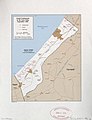 Israel settlements in the Gaza Strip, September 1984. LOC 2011586063.jpg 3,322 × 4,332; 1.34 MB
-
 Israel settlements in the Gaza Strip, September 1984. LOC 2011586063.tif 3,322 × 4,332; 41.17 MB
-
 Kennesaw Mountain, Kennesaw Mountain National Battlefield Park, Georgia LOC 93683084.jpg 5,042 × 4,723; 4.44 MB
-
 Kennesaw Mountain, Kennesaw Mountain National Battlefield Park, Georgia LOC 93683084.tif 5,042 × 4,723; 68.13 MB
-
 Land evaluation for site assessment map, Rogers County, Oklahoma LOC 85693937.jpg 6,689 × 8,916; 7.11 MB
-
 Land evaluation for site assessment map, Rogers County, Oklahoma LOC 85693937.tif 6,689 × 8,916; 170.63 MB
-
 Latin American narcotics connection, maritime trafficking. LOC 2010593036.jpg 7,812 × 8,986; 5.69 MB
-
 Latin American narcotics connection, maritime trafficking. LOC 2010593036.tif 7,812 × 8,986; 200.84 MB
-
 Lyndon B. Johnson National Historical Park, Texas LOC 91684793.jpg 5,204 × 9,665; 8.81 MB
-
 Lyndon B. Johnson National Historical Park, Texas LOC 91684793.tif 5,204 × 9,665; 143.9 MB
-
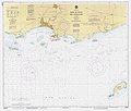 Mapa de la Bahía de Ponce, Puerto Rico, por NOAA, US Dept of Commerce, Dec 1985 (DP15).jpg 8,213 × 6,975; 3.19 MB
-
 Mappa del Comune di Padova.jpg 1,600 × 1,542; 236 KB
-
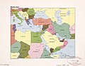 Middle East. LOC 2011585051.jpg 4,202 × 3,298; 1.7 MB
-
 Middle East. LOC 2011585051.tif 4,202 × 3,298; 39.65 MB
-
 MTN25-0904c3-1985-Andujar.jpg 7,764 × 5,377; 6.84 MB
-
 National forests in North Carolina LOC 98683606.jpg 8,908 × 7,422; 9.95 MB
-
 National forests in North Carolina LOC 98683606.tif 8,908 × 7,422; 189.16 MB
-
 Oceania. LOC 2011586136.tif 5,814 × 4,336; 72.13 MB
-
 Operation Rubikon Länder.svg 940 × 477; 1.57 MB
-
 Ozark and St. Francis national forests, Arkansas LOC 88691854.jpg 7,853 × 6,688; 6.93 MB
-
 Ozark and St. Francis national forests, Arkansas LOC 88691854.tif 7,853 × 6,688; 150.26 MB
-
 Prince William Forest Park, Virginia LOC 93681938.jpg 6,730 × 9,522; 9.29 MB
-
 Prince William Forest Park, Virginia LOC 93681938.tif 6,730 × 9,522; 183.34 MB
-

-

-

-

-
 Rock Creek Park, Washington, D.C. LOC 88693139.jpg 5,256 × 7,207; 5.76 MB
-
 Rock Creek Park, Washington, D.C. LOC 88693139.tif 5,256 × 7,207; 108.38 MB
-
 Santee National Wildlife LOC 2006458320.jpg 9,995 × 5,586; 8.27 MB
-
 Santee National Wildlife LOC 2006458320.tif 9,995 × 5,586; 159.74 MB
-
 Savannah National Wildlife Refuge LOC 2002621267.jpg 7,820 × 5,087; 3.29 MB
-
 Savannah National Wildlife Refuge LOC 2002621267.tif 7,820 × 5,087; 113.81 MB
-
 Statue of Liberty National Monument, maps LOC 98689753.jpg 5,365 × 4,372; 2.9 MB
-
 Statue of Liberty National Monument, maps LOC 98689753.tif 5,365 × 4,372; 67.11 MB
-
 Status of watersheds, Mississippi LOC 87693833.jpg 5,711 × 7,483; 3.96 MB
-
 Status of watersheds, Mississippi LOC 87693833.tif 5,711 × 7,483; 122.27 MB
-
 The world (guide to regional maps). LOC 2011589551.tif 7,496 × 4,385; 94.04 MB
-

-
 Tioga-Hammond lakes LOC 94684220.jpg 14,606 × 5,481; 12.21 MB
-
 Tioga-Hammond lakes LOC 94684220.tif 14,606 × 5,481; 229.04 MB
-
 Route of the 1985 Tour de France.png 3,198 × 3,204; 2.69 MB
-

-

-
 Uwharrie National Forest, North Carolina - 1985 LOC 97683426.jpg 12,172 × 6,362; 11.45 MB
-
 Uwharrie National Forest, North Carolina - 1985 LOC 97683426.tif 12,172 × 6,362; 221.55 MB


._LOC_87691539.jpg)


.jpg)


,_Kentucky,_1985_LOC_2007627960.jpg)


