Category:1958 maps of Europe
Jump to navigation
Jump to search
Temperate regions: North America · South America · Africa · Europe · Asia · – Polar regions: – Other regions:
English: 1958 maps of Europe
Español: Mapas de Europa en 1958
Suomi: Euroopan kartat vuodelta 1958
Română: Hărți ale Europei din 1958
Subcategories
This category has the following 2 subcategories, out of 2 total.
N
- 1958 maps of Norway (109 F)
S
- 1958 maps of Switzerland (2 F)
Media in category "1958 maps of Europe"
The following 4 files are in this category, out of 4 total.
-
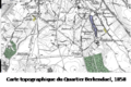 Carte topographique du Quartier Berkendael, 1958.png 306 × 203; 68 KB
-
 Kabardino-Balkarskaya Assr - DPLA - 780615cecd5c4b8100fb92c069b9cc20.jpg 9,490 × 7,559; 7.13 MB
-
 Ordnance Survey One-Inch Sheet 11 The Mourne Mountains, Published 1958.jpg 15,958 × 10,223; 16.83 MB
-
 Tour de France 1958 map.svg 600 × 600; 375 KB


