Category:1956 maps of Europe
Jump to navigation
Jump to search
Temperate regions: North America · South America · Africa · Europe · Asia · – Polar regions: – Other regions:
English: 1956 maps of Europe
Español: Mapas de Europa en 1956
Suomi: Euroopan kartat vuodelta 1956
Română: Hărți ale Europei din 1956
Subcategories
This category has the following 7 subcategories, out of 7 total.
E
F
- 1956 maps of Finland (1 F)
N
- 1956 maps of the Netherlands (1 F)
- 1956 maps of Norway (50 F)
R
- 1956 maps of Romania (1 F)
- 1956 maps of Russia (3 F)
S
- 1956 maps of Switzerland (2 F)
Media in category "1956 maps of Europe"
The following 9 files are in this category, out of 9 total.
-
 1958 Iceland (30848666606).jpg 4,349 × 3,196; 8.14 MB
-
 Bulgaria- Population - DPLA - 4e305d849b1af9dfeebc33bb8586c93e.jpg 4,470 × 3,475; 2 MB
-
 Dislocation of Csangos Hu-Baranya map.png 981 × 1,165; 1.14 MB
-
 Dislocation of Csangos Hu-Ro.png 1,493 × 909; 1.37 MB
-
 Institut géographique national, Plan de Paris, Édition de 1956 - Paris Musées.jpg 15,941 × 12,829; 125.5 MB
-
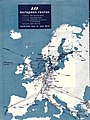 SAS 1956 - Europe.jpg 1,331 × 1,782; 728 KB
-
 Tour de France 1956 map.svg 600 × 600; 368 KB
-
 Tramway de Nantes 1956.svg 1,241 × 1,513; 1.49 MB
-
 Бендерский район.png 1,061 × 833; 1.57 MB
.jpg)


