Category:1940s maps of Morocco
Jump to navigation
Jump to search
Countries of Africa: Algeria · Egypt‡ · Ethiopia · Liberia · Libya · Madagascar · Morocco · Namibia · Somalia · South Africa · Sudan · Tunisia
Limited recognition: Somaliland
‡: partly located in Africa
Limited recognition: Somaliland
‡: partly located in Africa
Subcategories
This category has the following 4 subcategories, out of 4 total.
- 1940 maps of Morocco (1 F)
- 1943 maps of Morocco (1 F)
- 1947 maps of Morocco (1 F)
- 1948 maps of Morocco (3 F)
Media in category "1940s maps of Morocco"
The following 4 files are in this category, out of 4 total.
-
 Afrique du Nord - btv1b531215311 (1 of 2).jpg 12,182 × 7,994; 15.37 MB
-
 Angriffspositionen vor fedala.jpg 1,000 × 649; 62 KB
-
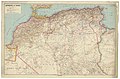
 Marokko. Übersichtskarte - btv1b531213854.jpg 8,426 × 7,922; 9.68 MB
-
 خريطة الرباط سلا 1942.jpg 4,378 × 5,966; 7.76 MB
.jpg)


