Category:1898 maps of Oregon
Jump to navigation
Jump to search
States of the United States: Alaska · California · Connecticut · Florida · Georgia · Illinois · Iowa · Kentucky · Louisiana · Maine · Maryland · Massachusetts · Michigan · Minnesota · Mississippi · Missouri · Montana · New Hampshire · New Jersey · New Mexico · New York · North Carolina · North Dakota · Ohio · Oklahoma · Oregon · Pennsylvania · Rhode Island · South Carolina · South Dakota · Tennessee · Texas · Vermont · Virginia · Washington · West Virginia · Wisconsin – Washington, D.C.
Puerto Rico
Puerto Rico
| ← 1890 1891 1892 1893 1894 1895 1896 1897 1898 1899 |
Subcategories
This category has the following 10 subcategories, out of 10 total.
S
Media in category "1898 maps of Oregon"
The following 24 files are in this category, out of 24 total.
-

-
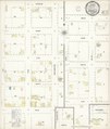
 Sanborn Fire Insurance Map from Junction City, Lane County, Oregon. LOC sanborn07390 004-1.tif 6,450 × 7,650; 141.17 MB
-

-
 Sanborn Fire Insurance Map from Junction City, Lane County, Oregon. LOC sanborn07390 004-2.tif 6,450 × 7,650; 141.17 MB
-

-
 Sanborn Fire Insurance Map from Junction City, Lane County, Oregon. LOC sanborn07390 004-3.tif 6,450 × 7,650; 141.17 MB
-

-
 Sanborn Fire Insurance Map from Junction City, Lane County, Oregon. LOC sanborn07390 004-4.tif 6,450 × 7,650; 141.17 MB
-

-
 Sanborn Fire Insurance Map from Drain, Douglas County, Oregon. LOC sanborn07350 004.jpg 6,450 × 7,650; 3.45 MB
-
 Sanborn Fire Insurance Map from Drain, Douglas County, Oregon. LOC sanborn07350 004.tif 6,450 × 7,650; 141.17 MB
-
 Sanborn Fire Insurance Map from Gardiner, Douglas County, Oregon. LOC sanborn07363 001.jpg 6,450 × 7,650; 4.31 MB
-
 Sanborn Fire Insurance Map from Gardiner, Douglas County, Oregon. LOC sanborn07363 001.tif 6,450 × 7,650; 141.17 MB
-

-
 Sanborn Fire Insurance Map from Gold Hill, Jackson County, Oregon. LOC sanborn07369 001.tif 6,450 × 7,650; 141.17 MB
-
 Sanborn Fire Insurance Map from Jefferson, Marion County, Oregon. LOC sanborn07387 003.jpg 6,450 × 7,650; 3.27 MB
-
 Sanborn Fire Insurance Map from Oakland, Douglas County, Oregon. LOC sanborn07428 006.jpg 6,450 × 7,650; 3.12 MB
-
 Sanborn Fire Insurance Map from Oakland, Douglas County, Oregon. LOC sanborn07428 006.tif 6,450 × 7,650; 141.17 MB
-
 Sanborn Fire Insurance Map from Shedd, Linn County, Oregon. LOC sanborn07460 001.jpg 6,450 × 7,650; 3.01 MB
-
 Sanborn Fire Insurance Map from Shedd, Linn County, Oregon. LOC sanborn07460 001.tif 6,450 × 7,650; 141.17 MB
-
 Sanborn Fire Insurance Map from Sodaville, Linn County, Oregon. LOC sanborn07464 001.jpg 6,450 × 7,650; 3.02 MB
-
 Sanborn Fire Insurance Map from Sodaville, Linn County, Oregon. LOC sanborn07464 001.tif 6,450 × 7,650; 141.17 MB
-
 Sanborn Fire Insurance Map from Turner, Marion County, Oregon. LOC sanborn07477 001.jpg 6,450 × 7,650; 3.34 MB
-
 Sanborn Fire Insurance Map from Turner, Marion County, Oregon. LOC sanborn07477 001.tif 6,450 × 7,650; 141.17 MB


_-_1898.jpg)


