Category:Topographic maps of Pakistan
Jump to navigation
Jump to search
Subcategories
This category has only the following subcategory.
S
Media in category "Topographic maps of Pakistan"
The following 24 files are in this category, out of 24 total.
-
1999 Afghanistan (30249737763).jpg 7,446 × 5,764; 28.57 MB
-
Afghanistan Pakistan central border 2008.jpg 3,242 × 3,766; 2.82 MB
-
Atentados 10 de enero de 2013 en Pakistán.PNG 670 × 535; 810 KB
-
Bajisitan-ditu-2002-zh.jpg 1,626 × 2,000; 882 KB
-
Campaigns on the North-west Frontier (1912) (14764243792).jpg 3,566 × 2,414; 1.16 MB
-
Gasherbrum II Pakistan.png 2,365 × 1,890; 7.47 MB
-
Historic pakistan rel96.JPG 1,104 × 1,332; 356 KB
-
Mehrgarh pakistan rel96.JPG 978 × 1,199; 573 KB
-
Mountain passes Afghanistan Pakistan.png 1,122 × 866; 1.93 MB
-
Operational Navigation Chart G-6, 7th edition.jpg 9,254 × 6,700; 20.67 MB
-
Operational Navigation Chart G-7, 6th edition.jpg 9,254 × 6,707; 20.89 MB
-
Pakistan 2002 CIA map.jpg 1,626 × 2,000; 589 KB
-
Pakistan Mountain Ranges BMNG.jpg 1,973 × 1,938; 1.32 MB
-
Pakistan Physiography.jpg 2,008 × 2,657; 1.52 MB
-
Pakistan Pothohar BMNG.jpg 1,973 × 1,938; 1.29 MB
-
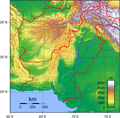
Pakistan relief location map.jpg 2,365 × 1,890; 1.93 MB
-
Pakistan Topography.png 1,726 × 1,698; 3.25 MB
-
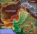
Paktopo de.jpg 1,187 × 1,102; 1.28 MB
-
Pamir and NW Karakoram 35to39N 70to76E Topo Rainbow Zebra 1428.jpg 7,141 × 4,764; 36.57 MB
-
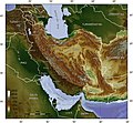
Persian plateau topo en.jpg 1,000 × 923; 317 KB
-
Persian Plateau.png 717 × 430; 484 KB
-
SE Karakoram west Himalaya 32to37N 75to79E Topo Rainbow Zebra 1734.jpg 4,761 × 5,952; 29.79 MB
-
Tajikistan NE Pakistan west China 33to40N 69to78E Topo Rainbow Zebra 1734.jpg 10,800 × 8,400; 82.19 MB
-
Topographie de la partie est de la satrapie de Gédrosie.jpg 800 × 743; 179 KB


