Category:Topographic maps of Iran
Jump to navigation
Jump to search
Subcategories
This category has only the following subcategory.
S
- SVG topographic maps of Iran (11 F)
Media in category "Topographic maps of Iran"
The following 44 files are in this category, out of 44 total.
-
 2008 Southern Iran earthquake.jpg 612 × 710; 114 KB
-
 Adurbadagan Sasanian era.png 1,178 × 897; 1.76 MB
-
 Amsterdam J. Covens et C. Mortier,1720.jpg 1,080 × 914; 407 KB
-
 Avestan geography mihr yasht.png 2,330 × 1,378; 4.13 MB
-
 Bukan map 1918(1297).jpg 969 × 814; 1.39 MB
-
 Bukan map 1924(1303).jpg 1,286 × 836; 1.1 MB
-
 Bukan map 1945(1324) russian.jpg 904 × 698; 979 KB
-
 Bushehr province - topological and bathmetery map.png 7,200 × 10,794; 22.45 MB
-
 Farsi island-en.png 2,124 × 2,036; 842 KB
-
 Geography avesta sistan.png 2,291 × 1,363; 4.2 MB
-
 Hamadan Topography.PNG 458 × 475; 419 KB
-
 Ilam Relief No Label.png 3,543 × 2,976; 2.27 MB
-
 Iran Geografia fisica.png 672 × 600; 828 KB
-
 Iran Physiography.jpg 2,000 × 2,001; 1.68 MB
-
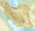
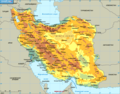
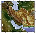
 Iran relief location light map.jpg 1,200 × 1,071; 165 KB
-
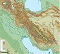
 Iran relief location map.jpg 1,200 × 1,071; 941 KB
-
 Iran topo blank.jpg 1,400 × 1,291; 629 KB
-
 Iran topo en.jpg 1,400 × 1,291; 686 KB
-
 Iran topo hr.svg 1,005 × 927; 2.38 MB
-
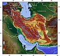
 Iran topo-fr.jpg 1,400 × 1,291; 722 KB
-
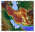
 Iran topo.jpg 1,400 × 1,291; 690 KB
-
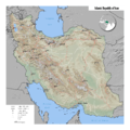
 Iran Topography.png 1,608 × 1,502; 2.96 MB
-
 Iran-afsharids(1).jpg 3,621 × 3,045; 1.8 MB
-
 Iran-xerite.png 1,106 × 870; 114 KB
-
 Kabir Kouh Topo 01.png 1,203 × 780; 1.72 MB
-
 Karunrivermapfinal.jpg 1,274 × 1,484; 711 KB
-
 Chonga zenvil.jpg 305 × 350; 29 KB
-
 Map Iran earthquakes 1990.gif 523 × 440; 139 KB
-
 Map of northern Iran under late Sasanian rule.png 1,789 × 887; 1.53 MB
-
 Map of northern Iran under the Sasanians.jpg 1,211 × 623; 870 KB
-
 MapOfIran.png 3,568 × 3,568; 9.7 MB
-
 Mazandaran Relief Map.png 1,499 × 674; 1.76 MB
-
 Neolithic sites in Iran.jpg 1,162 × 855; 105 KB
-
 Operational Navigation Chart G-6, 7th edition.jpg 9,254 × 6,700; 20.67 MB
-
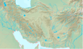
 Persian plateau topo en.jpg 1,000 × 923; 317 KB
-
 Persian Plateau.png 717 × 430; 484 KB
-
 Relief Map of Ilam Province.png 6,391 × 6,009; 12.26 MB
-
 Sasanian province of Pars.png 1,193 × 918; 932 KB
-
 Screenshot ۲۰۲۲۰۵۱۷-۲۰۱۷۲۶ Chrome.jpg 1,004 × 916; 631 KB
-
 Topographic Map of Ilam Province.png 6,391 × 6,009; 9.99 MB
-
 Zagros.png 1,299 × 1,198; 2.92 MB
-
 نقشه توپوگرافی و عمق سنجی استان بوشهر.png 7,200 × 10,794; 22.65 MB
-
 نقشه جزیره فارسی.png 2,124 × 2,016; 843 KB
-
 نقشه حمل و نقل استان بوشهر.png 7,200 × 10,794; 20.42 MB


.jpg)
.jpg)
_russian.jpg)


.jpg)


