Category:Topographic maps of Lebanon
Jump to navigation
Jump to search
Subcategories
This category has only the following subcategory.
S
Media in category "Topographic maps of Lebanon"
The following 13 files are in this category, out of 13 total.
-
 Composite, A Sketch of the Countries between Jerusalem and Aleppo.jpg 7,830 × 11,810; 12.92 MB
-
 1862 French map of Lebanon.jpg 8,364 × 11,071; 21.53 MB
-
 Asendi kaart Liibanon.png 272 × 317; 53 KB
-
 Awali River Route.png 1,581 × 1,818; 3.7 MB
-
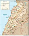
 Lebanon location map Topographic.png 993 × 1,142; 990 KB
-
 Lebanon physical blank map.png 993 × 1,142; 970 KB
-
 Lebanon Physiography.jpg 1,986 × 2,458; 1.56 MB
-
 Lebanon topographical map.png 1,581 × 1,818; 3.35 MB
-
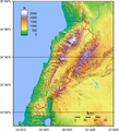 Lebanon Topography.png 1,636 × 1,804; 3.48 MB
-
 Libanen ditu1.PNG 764 × 884; 600 KB
-
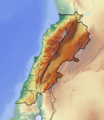
 Reliefkarte Libanon.png 2,091 × 2,527; 4.66 MB
-
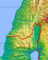 Southern Lebanon and Northern Israel topography.png 506 × 628; 561 KB
-
 USGS CMG InfoBank Atlas, Lebanon regions.jpg 623 × 732; 219 KB


