Category:Maps of Pakistan
Appearance
Use the appropriate category for maps showing all or a large part of Pakistan. See subcategories for smaller areas:
| If the map shows | Category to use |
|---|---|
| Pakistan on a recently created map | Category:Maps of Pakistan or its subcategories |
| Pakistan on a map created more than 70 years ago | Category:Old maps of Pakistan or its subcategories |
| the history of Pakistan on a recently created map | Category:Maps of the history of Pakistan or its subcategories |
| the history of Pakistan on a map created more than 70 years ago | Category:Old maps of the history of Pakistan or its subcategories |
- See also maps needing categories in Category:Unidentified maps
English: Maps of Pakistan
اردو: پاکستان کے نقشے
Wikimedia category | |||||
| Upload media | |||||
| Instance of | |||||
|---|---|---|---|---|---|
| Category combines topics | |||||
 | |||||
Subcategories
This category has the following 42 subcategories, out of 42 total.
*
A
B
C
D
E
- ECHO Daily Maps of Pakistan (72 F)
F
G
H
- Maps of the Hindu Kush (22 F)
K
- Khyber Pass maps (12 F)
L
M
O
P
R
S
- Sports maps of Pakistan (1 F)
T
U
- Unidentified maps of Pakistan (empty)
W
Pages in category "Maps of Pakistan"
The following 2 pages are in this category, out of 2 total.
Media in category "Maps of Pakistan"
The following 148 files are in this category, out of 148 total.
-
14 Ochomiles.png 4,480 × 2,472; 10.45 MB
-
15th Spetsnaz Brigade strike into Pakistan during the Soviet war in Afghanistan.png 1,221 × 1,619; 2.38 MB
-
Afghanistan and Pakistan map (UN).png 1,511 × 1,463; 458 KB
-
Alexander's Indian route.jpg 1,169 × 1,074; 168 KB
-
Archaeological Sites Swat Valley.jpg 2,500 × 1,497; 638 KB
-
Autonomous regions in the Middle East and Asia.jpg 720 × 694; 204 KB
-
Bahawalpur map.jpg 603 × 478; 43 KB
-
Bahawalpur Pakistan.jpg 722 × 600; 90 KB
-
Bajisitan-bankuai-zh-tw.png 244 × 266; 16 KB
-
Bajisitan-bankuai-zh.png 244 × 266; 15 KB
-
Bajisitan-bianjie-zh.png 833 × 1,026; 103 KB
-
Battle of Thorgo map 1.jpg 4,129 × 3,568; 519 KB
-
Chitral Khyber PK.jpg 722 × 600; 90 KB
-
Chitral state Pakistan.png 451 × 585; 23 KB
-
Cholistan desert location.jpg 250 × 236; 13 KB
-
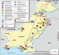
Corridorcpec.jpg 820 × 768; 930 KB
-
CPEC.png 1,780 × 1,122; 1.16 MB
-
Cpec.png 659 × 620; 431 KB
-
Current Pakistani Provincial Governments.png 3,488 × 2,456; 30 KB
-
Dera Ismail Khan map.jpg 148 × 191; 5 KB
-
DeraBugti.map.jpg 184 × 225; 11 KB
-
Deserts of Pakistan.jpg 711 × 545; 63 KB
-
Dhudikemap.gif 600 × 371; 31 KB
-
DI Khan &Tank Language Map.png 1,265 × 1,056; 314 KB
-
Dir Pakistan.jpg 722 × 600; 90 KB
-
Disputataj landlimoj inter Barato, Ĉinio kaj Pakistano.png 924 × 669; 154 KB
-
F09-06 1853 Geological Sketch Map of Salt Range.jpg 6,304 × 2,656; 7.14 MB
-
FLII Pakistan.png 1,390 × 897; 311 KB
-
Ggfg - Copy - Copy.png 525 × 593; 19 KB
-
Hazara Division Map and Jagirdars.jpg 1,080 × 1,710; 841 KB
-
Hub-District-Map-with-Tehsils-complete.jpg 700 × 658; 254 KB
-
Hunza Valley Map.jpg 1,024 × 768; 222 KB
-
India and Pakistan November 1971.png 1,270 × 1,108; 68 KB
-
India, Pakistan and disputed Kashmir.jpg 5,442 × 4,021; 641 KB
-
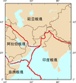
IranAndNeighbours.png 538 × 316; 11 KB
-
Islamabad.png 2,365 × 1,890; 403 KB
-
Jalalpur Irrigation Project.jpg 1,486 × 1,146; 287 KB
-
Kakar Range.jpg 300 × 241; 11 KB
-
Kalat Pakistan.jpg 722 × 600; 91 KB
-
Kashkar region 2004.jpg 484 × 295; 51 KB
-
Kashmir Borders Urdu.svg 2,200 × 1,777; 155 KB
-
Khadir-and-bangar.jpg 400 × 400; 25 KB
-
Khairpur Pakistan.jpg 722 × 600; 90 KB
-
Kharan Pakistan.jpg 722 × 600; 90 KB
-
Khyber Pass1914.jpg 1,664 × 1,140; 678 KB
-
Kouradia.gif 1,000 × 979; 265 KB
-
Kwaja Khel settlement.jpg 791 × 1,024; 119 KB
-
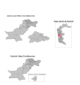
LA-14 Bagh-I (2021).png 1,636 × 1,720; 56 KB
-
LA-20 Poonch & Sudhanoti-III (2021).png 1,636 × 1,720; 56 KB
-
LA-22 Poonch & Sudhanoti-V (2021).png 1,636 × 1,720; 56 KB
-
Largest cities of Pakistan.png 3,840 × 2,160; 848 KB
-
Las Bela Pakistan.jpg 722 × 600; 90 KB
-
Major Powers and Central Asian Invasions, c. 250 BCE - 550 CE.jpg 1,016 × 1,380; 190 KB
-
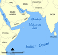
Makoran Sea Makran Sea map01.png 2,000 × 1,890; 756 KB
-
Map Khetran.JPG 2,246 × 4,148; 541 KB
-
Map new.png 647 × 460; 91 KB
-
Map of Gandhara, Pakistan.jpg 1,485 × 870; 512 KB
-
Map of Hattian Bala.png 1,380 × 2,120; 147 KB
-
Map of Kasur District.png 552 × 452; 142 KB
-
Map of Pakhali Sarkar along with Capital and Garrison Cities.png 800 × 804; 89 KB
-
Map of Pakistan showing borders length.jpg 1,600 × 1,451; 276 KB
-
Map of Peristan.jpg 547 × 547; 74 KB
-
Map of Swat including Kwaja Khel settlement.jpg 813 × 1,027; 141 KB
-
Map of the Northern territories of Pakistan.jpg 318 × 280; 14 KB
-
Mapa Pákistánu.PNG 330 × 354; 47 KB
-
Mintaka pass pakistan map (1990 version).jpg 351 × 377; 49 KB
-
Multan fort.png 600 × 391; 284 KB
-
Nagar Pakistan.jpg 722 × 600; 90 KB
-
Nagri Tutial Abbottabad.png 600 × 490; 15 KB
-
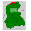
Nara Tehsil Map.png 720 × 635; 144 KB
-
Nartopa signpot.jpg 964 × 754; 178 KB
-
Nasirabad Tehsils.jpg 554 × 554; 34 KB
-
Nawabshah.png 3,264 × 3,264; 829 KB
-
Northern Pakistan 37.JPG 1,800 × 2,400; 4.42 MB
-
NWFP 1947 Referendum result.png 989 × 1,341; 36 KB
-
OG00007.jpg 1,688 × 2,200; 827 KB
-
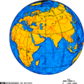
Orthographic projection centred over Gwadar, Pakistan.png 488 × 487; 23 KB
-
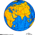
Orthographic projection centred over Karachi, Pakistan.png 488 × 487; 23 KB
-
Pakistan - Balochistan - Hub (2022).png 2,560 × 1,965; 529 KB
-
Pakistan - Balochistan - Lasbela (2022).png 2,560 × 1,965; 530 KB
-
Pakistan - DPLA - 3c1d1302c48a8d33180f5583b62dc8eb.jpg 2,556 × 3,272; 7.33 MB
-
Pakistan - DPLA - 61932b74a341a9ea7a2d7a31850ac4cb.jpg 2,560 × 3,282; 6.72 MB
-
Pakistan - DPLA - 752783d45b7d578be0ee5b39e7c25fef.jpg 2,556 × 3,276; 6.65 MB
-
Pakistan - DPLA - acf44facadf1b529b26dcdf79ac37e96.jpg 2,556 × 3,274; 5.72 MB
-
Pakistan - DPLA - bebe78f61e9012e184d88e5404800943.jpg 2,550 × 3,280; 6.07 MB
-
Pakistan - DPLA - c7c0afee239d5d87b5065fd76ef8d62e.jpg 2,554 × 3,274; 6.39 MB
-
Pakistan - DPLA - e64cb709a2dae8adf7216877909e9211.jpg 2,556 × 3,274; 5.54 MB
-
Pakistan - Gujrat map.png 302 × 240; 34 KB
-
Pakistan and Afghanistan Map.jpg 486 × 554; 114 KB
-
Pakistan Base Map.png 1,104 × 698; 427 KB
-
Pakistan boundaries.png 833 × 1,026; 26 KB
-
Pakistan disputed w1 countrymap.svg 1,000 × 1,000; 37 KB
-
Pakistan Div.png 926 × 774; 49 KB
-
Pakistan Dives.png 400 × 334; 61 KB
-
Pakistan GHI Solar-resource-map GlobalSolarAtlas World-Bank-Esmap-Solargis.png 1,842 × 2,046; 2.72 MB
-
Pakistan image.jpg 517 × 425; 34 KB
-
Pakistan Jul06.PNG 926 × 774; 43 KB
-
Pakistan Khairabad digital elevation model by TanDEM-X (DLR).jpg 2,268 × 2,526; 2.28 MB
-
Pakistan location map4.svg 2,365 × 1,890; 657 KB
-
Pakistan Map and Neighbors.jpg 712 × 600; 98 KB
-
Pakistan map blank.png 2,015 × 1,504; 380 KB
-
Pakistan Map explaining Kashmir.jpg 634 × 646; 106 KB
-
Pakistan map outline.png 406 × 363; 3 KB
-
Pakistan Map with Sea Ports.jpg 1,002 × 799; 247 KB
-
Pakistan Map.jpg 709 × 600; 101 KB
-
Pakistan Maps.svg 2,350 × 1,890; 409 KB
-
Pakistan psl map cities 2022.png 3,596 × 2,448; 91 KB
-
Pakistan psl map logos.png 406 × 363; 21 KB
-
Pakistan regional map.png 406 × 363; 4 KB
-
Pakistan rivers and provinces.png 951 × 899; 112 KB
-
Pakistan- Administrative Divisions - DPLA - cadc808b02bdaa4d3526ccf2e5b92012.jpg 2,554 × 3,268; 5.11 MB
-
Pakistan-Cricket-Regions-Map.png 3,596 × 2,448; 96 KB
-
PakistanPremierLeagueMap2004.png 409 × 353; 40 KB
-
PalulaMap.png 645 × 980; 1.05 MB
-
Parri Bangla.png 750 × 599; 98 KB
-
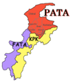
PAT - Pakistan.gif 855 × 1,000; 334 KB
-
Peshawar city map.jpg 1,609 × 1,219; 103 KB
-
Phulra Pakistan.jpg 722 × 600; 100 KB
-
PM visits by Imran Khan.png 4,500 × 2,234; 305 KB
-
Pothohar map.jpg 958 × 656; 223 KB
-
Ppl06-07.png 396 × 339; 34 KB
-
PU GEOGRAPHER.jpg 4,320 × 3,600; 2.91 MB
-
Rigvedic geography.jpg 756 × 539; 149 KB
-
SAARC 1717549468.png 273 × 287; 8 KB
-
Saraiki region of Sindh and Balochistan.jpg 752 × 960; 59 KB
-
Saraikistan.JPG 532 × 455; 41 KB
-
Shekhawatiregion.jpg 781 × 711; 70 KB
-
Siddiqui in Pakistan 2014.png 1,280 × 720; 56 KB
-
Sikhism in Pakistan - 2023 Census.png 2,560 × 1,862; 525 KB
-
Sindh-Divisions-Map.png 1,400 × 1,864; 353 KB
-
Sivallik Hills map.svg 3,099 × 2,868; 6.99 MB
-
SoanFig5.jpg 4,320 × 2,798; 1.31 MB
-
South Asia UN.png 2,960 × 3,588; 1.63 MB
-
Sub Regional Economic Cooperation Zones.gif 1,320 × 1,400; 92 KB
-
Swabi.jpg 3,982 × 3,368; 1.77 MB
-
Swat Khyber PK.jpg 722 × 600; 90 KB
-
Sylhet 1947.png 661 × 412; 20 KB
-
Tharparkar Administrative Divisions.svg 512 × 384; 22 KB
-
Tourist Map of Northern area of pakistan.jpg 1,440 × 2,560; 1.81 MB
-
TWA-Cables.jpg 10,504 × 7,504; 8.63 MB
-
UBL worldwide.png 2,753 × 1,400; 103 KB
-
Un-pakistan.png 3,063 × 4,003; 3.05 MB
-
中巴经济走廊主要项目分布.jpg 1,270 × 713; 307 KB


