Category:SVG topographic maps of Portugal
Jump to navigation
Jump to search
Media in category "SVG topographic maps of Portugal"
The following 22 files are in this category, out of 22 total.
-
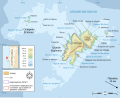
 Arquipélago das Berlengas-en.svg 1,643 × 2,743; 209 KB
-
 Arquipélago das Berlengas-fr.svg 1,643 × 2,743; 209 KB
-
 Arquipélago das Berlengas-mk.svg 1,643 × 2,743; 210 KB
-
 Arquipélago das Berlengas-pt.svg 1,643 × 2,743; 209 KB
-
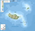
 Azoren be map.svg 706 × 417; 96 KB
-
 Berlengas-en.svg 1,500 × 1,219; 193 KB
-
 Berlengas-fr.svg 1,500 × 1,219; 193 KB
-
 Berlengas-mk.svg 1,500 × 1,219; 191 KB
-
 Berlengas-pt.svg 1,500 × 1,219; 193 KB
-
 Desertas topographic map.svg 310 × 271; 284 KB
-
 Madeira relief location map.svg 1,590 × 1,365; 357 KB
-
 Madeira topographic map-fr.svg 1,194 × 1,037; 2.18 MB
-
 Madeira topographic map-lt.svg 1,194 × 1,037; 2.18 MB
-
 Madeira topographic map-mk.svg 1,194 × 1,037; 2.18 MB
-
 Madeira-es.svg 870 × 702; 1.24 MB
-
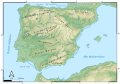 MapaTopográficoPenínsulaIbérica.svg 1,044 × 733; 18.24 MB
-
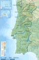
 Portugal topographic map-en.svg 1,738 × 3,070; 11.35 MB
-
 Portugal topographic map-es.png 3,621 × 6,396; 7.56 MB
-
 Portugal topographic map-es.svg 453 × 703; 25.12 MB
-
 Portugal topographic map-fr.svg 1,738 × 3,070; 11.35 MB
-
 Portugal topographic map-mk.svg 1,738 × 3,070; 12.05 MB
-
 Portugal topographic map-pt.svg 1,738 × 3,070; 12.42 MB


